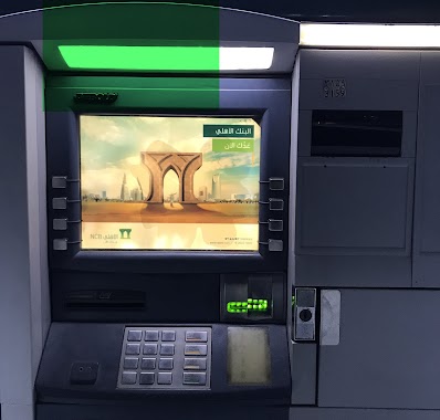
Atm nearby ATM machine to Sab🏧
Saudi Arabia
Atm nearby ATM machine to Sab🏧
ATM machine to Sab🏧
حي المحجر،, حي المحجر، Jeddah 22423, Saudi Arabia
contacts phone
:
+966
Latitude:
21.4359188
, Longitude:
39.214283
larger map & directions
read more
nearest Atm
25 m
SABB
Hedadh Co, Indus'l City, Jeddah
Atm
read more
551 m
صراف البنك الأهلي
حي المحجر، جدة
Atm
read more
551 m
National Commercial Bank ATM 🏧
Jeddah
Atm
read more
936 m
Tahweel Al Rajhi
reet Number 30, Sinaiyah Jeddah, Jeddah
Atm
read more
1.426 km
ساب
شارع المحجر، المحجر، جدة
Atm
read more
1.427 km
SABB
King abdulaziz Hospital, Jeddah
Atm
read more
1.454 km
صراف البلاد
جدة
Atm
read more
1.464 km
SABB
Sasco Almahjar D/T (36-9831, Jeddah
Atm
read more
1.484 km
مصرف الراجحي
شارع المحجر - حي غليل، جدة
Atm
read more
1.719 km
صراف بنك الرياض
جدة
Atm
read more
1.722 km
بنك الرياض
جدة
Atm
read more
1.723 km
Riyad Bank🏧
8126 زينل، حي غليل جدة 22413 5071 Zaynal, Jeddah
Atm
read more
1.743 km
ATM
8126 زينل، حي غليل جدة 22413 5071 Zaynal, Jeddah
Atm
read more
1.771 km
NCB ATM Al Mahjar
3870 Al Mahjar Petromin District Jeddah 22412 6688 Al Mahjar, Jeddah
Atm
read more
1.788 km
بنك الرياض
مينا مول، شارع المحجر، جدة
Atm
read more
1.79 km
بنك الرياض
ساوت مول - حي غليل، جدة
Atm
read more
1.794 km
بنك الرياض
ساوث مول، حي غليل، جدة
Atm
read more
1.854 km
ATM
4265 حسن حسنين، حي غليل جدة 22413
Atm
read more
1.857 km
Tahweel Al Rajhi
Television, Petromin, Jeddah
Atm
read more
1.871 km
Riyad ATM
Al Mahjar, Jeddah
Atm
read more
1.928 km
Riyad ATM
8334 Al Jaziri, حي غليل،, Jeddah
Atm
read more
1.935 km
NCB ATM
حسن حسنين Asan Hasanain, Jeddah
Atm
read more
1.983 km
صراف الأهلي NCB ATM
8168 Sayim Ad Dahr, Jeddah
Atm
read more
1.985 km
الأهلي
حي غليل، جدة
Atm
read more
2.008 km
صراف العربي
4690 Muhammad Harasani, حي غليل, Jeddah
Atm
read more
📑
all categories
Accounting
Administrative area level 1
Airport
Amusement park
Aquarium
Art gallery
Atm
Bakery
Bank
Bar
Beauty salon
Bicycle store
Book store
Bowling alley
Bus station
Cafe
Campground
Car dealer
Car rental
Car repair
Car wash
Casino
Cemetery
Church
City hall
Clothing store
Colloquial area
Convenience store
Country
Courthouse
Dentist
Department store
Doctor
Electrician
Electronics store
Embassy
Finance
Fire station
Florist
Food
Funeral home
Furniture store
Gas station
General contractor
Grocery or supermarket
Gym
Hair care
Hardware store
Health
Hindu Temple
Home goods store
Hospital
Insurance agency
Intersection
Jewelry store
Laundry
Lawyer
Library
Light rail station
Liquor store
Local government office
Locality
Locksmith
Lodging
Meal delivery
Meal takeaway
Mosque
Movie rental
Movie theater
Moving company
Museum
Natural feature
Neighborhood
Night club
Painter
Park
Parking
Pet store
Pharmacy
Physiotherapist
Place of worship
Plumber
Point of interest
Police
Political
Post office
Premise
Real estate agency
Restaurant
Roofing contractor
Route
Rv park, camping
School
Shoe store
Shopping mall
Spa
Stadium
Storage
Store
Sublocality
Subpremise
Subway station
Supermarket
Taxi stand
Train station
Transit station
Travel agency
University
Veterinary care
Zoo
sublocality level 1
↑