Atm nearby بنك الرياض
Saudi Arabia
Atm nearby بنك الرياض
بنك الرياض
2709, Umm Almuminin Safiah, 23233, Jeddah, SA Saudi Arabia
contacts phone
:
+966 800 124 2020
website:
www.riyadbank.com
Latitude:
21.5196755
, Longitude:
39.2243731
larger map & directions
read more
nearest Atm
211 m
الأهلي
شارع النسيم Al Naseem Street, حي النسيم, Jeddah
Atm
read more
281 m
SABB
Al Naseem ATM, Jeddah
Atm
read more
357 m
Aljazira ATM
2593 Al Naseem Street, حي النسيم 6818, Jeddah
Atm
read more
455 m
Alawwal Bank ATM 🏧
7569 Al Naseem Street, An Nasim District 2506, Jeddah
Atm
read more
659 m
Al Rajhi ATM🏧
Um Almuminin Sawdah, Jeddah
Atm
read more
695 m
Alinma ATM
6511 Al Naseem Street, 6483-, Jeddah
Atm
read more
778 m
ATM Riyadbank
Al Nahdey Market, Al Naseem Street, Al Naseem، جدة
Atm
read more
784 m
Alinma ATM
Um Almuminin Sawdah, Jeddah
Atm
read more
954 m
Al-Rajhi ATM 🏧
King Abdullah Road, Jeddah
Atm
read more
1.22 km
Riyad ATM
Bani Malik, Jeddah
Atm
read more
1.248 km
بنك البلاد
شارع الملك عبدالله، حي الفيحاء، جدة
Atm
read more
1.32 km
NCB ATM
3647 بني مالك، حي النسيم جدة 23234 8045 Bani Malik, Jeddah
Atm
read more
1.364 km
البنك السعودي للإستثمار
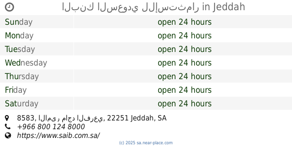
8583 الامير ماجد الفرعي, حي الفيحاء 2483, Jeddah
Atm
read more
1.378 km
NCB ATM🏧
Prince Majid Road, Jeddah
Atm
read more
1.381 km
NCB 2220
Jeddah
Atm
read more
1.381 km
الأهلي
شارع الملك عبد الله ، حي الفيحاء، جدة
Atm
read more
1.387 km
الأهلي
طريق الأمير ماجد، جدة
Atm
read more
1.398 km
صراف الانماء
شارع الملك عبد الله ، حي الفيحاء، جدة
Atm
read more
1.43 km
مصرف الإنماء
شارع الملك عبدالله، حي الفيحاء، جدة
Atm
read more
1.508 km
بنك الجزيرة
8799 Prince Majid Road, Jeddah
Atm
read more
1.523 km
بنك الجزيرة
الاندلس مول، جدة
Atm
read more
1.533 km
Bank Albilad ATM
Prince Majid Road, Jeddah
Atm
read more
1.566 km
Alrajhi Bank ATM
Jeddah
Atm
read more
1.58 km
Bank Aljazira ATM🏧
Abi Dharr Alghifari St, Jeddah
Atm
read more
1.624 km
صراف بنك الأهلي
الفيحاء،, Jeddah
Atm
read more
📑
all categories
Accounting
Administrative area level 1
Airport
Amusement park
Aquarium
Art gallery
Atm
Bakery
Bank
Bar
Beauty salon
Bicycle store
Book store
Bowling alley
Bus station
Cafe
Campground
Car dealer
Car rental
Car repair
Car wash
Casino
Cemetery
Church
City hall
Clothing store
Colloquial area
Convenience store
Country
Courthouse
Dentist
Department store
Doctor
Electrician
Electronics store
Embassy
Finance
Fire station
Florist
Food
Funeral home
Furniture store
Gas station
General contractor
Grocery or supermarket
Gym
Hair care
Hardware store
Health
Hindu Temple
Home goods store
Hospital
Insurance agency
Intersection
Jewelry store
Laundry
Lawyer
Library
Light rail station
Liquor store
Local government office
Locality
Locksmith
Lodging
Meal delivery
Meal takeaway
Mosque
Movie rental
Movie theater
Moving company
Museum
Natural feature
Neighborhood
Night club
Painter
Park
Parking
Pet store
Pharmacy
Physiotherapist
Place of worship
Plumber
Point of interest
Police
Political
Post office
Premise
Real estate agency
Restaurant
Roofing contractor
Route
Rv park, camping
School
Shoe store
Shopping mall
Spa
Stadium
Storage
Store
Sublocality
Subpremise
Subway station
Supermarket
Taxi stand
Train station
Transit station
Travel agency
University
Veterinary care
Zoo
sublocality level 1
↑