Atm nearby NCB ATM
Saudi Arabia
Atm nearby NCB ATM
NCB ATM
Prince Mutaib bin Abdulaziz Road, 23345, Jeddah, SA Saudi Arabia
contacts phone
:
+966
Latitude:
21.5582904
, Longitude:
39.2134951
larger map & directions
read more
nearest Atm
102 m
ATM
3121 Sulayyman Al Baji, District حي العزيزية, Jeddah
Atm
read more
184 m
Al Rajhi Bank ATM 🏧
Al Udaba, Jeddah
Atm
read more
341 m
بنك الرياض
العزيزية، جدة
Atm
read more
406 m
NCB ATM 🏧
Prince Mutaib bin Abdulaziz Rd Prince Mutaib bin Abdulaziz Road, Al Aziziyah District, Jeddah
Atm
read more
488 m
NCB ATM 🏧
Al Udaba, Jeddah
Atm
read more
508 m
الأهلي
شارع الأدباء - حي العزيزيه، جدة
Atm
read more
508 m
الأهلي
شارع الأدباء - حي العزيزية، جدة
Atm
read more
512 m
SABB
PJD Branch CDM, Jeddah
Atm
read more
570 m
Tahweel Al Rajhi
Prince Moteeb, Al-Rehab, Jeddah
Atm
read more
605 m
الأهلي
شارع المؤلفين، جدة
Atm
read more
610 m
Alahli ATM
Jeddah
Atm
read more
653 m
Al Rajhi ATM
جوف بن ناصر, حي الرحاب، جدة
Atm
read more
690 m
SAAB
Jeddah
Atm
read more
692 m
ATM
Jeddah
Atm
read more
705 m
ATM Bank Al Bilad 🏧
9220 حاز فارس، حي الرحاب جدة 23345 3334 Haz Faris, Jeddah
Atm
read more
741 m
ساب
طريق الامير متعب بن عبدالعزيز، حي الرحاب، جدة
Atm
read more
771 m
SABB
Al Sahafa Gas Station, Jeddah
Atm
read more
775 m
العربي
العزيزية، جدة
Atm
read more
776 m
Riyad ATM
Al Muallifeen Street Al Muallifeen Street, Al Aziziyah District, Jeddah
Atm
read more
780 m
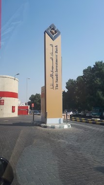
ATM Saudi Investment Bank
2862 Jafar Ba Abbud, Al Aziziyah District Jeddah 23342 7970 Jafar Ba Abbud, Jeddah
Atm
read more
798 m
Bank Aljazira ATM🏧
Al Muallifin, Jeddah
Atm
read more
803 m
Al Rajhi ATM 🏧
Al Amir Mitab, Jeddah
Atm
read more
832 m
Al Jazira ATM
Prince Mutaib bin Abdulaziz Road, Jeddah
Atm
read more
870 m
الأهلي
طريق الامير متعب بن عبدالعزيز، حي الرحاب، جدة
Atm
read more
901 m
ATM
طريق الامير متعب بن عبدالعزيز،, Jeddah
Atm
read more
📑
all categories
Accounting
Administrative area level 1
Airport
Amusement park
Aquarium
Art gallery
Atm
Bakery
Bank
Bar
Beauty salon
Bicycle store
Book store
Bowling alley
Bus station
Cafe
Campground
Car dealer
Car rental
Car repair
Car wash
Casino
Cemetery
Church
City hall
Clothing store
Colloquial area
Convenience store
Country
Courthouse
Dentist
Department store
Doctor
Electrician
Electronics store
Embassy
Finance
Fire station
Florist
Food
Funeral home
Furniture store
Gas station
General contractor
Grocery or supermarket
Gym
Hair care
Hardware store
Health
Hindu Temple
Home goods store
Hospital
Insurance agency
Intersection
Jewelry store
Laundry
Lawyer
Library
Light rail station
Liquor store
Local government office
Locality
Locksmith
Lodging
Meal delivery
Meal takeaway
Mosque
Movie rental
Movie theater
Moving company
Museum
Natural feature
Neighborhood
Night club
Painter
Park
Parking
Pet store
Pharmacy
Physiotherapist
Place of worship
Plumber
Point of interest
Police
Political
Post office
Premise
Real estate agency
Restaurant
Roofing contractor
Route
Rv park, camping
School
Shoe store
Shopping mall
Spa
Stadium
Storage
Store
Sublocality
Subpremise
Subway station
Supermarket
Taxi stand
Train station
Transit station
Travel agency
University
Veterinary care
Zoo
sublocality level 1
↑