Atm nearby NCB ATM
Saudi Arabia
Atm nearby NCB ATM
NCB ATM
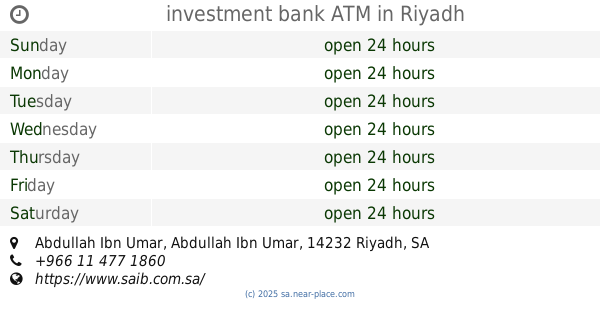
Saad Bin Abi Waqas Road، الرياض Saudi Arabia
contacts phone
:
+966
Latitude:
24.7416379
, Longitude:
46.8090011
read more
nearest Atm
139 m
Samba ATM
Front of Panda Naseem, Corner of Khurais Road & Ishara Arbaeen (40th st, Riyadh
Atm
read more
334 m
Alawwal Bank ATM
Khurais Road, Riyadh
Atm
read more
403 m
مصرف الإنماء
طريق خريص -النسيم، الرياض
Atm
read more
440 m
Riyad Bank ATM
Kharis Branch Road, Riyadh
Atm
read more
524 m
مصرف الراجحي
7354 Saad Ibn Abi Waqas, An Nasim Al Gharbi, Riyadh 14231 2796 Saad Ibn Abi Waqas, Riyadh
Atm
read more
563 m
صراف العربي
Usamah Ibn Zaid, Riyadh
Atm
read more
733 m
ATM NCB
7235 Saad Ibn Abi Waqas, Riyadh
Atm
read more
775 m
ATM Saudi Investment Bank
Usamah Ibn Zaid, Riyadh
Atm
read more
818 m
صراف البنك الاهلي
Ubaidah Ibn Al Harith, Riyadh
Atm
read more
938 m
Tahweel Al Rajhi
saad bin abi wgas, Naseem, Riyadh
Atm
read more
982 m
SABB BANK ATM
Abdullah Ibn Umar Abdullah Ibn Umar, Riyadh
Atm
read more
1.001 km
SABB
Abdullah bin Omar Almukhtar Street, Riyadh
Atm
read more
1.101 km
مركز سامبا كارد المصرفي
Riyadh
Atm
read more
1.104 km
البنك الأول
هايبر بنده، طريق خريص، الرياض
Atm
read more
1.105 km
سامبا
هايبر بنده، طريق خريص، الرياض
Atm
read more
1.105 km
بنك البلاد
Kharis Branch Road, Riyadh
Atm
read more
1.105 km
Alinma ATM
هايبر بنده، طريق خريص الفرعي، الرياض
Atm
read more
1.114 km
ATM Al Rajhi Bank
Riyadh
Atm
read more
1.179 km
بنك الاهلي النسيم
8131 Abdul Rahman Ibn Awf Road, Riyadh
Atm
read more
1.186 km
Riyadh Bank ATM
Al Ghoairi Gas Station، الرياض
Atm
read more
1.187 km
بنك الرياض
شارع عبد الرحمن الناصر حي الخليج، الرياض
Atm
read more
1.211 km
investment bank ATM
Abdullah Ibn Umar Abdullah Ibn Umar, Riyadh
Atm
read more
1.26 km
Alinma ATM
Hafsah Bint Umar, Riyadh
Atm
read more
1.288 km
Alawwal Bank ATM
4260 Kharis Branch Road, Riyadh
Atm
read more
1.311 km
Samba ATM
4260 Kharis Branch Road, Riyadh
Atm
read more
📑
all categories
Accounting
Administrative area level 1
Airport
Amusement park
Aquarium
Art gallery
Atm
Bakery
Bank
Bar
Beauty salon
Bicycle store
Book store
Bowling alley
Bus station
Cafe
Campground
Car dealer
Car rental
Car repair
Car wash
Casino
Cemetery
Church
City hall
Clothing store
Colloquial area
Convenience store
Country
Courthouse
Dentist
Department store
Doctor
Electrician
Electronics store
Embassy
Finance
Fire station
Florist
Food
Funeral home
Furniture store
Gas station
General contractor
Grocery or supermarket
Gym
Hair care
Hardware store
Health
Hindu Temple
Home goods store
Hospital
Insurance agency
Intersection
Jewelry store
Laundry
Lawyer
Library
Light rail station
Liquor store
Local government office
Locality
Locksmith
Lodging
Meal delivery
Meal takeaway
Mosque
Movie rental
Movie theater
Moving company
Museum
Natural feature
Neighborhood
Night club
Painter
Park
Parking
Pet store
Pharmacy
Physiotherapist
Place of worship
Plumber
Point of interest
Police
Political
Post office
Premise
Real estate agency
Restaurant
Roofing contractor
Route
Rv park, camping
School
Shoe store
Shopping mall
Spa
Stadium
Storage
Store
Sublocality
Subpremise
Subway station
Supermarket
Taxi stand
Train station
Transit station
Travel agency
University
Veterinary care
Zoo
sublocality level 1
↑