Atm nearby SABB
Saudi Arabia
Atm nearby SABB
SABB
Prince Saud Al Faisal, Panda, Jeddah Saudi Arabia
contacts phone
:
+966
Latitude:
21.574816
, Longitude:
39.163797
read more
nearest Atm
25 m
ساب
حي الروضة، جدة
Atm
read more
492 m
ATM Riyadh 🏧
Al Batha, Jeddah
Atm
read more
542 m
SABB
Farm Market-Rawdah Jeddah, Jeddah
Atm
read more
550 m
Riyad Bank ATM 🏧
Rayhanat Al Jazirah, Jeddah
Atm
read more
553 m
بنك الرياض
شارع ريحانة الجزيرة_ حي الفيصلية، جدة
Atm
read more
561 m
العربي
Hamad Al Jaser, Jeddah
Atm
read more
601 m
صراف العربي 🏧
Hamad Al Jaser, Jeddah
Atm
read more
629 m
Aljazira ATM 🏧
Hamad Al Jaser, Jeddah
Atm
read more
635 m
صراف البنك الأهلي
2338 Rayhanat Al Jazirah, Al Faisaliyah District, Jeddah 23442 8475 Rayhanat Al Jazirah, Jeddah
Atm
read more
635 m
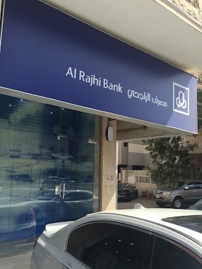
Al Rajhi
Jeddah
Atm
read more
637 m
الأهلي
شارع ريحانة الجزيرة ، حي الفيصلية، جدة
Atm
read more
652 m
SABB
Al-Salamah Station, Sari St, Jeddah
Atm
read more
653 m
SABB Bank ATM
Musa Ibn Nusayr, Jeddah
Atm
read more
856 m
صراف بنك سامبا
Mamad Rukn Ad Din, Jeddah
Atm
read more
888 m
الأهلي
شارع صاري، حي السلامة، جدة
Atm
read more
918 m
SABB
SJD Branch CDM, Jeddah
Atm
read more
938 m
Al Rajhi ATM
Al Miqdad, Jeddah
Atm
read more
939 m
Aljazeera ATM
Al Kayyal, Jeddah
Atm
read more
941 m
الأهلي
8452 الامام عبدالعزيز، حي الفيصلية، جدة 23442 2700 Al Imam Abdul Aziz, Jeddah
Atm
read more
941 m
Aljazira
3723 Al Kayyal, AR Rawdah District Jeddah 23433 8090 Al Kayyal, Jeddah
Atm
read more
1.002 km
صراف الأهلي
شارع صاري، حي الفيصلية، جدة
Atm
read more
1.01 km
Riyadh Bank ATM
8145 Al Imam Abdul Aziz, Al Faisaliyah District, Jeddah
Atm
read more
1.028 km
anb ATM🏧
Ibn Zaydun, Jeddah
Atm
read more
1.029 km
الأهلي
شارع صالح ، البوادي، جدة
Atm
read more
1.034 km
SABB
Al Rawdah Gas Station, Jeddah
Atm
read more
📑
all categories
Accounting
Administrative area level 1
Airport
Amusement park
Aquarium
Art gallery
Atm
Bakery
Bank
Bar
Beauty salon
Bicycle store
Book store
Bowling alley
Bus station
Cafe
Campground
Car dealer
Car rental
Car repair
Car wash
Casino
Cemetery
Church
City hall
Clothing store
Colloquial area
Convenience store
Country
Courthouse
Dentist
Department store
Doctor
Electrician
Electronics store
Embassy
Finance
Fire station
Florist
Food
Funeral home
Furniture store
Gas station
General contractor
Grocery or supermarket
Gym
Hair care
Hardware store
Health
Hindu Temple
Home goods store
Hospital
Insurance agency
Intersection
Jewelry store
Laundry
Lawyer
Library
Light rail station
Liquor store
Local government office
Locality
Locksmith
Lodging
Meal delivery
Meal takeaway
Mosque
Movie rental
Movie theater
Moving company
Museum
Natural feature
Neighborhood
Night club
Painter
Park
Parking
Pet store
Pharmacy
Physiotherapist
Place of worship
Plumber
Point of interest
Police
Political
Post office
Premise
Real estate agency
Restaurant
Roofing contractor
Route
Rv park, camping
School
Shoe store
Shopping mall
Spa
Stadium
Storage
Store
Sublocality
Subpremise
Subway station
Supermarket
Taxi stand
Train station
Transit station
Travel agency
University
Veterinary care
Zoo
sublocality level 1
↑