Atm nearby صراف الي
Saudi Arabia
Atm nearby صراف الي
صراف الي
2901 فلسطين، حي الشرفية جدة 23218، Al-Sharafeyah, Jeddah 8241, Saudi Arabia
contacts phone
:
+966
Latitude:
21.5309457
, Longitude:
39.187992
larger map & directions
read more
nearest Atm
10 m
Riyad ATM
Falastin, 2901 Ash Sharafiyah District 8241, Jeddah
Atm
read more
64 m
بنك الرياض
طارق بن عبيد ـ فلسطين، جدة
Atm
read more
99 m
Riyad Bank🏧
3388 Falastin, حي مشرفة،, Jeddah
Atm
read more
224 m
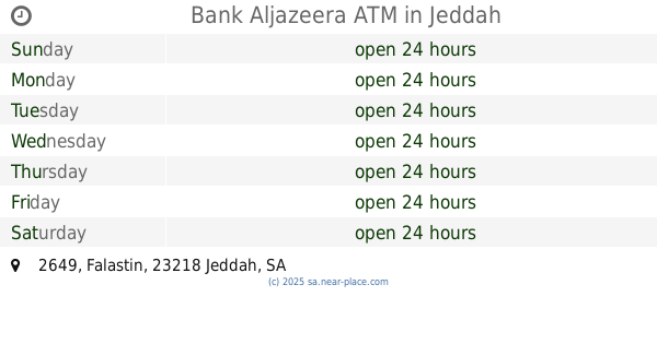
Bank Aljazeera ATM
2649 Falastin, Jeddah
Atm
read more
368 m
Al Rajhi Bank ATM 🏧
Khalid Ibn Al-Waleed, Jeddah
Atm
read more
529 m
Tahweel Al Rajhi
Palaine, Palastine St, Jeddah
Atm
read more
567 m
بنك الجزيرة
شارع محمد الطويل، حي المشرفه، جدة
Atm
read more
578 m
Aljazira Bank ATM 🏧
3407 Mohammed Altawel, Jeddah
Atm
read more
602 m
بنك الجزيرة
شارع محمد الطويل_حي مشرفة، جدة
Atm
read more
604 m
SABB
Mishrifah Lobby, Jeddah
Atm
read more
612 m
ساب
شارع محمد الطويل، حي مشرفه، جدة
Atm
read more
612 m
ساب
شارع محمد الطويل ، حي مشرفة، جدة
Atm
read more
614 m
Riyad ATM
3135 Mohammed Altawel, Jeddah
Atm
read more
635 m
Bank Albilad ATM
Falastin, Jeddah
Atm
read more
647 m
البلاد
شارع محمد الطويل، حي مشرفة، جدة
Atm
read more
656 m
Bank Albilad ATM
3614 Mohammed Altawel, Jeddah
Atm
read more
713 m
Bank Albilad ATM
King Fahd Road, Jeddah
Atm
read more
763 m
صراف الاهلي NCB ATM
2801 Dhu An Nurayn, حي الشرفية،, Jeddah
Atm
read more
832 m
Riyad ATM🏧
Dhu An Nurayn, Jeddah
Atm
read more
909 m
Al Rajhi ATM 🏧
Abu Bakr As Siddiq Road, Jeddah
Atm
read more
940 m
Al Rajhi ATM
7415 خالد ابن الوليد, Jeddah
Atm
read more
942 m
atm riyadh bank
Jeddah
Atm
read more
953 m
الأهلي
7342 Khalid Ibn Al-Waleed, حي الشرفية,, Jeddah
Atm
read more
965 m
Alinma ATM
Hamad Sulayyman, Jeddah
Atm
read more
968 m
Alinma ATM
7957 Al-Madinah Al-Munawarah Road, حي الشرفية, Jeddah
Atm
read more
📑
all categories
Accounting
Administrative area level 1
Airport
Amusement park
Aquarium
Art gallery
Atm
Bakery
Bank
Bar
Beauty salon
Bicycle store
Book store
Bowling alley
Bus station
Cafe
Campground
Car dealer
Car rental
Car repair
Car wash
Casino
Cemetery
Church
City hall
Clothing store
Colloquial area
Convenience store
Country
Courthouse
Dentist
Department store
Doctor
Electrician
Electronics store
Embassy
Finance
Fire station
Florist
Food
Funeral home
Furniture store
Gas station
General contractor
Grocery or supermarket
Gym
Hair care
Hardware store
Health
Hindu Temple
Home goods store
Hospital
Insurance agency
Intersection
Jewelry store
Laundry
Lawyer
Library
Light rail station
Liquor store
Local government office
Locality
Locksmith
Lodging
Meal delivery
Meal takeaway
Mosque
Movie rental
Movie theater
Moving company
Museum
Natural feature
Neighborhood
Night club
Painter
Park
Parking
Pet store
Pharmacy
Physiotherapist
Place of worship
Plumber
Point of interest
Police
Political
Post office
Premise
Real estate agency
Restaurant
Roofing contractor
Route
Rv park, camping
School
Shoe store
Shopping mall
Spa
Stadium
Storage
Store
Sublocality
Subpremise
Subway station
Supermarket
Taxi stand
Train station
Transit station
Travel agency
University
Veterinary care
Zoo
sublocality level 1
↑