Beauty salon nearby قطر الندى
Coronavirus disease (COVID-19) Situation
confirmed cases
841469
deaths
9646
Saudi Arabia
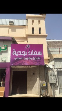
Beauty salon nearby قطر الندى
قطر الندى
Hail 55424, Arabia Saudyjska
contacts phone
:
+966
Latitude:
27.5259975
, Longitude:
41.6695959
larger map & directions
read more
nearest Beauty salon
898 m
مشغل زفاف
2926, Hail
Beauty salon
read more
1.03 km
لمسات الجمال 2
3611 صنعاء، العزيزية حائل 55424 8966
Beauty salon
read more
1.614 km
مركز guzel kose للتجميل
6462 Ibn Taymiyyah, Hail
Beauty salon
read more
2.06 km
صالون مريم البلوي
Hail
Beauty salon
read more
2.064 km
صالون نجم الثريا
Unnamed Road, Hail
Beauty salon
read more
2.328 km
مركز شور للعناية بالمرأة
king Faisal Road, Hail
Beauty salon
read more
2.861 km
Salon operator Diva Beauty
King Fahd Road, Hail
Beauty salon
read more
2.878 km
مشغل سيمفونية النسائي
Hail
Beauty salon
read more
2.96 km
مشغل جمال الاوركيد
Afnan, Hail
Beauty salon
read more
2.963 km
مركز ملامح
6373-6400 Afnan, Hail
Beauty salon
read more
3.038 km
مشغل تذكار النسائي
4495 Al Arubah, 7108, Hail
Beauty salon
read more
3.063 km
Fashionista Salon
Hail
Beauty salon
read more
3.069 km
Nagdih player features
6437, Hail
Beauty salon
read more
3.084 km
مشغل تومي
6358 الجديده, 2641, Hail
Beauty salon
read more
3.092 km
مشغل الوليد
Unnamed Road, Hail
Beauty salon
read more
3.108 km
مشغل لحظة الجمال
2680, Hail
Beauty salon
read more
3.117 km
laylacky building
King Faisal Rd King Faisal Road, Hail
Beauty salon
read more
3.119 km
Rest Salon
Unnamed Road, Hail
Beauty salon
read more
3.128 km
Z rahty زد راحتي
2706 King Faisal Road, 6264, Hail
Beauty salon
read more
3.13 km
صالون لمسات الجمال3
Hail
Beauty salon
read more
3.148 km
مشغل الازياء الراقية
6459 Bab As Safaqat, Hail
Beauty salon
read more
3.22 km
مشغل الفن المتجدد
3685 Jaddah, Hail
Beauty salon
read more
3.229 km
اتلية
الوسيطاء،
Beauty salon
read more
3.232 km
مشغل دار الزين
حائل - شارع جدة - مقابل قاردن
Beauty salon
read more
3.264 km
مشغل المناهل النسائي
Bab As Safaqat Street,Barzan، حائل
Beauty salon
read more
📑
all categories
Accounting
Administrative area level 1
Airport
Amusement park
Aquarium
Art gallery
Atm
Bakery
Bank
Bar
Beauty salon
Bicycle store
Book store
Bowling alley
Bus station
Cafe
Campground
Car dealer
Car rental
Car repair
Car wash
Casino
Cemetery
Church
City hall
Clothing store
Colloquial area
Convenience store
Country
Courthouse
Dentist
Department store
Doctor
Electrician
Electronics store
Embassy
Finance
Fire station
Florist
Food
Funeral home
Furniture store
Gas station
General contractor
Grocery or supermarket
Gym
Hair care
Hardware store
Health
Hindu Temple
Home goods store
Hospital
Insurance agency
Intersection
Jewelry store
Laundry
Lawyer
Library
Light rail station
Liquor store
Local government office
Locality
Locksmith
Lodging
Meal delivery
Meal takeaway
Mosque
Movie rental
Movie theater
Moving company
Museum
Natural feature
Neighborhood
Night club
Painter
Park
Parking
Pet store
Pharmacy
Physiotherapist
Place of worship
Plumber
Point of interest
Police
Political
Post office
Premise
Real estate agency
Restaurant
Roofing contractor
Route
Rv park, camping
School
Shoe store
Shopping mall
Spa
Stadium
Storage
Store
Sublocality
Subpremise
Subway station
Supermarket
Taxi stand
Train station
Transit station
Travel agency
University
Veterinary care
Zoo
sublocality level 1
↑