Cafe nearby Dunkin Donuts
Coronavirus disease (COVID-19) Situation
confirmed cases
841469
deaths
9646
Saudi Arabia
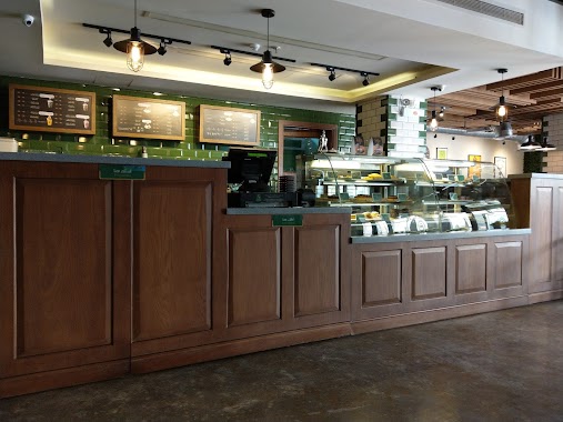
Cafe nearby Dunkin Donuts
Dunkin Donuts
Alrayan, Buraida 52379, Saudi-Arabien
contacts phone
:
+966 59 164 6325
website:
www.dunkindonuts.sa
Latitude:
26.392919
, Longitude:
43.924813
larger map & directions
read more
nearest Cafe
189 m
تاليدا
Buraydah
Cafe
read more
206 m
Fan.Jan.Cafe
Umar Ibn Al Khatab Road, Buraydah
Cafe
read more
296 m
أستاذ القهوة
King Salman Road, Buraydah
Cafe
read more
355 m
Cherry Beans Cafe حبات الكرز
King Salman Road, تقاطع طريق الملك سلمان مع طريق الإمام البخاري, Buraydah
Cafe
read more
365 m
Oromo coffee | اورمو كوفي
6337 Umar Ibn Al Khatab Road, Buraydah
Cafe
read more
387 m
سينامون وكافيه
Buraydah
Cafe
read more
404 m
Wild Cherry
Buraydah
Cafe
read more
411 m
Sulaiman Tea
5381, مخطط الرواف, Buraydah
Cafe
read more
425 m
قهوة و كلمات
Al Rawaf Planning Buraydah، 52379
Cafe
read more
425 m
Coffee and Words
Al Rawaf Planning Buraydah، 52379
Cafe
read more
470 m
قهوة نوقا
شارع البخاري، الريان، بريدة
Cafe
read more
472 m
Daily Dose
7460، الريان، بريدة 52379
Cafe
read more
528 m
كيف المساء
بريدة
Cafe
read more
528 m
درة الكيف
بريدة
Cafe
read more
573 m
درة الكيف للقهوة العربية
بريدة
Cafe
read more
574 m
درة الكيف للقهوة العربية
شارع عمر بن سليم،, Buraydah
Cafe
read more
614 m
Caffe bene
Al Bukhari Street, Ar Rayyan، بريدة
Cafe
read more
734 m
دلة الاجداد
4833, Buraydah
Cafe
read more
742 m
Blue Gold Coffee
Buraydah
Cafe
read more
753 m
Monkey Cookies
6699-6737 Umar Ibn Al Khatab Road, Buraydah
Cafe
read more
760 m
رشفة روعة القهوة
4770, 7170, Buraydah
Cafe
read more
763 m
modi cafe
Buraydah
Cafe
read more
763 m
Rshfah coffee
4770 الريان، بريدة 52379
Cafe
read more
830 m
Canto Specialty Coffee
9216 Uthman Ibn Affan Rd, Al Iskan Buraydah 52386 2624 Uthman Ibn Affan Road, Buraydah
Cafe
read more
841 m
مجموعة دار كيف كافية
Buraydah
Cafe
read more
📑
all categories
Accounting
Administrative area level 1
Airport
Amusement park
Aquarium
Art gallery
Atm
Bakery
Bank
Bar
Beauty salon
Bicycle store
Book store
Bowling alley
Bus station
Cafe
Campground
Car dealer
Car rental
Car repair
Car wash
Casino
Cemetery
Church
City hall
Clothing store
Colloquial area
Convenience store
Country
Courthouse
Dentist
Department store
Doctor
Electrician
Electronics store
Embassy
Finance
Fire station
Florist
Food
Funeral home
Furniture store
Gas station
General contractor
Grocery or supermarket
Gym
Hair care
Hardware store
Health
Hindu Temple
Home goods store
Hospital
Insurance agency
Intersection
Jewelry store
Laundry
Lawyer
Library
Light rail station
Liquor store
Local government office
Locality
Locksmith
Lodging
Meal delivery
Meal takeaway
Mosque
Movie rental
Movie theater
Moving company
Museum
Natural feature
Neighborhood
Night club
Painter
Park
Parking
Pet store
Pharmacy
Physiotherapist
Place of worship
Plumber
Point of interest
Police
Political
Post office
Premise
Real estate agency
Restaurant
Roofing contractor
Route
Rv park, camping
School
Shoe store
Shopping mall
Spa
Stadium
Storage
Store
Sublocality
Subpremise
Subway station
Supermarket
Taxi stand
Train station
Transit station
Travel agency
University
Veterinary care
Zoo
sublocality level 1
↑