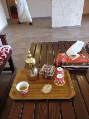
Cafe nearby i Sweet Cafe
Coronavirus disease (COVID-19) Situation
confirmed cases
841469
deaths
9646
Saudi Arabia
Cafe nearby i Sweet Cafe
i Sweet Cafe
Al Qusur, Dhahran Saudi-Arabien
contacts phone
:
+966
Latitude:
26.3457069
, Longitude:
50.1458462
larger map & directions
read more
nearest Cafe
6 m
Smallcakes Bakery
Prince Mohammed Bin Fahd Rd, Al Qusur، الظهران
Cafe
read more
6 m
Smallcakes Bakery
Prince Mohammed Bin Fahd Road, Dhahran
Cafe
read more
76 m
Bellamia
Prince Mohammed Bin Fahd Rd، الدمام
Cafe
read more
98 m
Majlis Cafe
Prince Mohammed Bin Fahd Road, Dhahran
Cafe
read more
203 m
كاندي ستوري candy story
Dhahran
Cafe
read more
316 m
صنّاع الحلاويات
Dhahran
Cafe
read more
322 m
سويت فاكتوري
Dhahran
Cafe
read more
872 m
Dunkin' Donuts
Prince Mohammed Bin Fahd Branch Road, 619, Dhahran
Cafe
read more
880 m
Cafe' JAMOKA
القصور، الظهران
Cafe
read more
883 m
مكسرات الضيافه
Dhahran
Cafe
read more
1.051 km
Oasis Cafe
Marbella Compound، Al Qusur، الظهران
Cafe
read more
1.051 km
Oasis Cafe
Marbella Compound, Dhahran
Cafe
read more
1.157 km
الخولاني
Al Khobar
Cafe
read more
1.406 km
Dunkin Donuts
5365 Prince Sultan Road, Dhahran
Cafe
read more
1.423 km
ديوانية تكية
Dhahran
Cafe
read more
1.437 km
ديوانية كيف القيصرية
Prince Sultan Road, Dhahran
Cafe
read more
1.571 km
Saad Alshahrani residence
Omar Ibn Abdulaziz Street, Dhahran
Cafe
read more
2.118 km
كفتيريا قدري محمد
Martyr Alqahtani Street, Dhahran
Cafe
read more
2.163 km
Derby Coffee
Prince Sultan Road, Dhahran
Cafe
read more
2.172 km
Derby
Prince Sultan Road, Dhahran
Cafe
read more
2.238 km
Big & Co. Coffee
Prince Sultan Road, Shop No.11, Farm 5, Dhahran
Cafe
read more
2.378 km
Starbucks
Prince Sultan Road, Dhahran
Cafe
read more
2.594 km
Seattle Cafe
Munirah Road, Dhahran
Cafe
read more
2.648 km
Starbucks Coffee
Inside Energy Center, Ithraa, Dhahran
Cafe
read more
2.824 km
aldiwan coffee
Cafe
read more
📑
all categories
Accounting
Administrative area level 1
Airport
Amusement park
Aquarium
Art gallery
Atm
Bakery
Bank
Bar
Beauty salon
Bicycle store
Book store
Bowling alley
Bus station
Cafe
Campground
Car dealer
Car rental
Car repair
Car wash
Casino
Cemetery
Church
City hall
Clothing store
Colloquial area
Convenience store
Country
Courthouse
Dentist
Department store
Doctor
Electrician
Electronics store
Embassy
Finance
Fire station
Florist
Food
Funeral home
Furniture store
Gas station
General contractor
Grocery or supermarket
Gym
Hair care
Hardware store
Health
Hindu Temple
Home goods store
Hospital
Insurance agency
Intersection
Jewelry store
Laundry
Lawyer
Library
Light rail station
Liquor store
Local government office
Locality
Locksmith
Lodging
Meal delivery
Meal takeaway
Mosque
Movie rental
Movie theater
Moving company
Museum
Natural feature
Neighborhood
Night club
Painter
Park
Parking
Pet store
Pharmacy
Physiotherapist
Place of worship
Plumber
Point of interest
Police
Political
Post office
Premise
Real estate agency
Restaurant
Roofing contractor
Route
Rv park, camping
School
Shoe store
Shopping mall
Spa
Stadium
Storage
Store
Sublocality
Subpremise
Subway station
Supermarket
Taxi stand
Train station
Transit station
Travel agency
University
Veterinary care
Zoo
sublocality level 1
↑