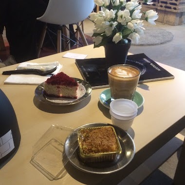
Cafe nearby كافيه قهوه السيدات
Coronavirus disease (COVID-19) Situation
confirmed cases
841469
deaths
9646
Saudi Arabia
Cafe nearby كافيه قهوه السيدات
كافيه قهوه السيدات
طريق المدينه، حائل 55425 8005،، Al Samra, Hail 55425, Saudi Arabia
contacts phone
:
+966
Latitude:
27.5113222
, Longitude:
41.7183746
larger map & directions
read more
nearest Cafe
865 m
كوفي ديلي دونات
3775 طريق الديعجان، لبدة، حائل 55425 8750 Ad Dayajan Road, Hail
Cafe
read more
930 m
مقهـي رول آيس
Hail
Cafe
read more
930 m
كوفي رول آيس
Hail
Cafe
read more
1.109 km
مقهى ذا بالمز The Palm's coffee
Hail
Cafe
read more
1.13 km
ذا كاسل كوفي - The Casle Coffee
Hail
Cafe
read more
1.309 km
Alheer coffeehouse
6312 طريق الديعجان، مغيضة حائل 55428 4426 Ad Dayajan Road, Hail
Cafe
read more
1.471 km
Masud coffee shop
Hail
Cafe
read more
1.53 km
معاذ
Al Jarr, Hail
Cafe
read more
1.642 km
بوفيه و قهوة أكوبام
8140 الامير مقرن بن عبدالعزيز،، حائل
Cafe
read more
1.739 km
Coffee Corrner
2520 Muhammad Al Abdullah Ar Rashid, Hail
Cafe
read more
2.174 km
Z Cafe
Bab As Safaqat, Hail
Cafe
read more
2.234 km
مقهى
باب الصفاقات،، حائل
Cafe
read more
2.273 km
تاستي ديب
2772 الخريفة, Hail
Cafe
read more
2.275 km
Coffee Shop Luxury Coffee
king Faisal Road, حائل - برزان, Hail
Cafe
read more
2.31 km
dip4dip
Hail
Cafe
read more
2.331 km
كوفي شوب ذا كيرف
2281 طائف, Hail
Cafe
read more
2.369 km
القهوة الخالدة
6483 الجديده, Hail
Cafe
read more
2.405 km
Angel cafe
2720, 6594, Hail
Cafe
read more
2.427 km
Coffee Club
Hail
Cafe
read more
2.459 km
الخير كافية
4635-4698 ابن خلدون،, Hail
Cafe
read more
2.574 km
محمصة البن الفاخر
Al Amir Sultan Ibn Abdul Aziz, Hail
Cafe
read more
2.696 km
Bait Al Halwiyat
7599 Az Ziraah, Hail
Cafe
read more
2.725 km
مقهى فلكلور النسائي
حائل
Cafe
read more
2.803 km
ماماروتي
8989, Hail
Cafe
read more
2.904 km
Majlis Villa
Hail
Cafe
read more
📑
all categories
Accounting
Administrative area level 1
Airport
Amusement park
Aquarium
Art gallery
Atm
Bakery
Bank
Bar
Beauty salon
Bicycle store
Book store
Bowling alley
Bus station
Cafe
Campground
Car dealer
Car rental
Car repair
Car wash
Casino
Cemetery
Church
City hall
Clothing store
Colloquial area
Convenience store
Country
Courthouse
Dentist
Department store
Doctor
Electrician
Electronics store
Embassy
Finance
Fire station
Florist
Food
Funeral home
Furniture store
Gas station
General contractor
Grocery or supermarket
Gym
Hair care
Hardware store
Health
Hindu Temple
Home goods store
Hospital
Insurance agency
Intersection
Jewelry store
Laundry
Lawyer
Library
Light rail station
Liquor store
Local government office
Locality
Locksmith
Lodging
Meal delivery
Meal takeaway
Mosque
Movie rental
Movie theater
Moving company
Museum
Natural feature
Neighborhood
Night club
Painter
Park
Parking
Pet store
Pharmacy
Physiotherapist
Place of worship
Plumber
Point of interest
Police
Political
Post office
Premise
Real estate agency
Restaurant
Roofing contractor
Route
Rv park, camping
School
Shoe store
Shopping mall
Spa
Stadium
Storage
Store
Sublocality
Subpremise
Subway station
Supermarket
Taxi stand
Train station
Transit station
Travel agency
University
Veterinary care
Zoo
sublocality level 1
↑