Cafe nearby خوش كرك
Coronavirus disease (COVID-19) Situation
confirmed cases
841469
deaths
9646
Saudi Arabia
Cafe nearby خوش كرك
خوش كرك
Al Samer, Opp. NCB ATM, Al Samer Dist., 23461, جدة, SA Saudi Arabia
contacts phone
:
+966 54 151 5011
website:
www.instagram.com
Latitude:
21.5811769
, Longitude:
39.2387512
larger map & directions
read more
nearest Cafe
434 m
وافل هوم
Jeddah
Cafe
read more
439 m
ديوانية الأمراء
شارع الحسين السهواجي، حي السامر، جدة
Cafe
read more
479 m
Laziz Burger Samir
6272-6378 Wahib Bin Umair, Jeddah
Cafe
read more
573 m
ديوانية الدلة البغدادية
2596, As Samir District, Jeddah
Cafe
read more
719 m
مركاز القهوة
عبدالله بن عطاء, Jeddah
Cafe
read more
734 m
meerkaz cafe
Jeddah
Cafe
read more
756 m
Almaqsaf Cafeteria
Al Samer, Jeddah
Cafe
read more
798 m
كرك الخليج
جدة
Cafe
read more
809 m
ربوة الخميس
2278 Arramih Almuri, As Samir District Jeddah 23461 7612 Arramih Almuri, Jeddah
Cafe
read more
836 m
Coffee
Alhusain Alsouhwagi, Jeddah
Cafe
read more
839 m
القهوة الحديثة
Jeddah
Cafe
read more
874 m
Diwaniya origins of coffee
Ankara, Jeddah
Cafe
read more
882 m
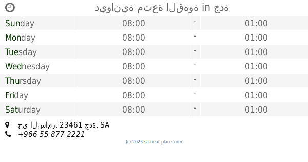
ديوانية متعة القهوة
حي السامر، جدة
Cafe
read more
885 m
ديوانية المكارم
Alhusain Alsouhwagi, Jeddah
Cafe
read more
889 m
مقهى خيال
Jeddah
Cafe
read more
901 m
مقهى القهوة ذوق
Jeddah
Cafe
read more
905 m
Ice Cream Shop
6583 عمر بن قيس, Jeddah
Cafe
read more
925 m
ستاربوكس
Jeddah
Cafe
read more
1.004 km
دربي كافية
Jeddah
Cafe
read more
1.029 km
LE Churro
Al Samer, Jeddah
Cafe
read more
1.032 km
معسلات الكيف الراقي
شارع،, وهيب بن عمير، السامر، جدة السعودية, Jeddah
Cafe
read more
1.117 km
قافلة القهوة
King Fahd Road, Jeddah
Cafe
read more
1.269 km
كافي الحبايب
شارع الشاكرين، حي الصفا، جدة
Cafe
read more
1.28 km
شاي أبو لتين الغامدي
6535 الطريق الدائري، حي السامر جدة 23462
Cafe
read more
1.281 km
ديوانية الدله المهيله
شارع الشاكرين_ حي الصفا، جدة
Cafe
read more
📑
all categories
Accounting
Administrative area level 1
Airport
Amusement park
Aquarium
Art gallery
Atm
Bakery
Bank
Bar
Beauty salon
Bicycle store
Book store
Bowling alley
Bus station
Cafe
Campground
Car dealer
Car rental
Car repair
Car wash
Casino
Cemetery
Church
City hall
Clothing store
Colloquial area
Convenience store
Country
Courthouse
Dentist
Department store
Doctor
Electrician
Electronics store
Embassy
Finance
Fire station
Florist
Food
Funeral home
Furniture store
Gas station
General contractor
Grocery or supermarket
Gym
Hair care
Hardware store
Health
Hindu Temple
Home goods store
Hospital
Insurance agency
Intersection
Jewelry store
Laundry
Lawyer
Library
Light rail station
Liquor store
Local government office
Locality
Locksmith
Lodging
Meal delivery
Meal takeaway
Mosque
Movie rental
Movie theater
Moving company
Museum
Natural feature
Neighborhood
Night club
Painter
Park
Parking
Pet store
Pharmacy
Physiotherapist
Place of worship
Plumber
Point of interest
Police
Political
Post office
Premise
Real estate agency
Restaurant
Roofing contractor
Route
Rv park, camping
School
Shoe store
Shopping mall
Spa
Stadium
Storage
Store
Sublocality
Subpremise
Subway station
Supermarket
Taxi stand
Train station
Transit station
Travel agency
University
Veterinary care
Zoo
sublocality level 1
↑