Cafe nearby مهيله البن
Coronavirus disease (COVID-19) Situation
confirmed cases
841469
deaths
9646
Saudi Arabia
Cafe nearby مهيله البن
مهيله البن
4745, Al Mahattah, Hail 55424 7540, Saudi Arabia
contacts phone
:
+966 53 000 4729
Latitude:
27.5212625
, Longitude:
41.6850891
larger map & directions
read more
nearest Cafe
162 m
قطر الندى
4907-5055 Uqdah Road, Hail
Cafe
read more
256 m
ماستر كوفي 2
Umm Al Muminin Aishah, Hail
Cafe
read more
402 m
مقهى الكاغد
king Faisal Road, Hail
Cafe
read more
469 m
توليب كافيه
طريق عقدة،، حائل
Cafe
read more
726 m
Ewan coffee shop coffee
3926 طريق عقدة، الوسيطاء حائل 55424 7394 Uqdah Road, Hail
Cafe
read more
761 m
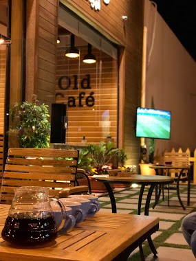
Old Cafe
Hail
Cafe
read more
770 m
اولد كوفي
Uqdah Road, Hail
Cafe
read more
851 m
Bait Al Halwiyat
7599 Az Ziraah, Hail
Cafe
read more
927 m
تعاليل الديوان
الوسيطاء،
Cafe
read more
998 m
Caffein Time
3811 Uqdah Road, Hail
Cafe
read more
1.174 km
الخير كافية
4635-4698 ابن خلدون،, Hail
Cafe
read more
1.238 km
استراحة العزيزية
5284 ظافر الكاظم, Hail
Cafe
read more
1.325 km
Majlis Villa
Hail
Cafe
read more
1.37 km
كوفي شوب ذا كيرف
2281 طائف, Hail
Cafe
read more
1.638 km
Z Cafe
Bab As Safaqat, Hail
Cafe
read more
1.644 km
القهوة الخالدة
6483 الجديده, Hail
Cafe
read more
1.662 km
Coffee Shop Luxury Coffee
king Faisal Road, حائل - برزان, Hail
Cafe
read more
1.681 km
مقهى
باب الصفاقات،، حائل
Cafe
read more
1.727 km
dip4dip
Hail
Cafe
read more
1.734 km
Angel cafe
2720, 6594, Hail
Cafe
read more
1.737 km
تاستي ديب
2772 الخريفة, Hail
Cafe
read more
1.762 km
Coffee Corrner
2520 Muhammad Al Abdullah Ar Rashid, Hail
Cafe
read more
1.812 km
Sevice
المطار،
Cafe
read more
1.892 km
بوفيه و قهوة أكوبام
8140 الامير مقرن بن عبدالعزيز،، حائل
Cafe
read more
1.938 km
مونكي كوكيز Monkey Cookies
Al Amir Sultan Ibn Abdul Aziz, 8572, 8552, Hail
Cafe
read more
📑
all categories
Accounting
Administrative area level 1
Airport
Amusement park
Aquarium
Art gallery
Atm
Bakery
Bank
Bar
Beauty salon
Bicycle store
Book store
Bowling alley
Bus station
Cafe
Campground
Car dealer
Car rental
Car repair
Car wash
Casino
Cemetery
Church
City hall
Clothing store
Colloquial area
Convenience store
Country
Courthouse
Dentist
Department store
Doctor
Electrician
Electronics store
Embassy
Finance
Fire station
Florist
Food
Funeral home
Furniture store
Gas station
General contractor
Grocery or supermarket
Gym
Hair care
Hardware store
Health
Hindu Temple
Home goods store
Hospital
Insurance agency
Intersection
Jewelry store
Laundry
Lawyer
Library
Light rail station
Liquor store
Local government office
Locality
Locksmith
Lodging
Meal delivery
Meal takeaway
Mosque
Movie rental
Movie theater
Moving company
Museum
Natural feature
Neighborhood
Night club
Painter
Park
Parking
Pet store
Pharmacy
Physiotherapist
Place of worship
Plumber
Point of interest
Police
Political
Post office
Premise
Real estate agency
Restaurant
Roofing contractor
Route
Rv park, camping
School
Shoe store
Shopping mall
Spa
Stadium
Storage
Store
Sublocality
Subpremise
Subway station
Supermarket
Taxi stand
Train station
Transit station
Travel agency
University
Veterinary care
Zoo
sublocality level 1
↑