Cafe nearby عسير نت DSL
Saudi Arabia
Cafe nearby عسير نت DSL
عسير نت DSL
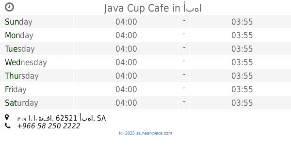
7050-7028, طريق الإمام عبدالرحمن بن فيصل بن تركي, 62521, Abha, SA Saudi Arabia
contacts phone
:
+966
Latitude:
18.2087662
, Longitude:
42.5009628
larger map & directions
read more
nearest Cafe
455 m
مطاحن ومحامص ابها Abha Mills and Roastery
7414 Umar Ibn Abdulaziz, Abha
Cafe
read more
482 m
Barncafe بارن كافيه
حي الشفا, Abha
Cafe
read more
521 m
ديوانية المفتاحة
6533 3586 طريق الإمام عبدالرحمن بن فيصل بن تركي، حي الشفاء، أبها
Cafe
read more
608 m
Cafe Promised
2875 الملك سعود، المفتاحة، أبها
Cafe
read more
722 m
ديوانية المفتاحة للقهوة العربية
Abha
Cafe
read more
773 m
حارة الفن كافيه
Abha
Cafe
read more
792 m
قولدن بان كافيه - فرع المفتاحة
Unnamed Road, Abha
Cafe
read more
832 m
ابها الجديدة
أبها
Cafe
read more
888 m
Mhelh originality Arabic coffee
2564 الملك سعود، الحزام، أبها
Cafe
read more
892 m
Nibras Cafe
King Faisal Road, Abha
Cafe
read more
893 m
ديوانية زمن أبها
7819, Abha
Cafe
read more
895 m
مقهى ليالي نت أبها
النزهة،, Abha
Cafe
read more
900 m
Abha walk
Saudi Arabia
Cafe
read more
910 m
كوفي شوب ميلان
King Khalid Road, Abha
Cafe
read more
929 m
بوفية سعد آل ناجي لتقديم الوجبات
وسط المدينة،, Abha
Cafe
read more
929 m
Cafe Saad Al Naji
وسط المدينة،, Abha
Cafe
read more
966 m
Java Cup Cafe
حي الشفا، أبها
Cafe
read more
966 m
مقهى السلوى
6507 طريق الملك عبدالعزيز،, 2626, Abha
Cafe
read more
971 m
مقهى السلوى
أبها
Cafe
read more
971 m
كوب لاونج
Abha
Cafe
read more
973 m
Cafe Baran
6543 طريق الملك عبدالعزيز،, 2592, Abha
Cafe
read more
973 m
بارن كافية
6543 طريق الملك عبدالعزيز،, 2592, Abha
Cafe
read more
974 m
عصائر كوب
6543 طريق الملك عبدالعزيز،, 2592, Abha
Cafe
read more
975 m
Coffee horizon
Abha
Cafe
read more
982 m
جباتي كرك
4048 King Abdul Aziz Road, Abha
Cafe
read more
📑
all categories
Accounting
Administrative area level 1
Airport
Amusement park
Aquarium
Art gallery
Atm
Bakery
Bank
Bar
Beauty salon
Bicycle store
Book store
Bowling alley
Bus station
Cafe
Campground
Car dealer
Car rental
Car repair
Car wash
Casino
Cemetery
Church
City hall
Clothing store
Colloquial area
Convenience store
Country
Courthouse
Dentist
Department store
Doctor
Electrician
Electronics store
Embassy
Finance
Fire station
Florist
Food
Funeral home
Furniture store
Gas station
General contractor
Grocery or supermarket
Gym
Hair care
Hardware store
Health
Hindu Temple
Home goods store
Hospital
Insurance agency
Intersection
Jewelry store
Laundry
Lawyer
Library
Light rail station
Liquor store
Local government office
Locality
Locksmith
Lodging
Meal delivery
Meal takeaway
Mosque
Movie rental
Movie theater
Moving company
Museum
Natural feature
Neighborhood
Night club
Painter
Park
Parking
Pet store
Pharmacy
Physiotherapist
Place of worship
Plumber
Point of interest
Police
Political
Post office
Premise
Real estate agency
Restaurant
Roofing contractor
Route
Rv park, camping
School
Shoe store
Shopping mall
Spa
Stadium
Storage
Store
Sublocality
Subpremise
Subway station
Supermarket
Taxi stand
Train station
Transit station
Travel agency
University
Veterinary care
Zoo
sublocality level 1
↑