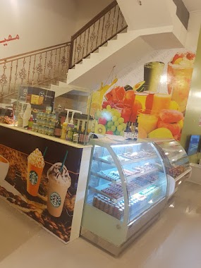
Cafe nearby وقت القهوة
Coronavirus disease (COVID-19) Situation
confirmed cases
841469
deaths
9646
Saudi Arabia
Cafe nearby وقت القهوة
وقت القهوة
Al Souq, Sharorah 68372, Saudi Arabia
contacts phone
:
+966
Latitude:
17.4928717
, Longitude:
47.114028
larger map & directions
read more
nearest Cafe
554 m
مهيلة الجود
8605, Sharorah
Cafe
read more
609 m
مهيلة جود
8669، شرورة 68372
Cafe
read more
692 m
مهيلة الصيعري للقهوة العربية
7950, 3165, Sharorah
Cafe
read more
702 m
مهيلة سما شروره قهوه
7950, 3165, Sharorah
Cafe
read more
704 m
بوفية وجبات سريعة
Sharorah
Cafe
read more
725 m
هوت تشيكن Hot chicken
Unnamed Road, Sharorah
Cafe
read more
816 m
Mhelh qualitative Shahi of steam
3509, Sharorah
Cafe
read more
917 m
مقهى جوكر معسلات
الشارع العام حي مشعل ١ أمام محطة السعادة مدينة،, Sharorah
Cafe
read more
932 m
الكايف لشاهي البخار التركي
Sharorah
Cafe
read more
1000 m
كافية واحة المساء النسائي
Sharorah
Cafe
read more
1.019 km
كافية المساء للسيدات
Sharorah
Cafe
read more
1.132 km
Rowan south of shish and Molasses
Sharorah
Cafe
read more
1.159 km
كوفي شوب الغزالي
4202, 6960،, Sharorah
Cafe
read more
1.303 km
قويتو الكيف
Sharorah
Cafe
read more
1.402 km
الفيصليه للافراح
7167, Sharorah
Cafe
read more
1.444 km
ديوانية رنز إن
Sharorah
Cafe
read more
1.616 km
منتزه الرمال
Unnamed Road, Sharorah
Cafe
read more
1.699 km
الباشا
Sharorah
Cafe
read more
2.096 km
Welfar Tital Coffee Shop
7410, Sharorah
Cafe
read more
2.111 km
كافيك Cavic Coffee Shop
6757, Sharorah
Cafe
read more
2.287 km
مهيلة و ديوانية الأمراء
King Fahd Road, Riyadh
Cafe
read more
2.842 km
عصاير وكوفي وقت الكافي
Sharorah
Cafe
read more
2.961 km
فنجال وعلوم رجال
Sharorah
Cafe
read more
3.188 km
خلف السبيعي
Sharorah
Cafe
read more
4.845 km
Porch Cafe
4686, Sharorah
Cafe
read more
📑
all categories
Accounting
Administrative area level 1
Airport
Amusement park
Aquarium
Art gallery
Atm
Bakery
Bank
Bar
Beauty salon
Bicycle store
Book store
Bowling alley
Bus station
Cafe
Campground
Car dealer
Car rental
Car repair
Car wash
Casino
Cemetery
Church
City hall
Clothing store
Colloquial area
Convenience store
Country
Courthouse
Dentist
Department store
Doctor
Electrician
Electronics store
Embassy
Finance
Fire station
Florist
Food
Funeral home
Furniture store
Gas station
General contractor
Grocery or supermarket
Gym
Hair care
Hardware store
Health
Hindu Temple
Home goods store
Hospital
Insurance agency
Intersection
Jewelry store
Laundry
Lawyer
Library
Light rail station
Liquor store
Local government office
Locality
Locksmith
Lodging
Meal delivery
Meal takeaway
Mosque
Movie rental
Movie theater
Moving company
Museum
Natural feature
Neighborhood
Night club
Painter
Park
Parking
Pet store
Pharmacy
Physiotherapist
Place of worship
Plumber
Point of interest
Police
Political
Post office
Premise
Real estate agency
Restaurant
Roofing contractor
Route
Rv park, camping
School
Shoe store
Shopping mall
Spa
Stadium
Storage
Store
Sublocality
Subpremise
Subway station
Supermarket
Taxi stand
Train station
Transit station
Travel agency
University
Veterinary care
Zoo
sublocality level 1
↑