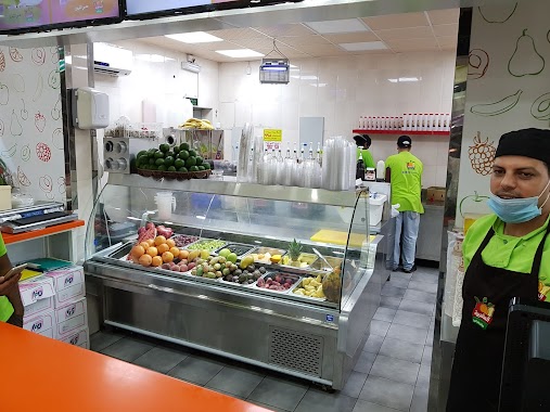
Food nearby تموينات التنوز العربي التجارية
Coronavirus disease (COVID-19) Situation
confirmed cases
841469
deaths
9646
Saudi Arabia
Food nearby تموينات التنوز العربي التجارية
تموينات التنوز العربي التجارية
Jeddah Saudi Arabia
contacts phone
:
+966
Latitude:
21.5362217
, Longitude:
39.2125275
read more
nearest Food
52 m
Grosery Shop
Jeddah
Food
read more
535 m
Mashrabia Aseerat
Prince Mutaib bin Abdulaziz Rd Prince Mutaib bin Abdulaziz Road, Jeddah
Food
read more
655 m
مؤسسة راسم محمد تقي شعبان
شارع الامير متعب ، الرحاب، جدة
Food
read more
674 m
Rassem M.T.Shaaban Trading Est.Branch
Price mutaib bin Abdullaziz Road Cross with Falastin Street, Jeddah
Food
read more
728 m
Taif Dairy Distributor
3779 Masjid Al Fitaihi, AR Rihab District, Jeddah 23343 6413
Food
read more
789 m
عرائسي النجوم
Jeddah
Food
read more
810 m
عصيرات لؤلؤ
شارع فلسطين - بني مالك، جدة
Food
read more
834 m
عصيرات الصخرة
شارع فلسطين_ حي الرحاب1 بجوار مدينة الكمبيوتر، جدة
Food
read more
885 m
معمل الدرقاء للمياه الصحية
شارع الصحافة، حي مشرفة، جدة
Food
read more
891 m
الصعيدي
Jeddah
Food
read more
906 m
طواحين السنابل (Al-Sanabel Mills)
8240, Bani Malik District, Jeddah
Food
read more
962 m
خالد صالح بن عمر للمواد الغذائية والبهارات
الامير ماجد ، بنى مالك، جدة
Food
read more
969 m
نقطة توزيع المياه الصحية
أبوحسان ، حي مالك، جدة
Food
read more
988 m
عصيرات النور
شارع بني مالك، حي بني مالك، جدة
Food
read more
1.003 km
مؤسسة الولاء الغربية التجارية لمواد خام المخابز والحلويات
Al Tadamun Al Arabi, Jeddah
Food
read more
1.003 km
Falooda Sweets
Prince Mutaib bin Abdulaziz Road, Jeddah
Food
read more
1.007 km
مؤسسة نبيل عبد الرزاق سخاخني التجارية
شارع التضامن العربي، حي مشرفة، جدة
Food
read more
1.059 km
عميد العرائسي
Jeddah
Food
read more
1.13 km
حلويات بني مالك
حي بني مالك، جدة
Food
read more
1.16 km
النقاء للمياه الصحية
شارع لؤلؤة المدينة - حي بني مالك، جدة
Food
read more
1.174 km
عصيرات الصعيدي
6944 Al-Rabitah Al-Islamiyah, Jeddah
Food
read more
1.185 km
Sugarcane juice
8263, Bani Malik District,, Jeddah
Food
read more
1.205 km
الفروج الذهبي
شارع الرابطة الإسلامية، حي المشرفة، جدة
Food
read more
1.205 km
دواجن وطني
حي بني مالك، جدة
Food
read more
1.285 km
النبع العربي
شارع غرناطة ، حي العزيزية، جدة
Food
read more
📑
all categories
Accounting
Administrative area level 1
Airport
Amusement park
Aquarium
Art gallery
Atm
Bakery
Bank
Bar
Beauty salon
Bicycle store
Book store
Bowling alley
Bus station
Cafe
Campground
Car dealer
Car rental
Car repair
Car wash
Casino
Cemetery
Church
City hall
Clothing store
Colloquial area
Convenience store
Country
Courthouse
Dentist
Department store
Doctor
Electrician
Electronics store
Embassy
Finance
Fire station
Florist
Food
Funeral home
Furniture store
Gas station
General contractor
Grocery or supermarket
Gym
Hair care
Hardware store
Health
Hindu Temple
Home goods store
Hospital
Insurance agency
Intersection
Jewelry store
Laundry
Lawyer
Library
Light rail station
Liquor store
Local government office
Locality
Locksmith
Lodging
Meal delivery
Meal takeaway
Mosque
Movie rental
Movie theater
Moving company
Museum
Natural feature
Neighborhood
Night club
Painter
Park
Parking
Pet store
Pharmacy
Physiotherapist
Place of worship
Plumber
Point of interest
Police
Political
Post office
Premise
Real estate agency
Restaurant
Roofing contractor
Route
Rv park, camping
School
Shoe store
Shopping mall
Spa
Stadium
Storage
Store
Sublocality
Subpremise
Subway station
Supermarket
Taxi stand
Train station
Transit station
Travel agency
University
Veterinary care
Zoo
sublocality level 1
↑