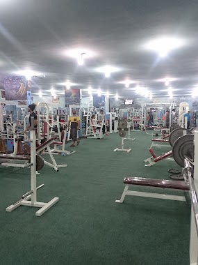
Gym nearby ملعب طارق
Coronavirus disease (COVID-19) Situation
confirmed cases
841469
deaths
9646
Saudi Arabia
Gym nearby ملعب طارق
ملعب طارق
عين الخيف،، Ayn Al Khif, Medina Saudi-Arabien
contacts phone
:
+966
Latitude:
24.423828
, Longitude:
39.6818994
larger map & directions
read more
nearest Gym
2.409 km
Chouran courts
3042 هجيمة بنت حيي الاوصابية, Medina
Gym
read more
2.52 km
مساج غير
Medina
Gym
read more
2.852 km
Reflection Fitness Lounge
2503 King Abdullah Branch Road, Medina
Gym
read more
2.875 km
استراحة جوهرة شوران
2976 يزيد بن حمير, 6395, Medina
Gym
read more
2.877 km
ريفليكشن فيتنيس لاونج
مذينب،
Gym
read more
3.284 km
Gold's Gym
King Abdullah Branch Road, Medina
Gym
read more
3.294 km
چولدز جيم GOLD'S GYM
الروابي،
Gym
read more
3.321 km
نادي اللياقة النسائي
طريق الملك عبدالله الروابي،
Gym
read more
3.33 km
Bodyline VIP center
King Abdullah Branch Road, Medina
Gym
read more
3.341 km
مركز خط الجسد BODY LINE
Medina
Gym
read more
3.388 km
أكاديمية النمور
4748 ذؤيب الخزاعي, Medina
Gym
read more
3.874 km
مسبح الخالدية
الخالدية،, Medina
Gym
read more
4.017 km
النادي الرياضي النسوي
الخالدية،, Medina
Gym
read more
4.045 km
وقت اللياقة النسائي
Medina
Gym
read more
4.045 km
Fitness Time Ladies - Khalida
Medina
Gym
read more
4.055 km
Fitness Time Ladies
Medina
Gym
read more
4.65 km
أكاديمية النجوم الرياضية
5503 نصر بن علي, Medina
Gym
read more
5.548 km
دراجتي المدينة
Unnamed Road, 42385, Medina
Gym
read more
5.613 km
دراج طيبة
Medina
Gym
read more
5.689 km
كرستال المدني
شوران،
Gym
read more
5.776 km
Tag spa
King Abdullah Road, Medina
Gym
read more
5.84 km
ملعب الاتحاد الريفي
Medina
Gym
read more
6.321 km
نادي النمر الرياضي
7482 احمد بن عبدالرحمن الشيرازي, Medina
Gym
read more
6.345 km
ملعب الدوكالي
طريق الملك عبد العزيز،
Gym
read more
6.459 km
ملعب اكادمية سوكر
المدينة المنورة
Gym
read more
📑
all categories
Accounting
Administrative area level 1
Airport
Amusement park
Aquarium
Art gallery
Atm
Bakery
Bank
Bar
Beauty salon
Bicycle store
Book store
Bowling alley
Bus station
Cafe
Campground
Car dealer
Car rental
Car repair
Car wash
Casino
Cemetery
Church
City hall
Clothing store
Colloquial area
Convenience store
Country
Courthouse
Dentist
Department store
Doctor
Electrician
Electronics store
Embassy
Finance
Fire station
Florist
Food
Funeral home
Furniture store
Gas station
General contractor
Grocery or supermarket
Gym
Hair care
Hardware store
Health
Hindu Temple
Home goods store
Hospital
Insurance agency
Intersection
Jewelry store
Laundry
Lawyer
Library
Light rail station
Liquor store
Local government office
Locality
Locksmith
Lodging
Meal delivery
Meal takeaway
Mosque
Movie rental
Movie theater
Moving company
Museum
Natural feature
Neighborhood
Night club
Painter
Park
Parking
Pet store
Pharmacy
Physiotherapist
Place of worship
Plumber
Point of interest
Police
Political
Post office
Premise
Real estate agency
Restaurant
Roofing contractor
Route
Rv park, camping
School
Shoe store
Shopping mall
Spa
Stadium
Storage
Store
Sublocality
Subpremise
Subway station
Supermarket
Taxi stand
Train station
Transit station
Travel agency
University
Veterinary care
Zoo
sublocality level 1
↑