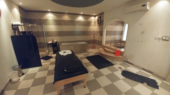
Health nearby Salam neighborhood clinic
Saudi Arabia
Health nearby Salam neighborhood clinic
Salam neighborhood clinic
3751, Wahtan, Buraydah 52347 6532, Saudi Arabia
contacts phone
:
+966
Latitude:
26.3179082
, Longitude:
43.9961152
larger map & directions
read more
nearest Health
867 m
Primary Health Care Center
Internal Ring Road - Southern Side, Buraydah
Health
read more
889 m
معمل النيرج لتركيب الأسنان
King Khalid Road, Buraydah
Health
read more
908 m
Abdullah Center for Physical Therapy
King Khalid Road, Afif, Buraydah
Health
read more
968 m
المساج التشيكي
King Khalid Road, Buraydah
Health
read more
1.076 km
Dispensary Habib
6654, Buraydah
Health
read more
1.078 km
Habib Medical Complex
6629, Buraydah
Health
read more
1.084 km
Family medicine clinic
3009 طريق عمر بن عبدالعزيز، ابن صبيح بريدة 52347 7366 Umar Ibn Abdul Aziz Road, Buraydah
Health
read more
1.391 km
ADEL PHARMACY NO1
4208 طريق الرياض القديم, Buraydah
Health
read more
1.427 km
عيادات عناية المستقبل الطبية
Umar Ibn Abdul Aziz Road, Ar Rafiah، بريدة
Health
read more
1.713 km
مستوصف البساتين
5181, Buraydah
Health
read more
1.716 km
Primary Health Care Center
طريق الدائري الداخلي الشرقي, Buraydah
Health
read more
1.921 km
دافيتا لغسيل الكلى
شارع الإمارة، الصدا, Buraydah
Health
read more
1.953 km
العلاج الطبيعي
الامارة Al Imarah, Buraydah
Health
read more
1.965 km
Human Development Center
King Faisal Road, Buraydah
Health
read more
2.045 km
Buraidah Care Medical Complex
طريق الدائري الداخلي الشرقي, Buraydah
Health
read more
2.89 km
مستوصف الرفيعة
4588, Buraydah
Health
read more
3.04 km
Red Crescent
6767 As Sadah, Buraydah
Health
read more
3.044 km
عيادات الشفاء الطبى
3702 Al Wihdah, Buraydah
Health
read more
3.044 km
Dispensary healing Buraidah Medical Clinics
Al Wihdah, Buraydah
Health
read more
3.047 km
مركز اسعاف
Buraydah
Health
read more
3.048 km
Shifa Burayda مجمع شفاء بريدة
3702 Al Wihdah, Buraydah
Health
read more
3.052 km
Primary Health Care Center
King Abdullah Road, Buraydah
Health
read more
3.073 km
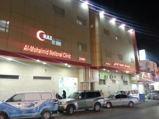
مستوصف المحيميد الوطني
Buraydah
Health
read more
3.177 km
مجمع السرايا الطبي
Al Imarah, Buraydah
Health
read more
3.541 km
High Care
At Taghirah, Buraydah
Health
read more
📑
all categories
Accounting
Administrative area level 1
Airport
Amusement park
Aquarium
Art gallery
Atm
Bakery
Bank
Bar
Beauty salon
Bicycle store
Book store
Bowling alley
Bus station
Cafe
Campground
Car dealer
Car rental
Car repair
Car wash
Casino
Cemetery
Church
City hall
Clothing store
Colloquial area
Convenience store
Country
Courthouse
Dentist
Department store
Doctor
Electrician
Electronics store
Embassy
Finance
Fire station
Florist
Food
Funeral home
Furniture store
Gas station
General contractor
Grocery or supermarket
Gym
Hair care
Hardware store
Health
Hindu Temple
Home goods store
Hospital
Insurance agency
Intersection
Jewelry store
Laundry
Lawyer
Library
Light rail station
Liquor store
Local government office
Locality
Locksmith
Lodging
Meal delivery
Meal takeaway
Mosque
Movie rental
Movie theater
Moving company
Museum
Natural feature
Neighborhood
Night club
Painter
Park
Parking
Pet store
Pharmacy
Physiotherapist
Place of worship
Plumber
Point of interest
Police
Political
Post office
Premise
Real estate agency
Restaurant
Roofing contractor
Route
Rv park, camping
School
Shoe store
Shopping mall
Spa
Stadium
Storage
Store
Sublocality
Subpremise
Subway station
Supermarket
Taxi stand
Train station
Transit station
Travel agency
University
Veterinary care
Zoo
sublocality level 1
↑