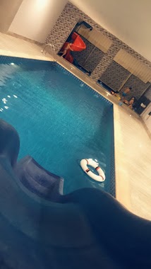
Lodging nearby إستراحة ميار
Saudi Arabia
Lodging nearby إستراحة ميار
إستراحة ميار
جدة Saudi Arabia
contacts phone
:
+966
Latitude:
21.8101889
, Longitude:
39.1015552
read more
nearest Lodging
1.382 km
عمارتي بحي الصواري
جدة
Lodging
read more
1.713 km
منتجع ليتل ريسورت
Unnamed Road, Jeddah
Lodging
read more
1.716 km
Little resort
3933, As Swaryee District, Jeddah
Lodging
read more
1.99 km
استراحات الصواري الفندقيه
4919 As Swaryee District Jeddah 23826
Lodging
read more
1.991 km
استراحة الصواري
4919 As Swaryee District Jeddah 23826
Lodging
read more
2.189 km
استراحة
8696, حي الياقوت،, Jeddah
Lodging
read more
2.195 km
استراحة Happy Day
8696, حي الياقوت،, Jeddah
Lodging
read more
2.352 km
منتجع الياقوت alyaqut istraha
Jeddah
Lodging
read more
2.356 km
Istraha Al Nakheel
طريق الملك سعود، حي الصوارى، جدة
Lodging
read more
2.37 km
استراحه الياقوت
Jeddah
Lodging
read more
2.686 km
ماديرا
Al Harith Ibn Zahrah, Jeddah
Lodging
read more
2.7 km
استراحة ماديرا
Jeddah
Lodging
read more
2.81 km
استراحة ريفييرا
بجانب استراحة موج، شارع سفيان ابن سخر، طيبة، جدة
Lodging
read more
2.907 km
منتجع المازنيه
Unnamed Road, Jeddah
Lodging
read more
2.91 km
دار آل خان الهاشمي
3013 Al Yaqoot District Jeddah 23826
Lodging
read more
2.91 km
Khan Alhashimi Residence
3013 Al Yaqoot District Jeddah 23826
Lodging
read more
2.913 km
إستراحة درة الرحيلي
، جدة
Lodging
read more
2.935 km
استراحة المحبة
7319 Taibah District Jeddah 23832
Lodging
read more
2.947 km
استراحة الامراء
Unnamed Road, Jeddah
Lodging
read more
2.978 km
ضيافة الجود
Jeddah
Lodging
read more
2.978 km
استراحه ضيافة جواد
2549، حي الزمرد، جدة 23826 8566،
Lodging
read more
3.023 km
استراحة ليالينا
6579, حي طيبة،, Jeddah
Lodging
read more
3.234 km
Bader Obhur Rest House استراحة بدر ابحر
6583, Al Yaqoot District, Jeddah
Lodging
read more
3.25 km
Break wave
Ibrahim Ibn Al Khashab, Jeddah
Lodging
read more
3.256 km
استراحة الهديل AlHadeel
Unnamed Road, Jeddah
Lodging
read more
📑
all categories
Accounting
Administrative area level 1
Airport
Amusement park
Aquarium
Art gallery
Atm
Bakery
Bank
Bar
Beauty salon
Bicycle store
Book store
Bowling alley
Bus station
Cafe
Campground
Car dealer
Car rental
Car repair
Car wash
Casino
Cemetery
Church
City hall
Clothing store
Colloquial area
Convenience store
Country
Courthouse
Dentist
Department store
Doctor
Electrician
Electronics store
Embassy
Finance
Fire station
Florist
Food
Funeral home
Furniture store
Gas station
General contractor
Grocery or supermarket
Gym
Hair care
Hardware store
Health
Hindu Temple
Home goods store
Hospital
Insurance agency
Intersection
Jewelry store
Laundry
Lawyer
Library
Light rail station
Liquor store
Local government office
Locality
Locksmith
Lodging
Meal delivery
Meal takeaway
Mosque
Movie rental
Movie theater
Moving company
Museum
Natural feature
Neighborhood
Night club
Painter
Park
Parking
Pet store
Pharmacy
Physiotherapist
Place of worship
Plumber
Point of interest
Police
Political
Post office
Premise
Real estate agency
Restaurant
Roofing contractor
Route
Rv park, camping
School
Shoe store
Shopping mall
Spa
Stadium
Storage
Store
Sublocality
Subpremise
Subway station
Supermarket
Taxi stand
Train station
Transit station
Travel agency
University
Veterinary care
Zoo
sublocality level 1
↑