Lodging nearby Ghala Al Taj hotel
Saudi Arabia
Lodging nearby Ghala Al Taj hotel
Ghala Al Taj hotel
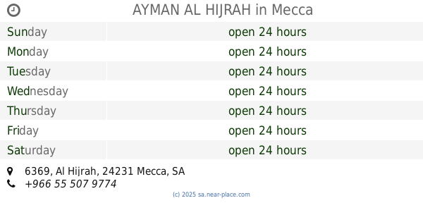
6340, Al Hijrah, 24231, Mecca, SA Saudi Arabia
contacts phone
:
+966
Latitude:
21.4142983
, Longitude:
39.8231174
larger map & directions
read more
nearest Lodging
11 m
Luluat Al Dar Hotel
Al Hijrah, shahrah e, Mecca
Lodging
read more
12 m
AYMAN AL HIJRAH
6369 Al Hijrah, Mecca
Lodging
read more
15 m
Malak Al-Taqwa Hotel 2
شارع الهجرة، مكة
Lodging
read more
18 m
Alreyadah alhirah hotel
6304 الهجرة، الهجلة، مكة 24231 3956 Al Hijrah, Mecca
Lodging
read more
18 m
Ryhan Al Taqwah
6351-6361 Al Hijrah, Mecca
Lodging
read more
19 m
Afwaj Touba Hotel
Afwaj Al-Tawba 11, Al Birkah Tunnel, Mecca
Lodging
read more
23 m
Ghala Al Tag Hotel
6369 Al Hijrah, Al Hajlah, Mecca 24231 3996 Al Hijrah, Mecca
Lodging
read more
30 m
Hotel Dayan Altaqwa
6369 Al Hijrah, Al Hajlah, Mecca 24231 3996 Al Hijrah, Mecca
Lodging
read more
31 m
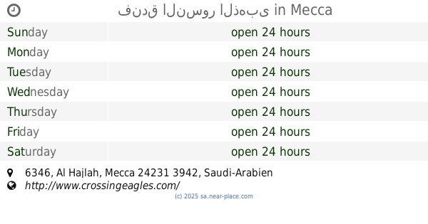
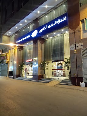
فندق النسور الذهبى
6346, Mecca
Lodging
read more
34 m
Minar ul Huda
حسين ابوبكر البيتي مكة, 3rd Ring Road, Almisfilla, Mecca
Lodging
read more
34 m
HMB ( Haji Mabrur Barokah )
6305 Al Hijrah, Mecca
Lodging
read more
35 m
Al nosour Al Zahabi Hotel
6347, Mecca
Lodging
read more
36 m
Tharwat Al Monsia Hotel
6397 Ibrahim Al Khalil, Mecca
Lodging
read more
37 m
Zowar Al Haramain Hotel
6318 Al Hijrah, Mecca
Lodging
read more
37 m
Zowar Al Harmain Hotel
6318 Al Hijrah, Mecca
Lodging
read more
38 m
Afwaj Al-Tawba 11
Al Birkah Tunnel, Mecca
Lodging
read more
40 m
Manar Al Huda Hotel
6299, Mecca
Lodging
read more
40 m
Beacon anti 2 hotels
4010, Mecca
Lodging
read more
40 m
Rehab Albayne
6291 Al Hijrah, Mecca
Lodging
read more
41 m
Rafif Bakkah
3959, Mecca
Lodging
read more
41 m
Rafif Bakkah Hotel
3959, Mecca
Lodging
read more
43 m
رحاب البيان للوحدات السكنية
6304 Al Hijrah, Mecca
Lodging
read more
43 m
al minar al zahbi 2
شارع الهجرة، مكة
Lodging
read more
43 m
Hotel Loulouh Maather
6309, Mecca
Lodging
read more
44 m
Rehab Al Qaswaa
Mecca
Lodging
read more
📑
all categories
Accounting
Administrative area level 1
Airport
Amusement park
Aquarium
Art gallery
Atm
Bakery
Bank
Bar
Beauty salon
Bicycle store
Book store
Bowling alley
Bus station
Cafe
Campground
Car dealer
Car rental
Car repair
Car wash
Casino
Cemetery
Church
City hall
Clothing store
Colloquial area
Convenience store
Country
Courthouse
Dentist
Department store
Doctor
Electrician
Electronics store
Embassy
Finance
Fire station
Florist
Food
Funeral home
Furniture store
Gas station
General contractor
Grocery or supermarket
Gym
Hair care
Hardware store
Health
Hindu Temple
Home goods store
Hospital
Insurance agency
Intersection
Jewelry store
Laundry
Lawyer
Library
Light rail station
Liquor store
Local government office
Locality
Locksmith
Lodging
Meal delivery
Meal takeaway
Mosque
Movie rental
Movie theater
Moving company
Museum
Natural feature
Neighborhood
Night club
Painter
Park
Parking
Pet store
Pharmacy
Physiotherapist
Place of worship
Plumber
Point of interest
Police
Political
Post office
Premise
Real estate agency
Restaurant
Roofing contractor
Route
Rv park, camping
School
Shoe store
Shopping mall
Spa
Stadium
Storage
Store
Sublocality
Subpremise
Subway station
Supermarket
Taxi stand
Train station
Transit station
Travel agency
University
Veterinary care
Zoo
sublocality level 1
↑