Lodging nearby Zomorodet Al Aseel Hotel
Saudi Arabia
Lodging nearby Zomorodet Al Aseel Hotel
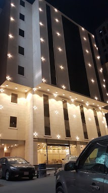
Zomorodet Al Aseel Hotel
9493, Al Aziziyah, Mecca 24235, Saudi Arabia
contacts phone
:
+966 56 630 1687
website:
zomorodetalaseelhotel.westsuites.club
Latitude:
21.4198483
, Longitude:
39.8480327
larger map & directions
read more
nearest Lodging
29 m
Diamond Hotel Almeredsah
3213, Mecca
Lodging
read more
45 m
فندق وردة المشاعر
أنفاق أجياد محبس الجن, Mecca
Lodging
read more
78 m
اجنحة المشاعر
العزيزية
Lodging
read more
80 m
فندق جوهرة العلا
Al Masjid Al Haram Road, Mecca
Lodging
read more
98 m
Masaat Al-Asil Hotel
Mecca
Lodging
read more
99 m
AL ASEEL PLAZA HOTEL
3225, 9580, Mecca
Lodging
read more
131 m
Sama Al Diyafah Hotel
King Abdul Aziz Road, Mecca
Lodging
read more
134 m
Crstalah Al Aseel Hotel
Mecca
Lodging
read more
134 m
Crstalah Al Aseel Hotel
Al Azizya Dst. Mahbas Al Jen, Mecca
Lodging
read more
135 m
Crestal el aseel Hotel
3367, 9576, Mecca
Lodging
read more
138 m
Best Palaces Hotel
Mecca
Lodging
read more
146 m
Ad Diyafah
sama al diyafah
Lodging
read more
156 m
فندق دار ام القري الذهبي
Unnamed Road, العزيزية،, Mecca
Lodging
read more
157 m
Alaseel Hotel
3367, Mecca
Lodging
read more
175 m
Dar Umm Al Qura Golden Hotel
King Abdul Aziz Road, Mecca
Lodging
read more
188 m
Zomorodat hotel mecca
King Abdul Aziz Road, Mecca
Lodging
read more
189 m
Safwat Albayt Hotel
King Abdul Aziz Road, Mecca
Lodging
read more
212 m
Jiwar An Noor
Mecca
Lodging
read more
219 m
Tofel Kendly Al Shorfa Hotel
King Abdulaziz Road, Mecca
Lodging
read more
219 m
Tofel Kendla Al Shorfa Hotel
King Abdulaziz Road, Mecca
Lodging
read more
221 m
فندق توفيل كندلى الشرفة - tofel kendla
3543, 9535،, Mecca
Lodging
read more
226 m
Aziziya Stand
King Abdul Aziz Road, Mecca
Lodging
read more
226 m
Bashrahil Hotel
15, العزيزية مخطط محبس الجن Mecca 24235 خلف كرستالات الأصيل, Mecca
Lodging
read more
230 m
Arkan Bakkah Hotel
King Abdul Aziz Road, Mecca
Lodging
read more
230 m
sapetco station
Ar Rahmah street, Mecca
Lodging
read more
📑
all categories
Accounting
Administrative area level 1
Airport
Amusement park
Aquarium
Art gallery
Atm
Bakery
Bank
Bar
Beauty salon
Bicycle store
Book store
Bowling alley
Bus station
Cafe
Campground
Car dealer
Car rental
Car repair
Car wash
Casino
Cemetery
Church
City hall
Clothing store
Colloquial area
Convenience store
Country
Courthouse
Dentist
Department store
Doctor
Electrician
Electronics store
Embassy
Finance
Fire station
Florist
Food
Funeral home
Furniture store
Gas station
General contractor
Grocery or supermarket
Gym
Hair care
Hardware store
Health
Hindu Temple
Home goods store
Hospital
Insurance agency
Intersection
Jewelry store
Laundry
Lawyer
Library
Light rail station
Liquor store
Local government office
Locality
Locksmith
Lodging
Meal delivery
Meal takeaway
Mosque
Movie rental
Movie theater
Moving company
Museum
Natural feature
Neighborhood
Night club
Painter
Park
Parking
Pet store
Pharmacy
Physiotherapist
Place of worship
Plumber
Point of interest
Police
Political
Post office
Premise
Real estate agency
Restaurant
Roofing contractor
Route
Rv park, camping
School
Shoe store
Shopping mall
Spa
Stadium
Storage
Store
Sublocality
Subpremise
Subway station
Supermarket
Taxi stand
Train station
Transit station
Travel agency
University
Veterinary care
Zoo
sublocality level 1
↑