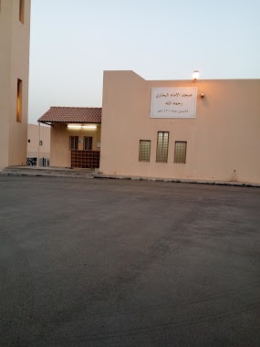
Mosque nearby Abdul Rahman Masjid
Coronavirus disease (COVID-19) Situation
confirmed cases
841469
deaths
9646
Saudi Arabia
Mosque nearby Abdul Rahman Masjid
Abdul Rahman Masjid
مسجد عبدالرحمن بن مهدي - حي الجزيرة تقاطع شارع 14 مع 7، Al Jazirah, Riyadh 14251, Arabia Saudita
contacts phone
:
+966
Latitude:
24.6764507
, Longitude:
46.7984815
larger map & directions
read more
nearest Mosque
292 m
Abdullah ibn Salamh Mosque
No. 7, Riyadh
Mosque
read more
330 m
مسجد
7420 هارون الرشيد, Riyadh
Mosque
read more
458 m
Omar ibn AlKhattab Mosque
شارع 15, Riyadh
Mosque
read more
488 m
مسجد صلاح الدين الأيوبي
Al Hisn, Riyadh
Mosque
read more
509 m
Mosque of Ibn Baz
Riyadh
Mosque
read more
520 m
مسجد أبو بكر الصديق رضي الله عنه
شارع 5, Riyadh
Mosque
read more
569 m
مسجد الجوير
3546, 7013, Riyadh
Mosque
read more
582 m
Al-Dwish Masjed
2828 Sulaiman At Taimi, Riyadh
Mosque
read more
587 m
مسجد سليمان الجوير
3546, 7013, Riyadh
Mosque
read more
632 m
مسجد صالح البراهيم الفوزان
7543 التمار, 2473, Riyadh
Mosque
read more
635 m
مسجد محطه اقبال
6581 هارون الرشيد الفرعي، الفيحاء الرياض 14254
Mosque
read more
729 m
Al-Falah Mosque
Haroon Al Rashid Road, Riyadh
Mosque
read more
768 m
مسجد
Al Jazirah
Mosque
read more
775 m
Imam Bukhari Mosque
6655 رقم 16, 3478, Riyadh
Mosque
read more
844 m
جامع الدخيل
An Naqib, Riyadh
Mosque
read more
844 m
Al Qhtani Mosque
Al Fayha
Mosque
read more
851 m
Al-Tawheed Mosque
4th, Riyadh
Mosque
read more
853 m
مسجد ابن جبرين بالجزيرة
3277, 7029, Riyadh
Mosque
read more
870 m
دار الذكر مقابل جامع التوحيد في الشارع الخامس بحي الجزيرة بالرياض
شارع الخامس, Riyadh
Mosque
read more
892 m
جامع العمر
Al Intisar, Riyadh
Mosque
read more
919 m
Jafar Tayyar Mosque
Al Anadul, Riyadh
Mosque
read more
934 m
Fawzan mosque
Sekaka Street, Riyadh
Mosque
read more
946 m
جامع عكاشة بن محصن
Harun Ar Rashid Service Road, Riyadh
Mosque
read more
972 m
مسجد الحاره
Riyadh
Mosque
read more
996 m
مسجد هارون الرشيد
اسلم
Mosque
read more
📑
all categories
Accounting
Administrative area level 1
Airport
Amusement park
Aquarium
Art gallery
Atm
Bakery
Bank
Bar
Beauty salon
Bicycle store
Book store
Bowling alley
Bus station
Cafe
Campground
Car dealer
Car rental
Car repair
Car wash
Casino
Cemetery
Church
City hall
Clothing store
Colloquial area
Convenience store
Country
Courthouse
Dentist
Department store
Doctor
Electrician
Electronics store
Embassy
Finance
Fire station
Florist
Food
Funeral home
Furniture store
Gas station
General contractor
Grocery or supermarket
Gym
Hair care
Hardware store
Health
Hindu Temple
Home goods store
Hospital
Insurance agency
Intersection
Jewelry store
Laundry
Lawyer
Library
Light rail station
Liquor store
Local government office
Locality
Locksmith
Lodging
Meal delivery
Meal takeaway
Mosque
Movie rental
Movie theater
Moving company
Museum
Natural feature
Neighborhood
Night club
Painter
Park
Parking
Pet store
Pharmacy
Physiotherapist
Place of worship
Plumber
Point of interest
Police
Political
Post office
Premise
Real estate agency
Restaurant
Roofing contractor
Route
Rv park, camping
School
Shoe store
Shopping mall
Spa
Stadium
Storage
Store
Sublocality
Subpremise
Subway station
Supermarket
Taxi stand
Train station
Transit station
Travel agency
University
Veterinary care
Zoo
sublocality level 1
↑