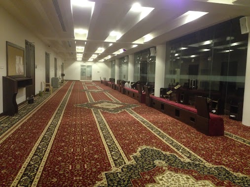
Mosque nearby Abdullah Harkan Mosque of Allah's mercy
Saudi Arabia
Mosque nearby Abdullah Harkan Mosque of Allah's mercy
Abdullah Harkan Mosque of Allah's mercy
3125, طفيل الكناني, 34252, Dammam, SA Saudi Arabia
contacts phone
:
+966 13 826 3535
website:
www.moia.gov.sa
Latitude:
26.3790538
, Longitude:
50.1017379
larger map & directions
read more
nearest Mosque
294 m
Shuhada Mosque
8442 عامر بن الطفيل, 2993, Dammam
Mosque
read more
299 m
Badria Mosque Allekelan
8708 7ج, Dammam
Mosque
read more
485 m
Abu Bakr Alseddiq Mosque
Abdullah Ibn Asaker Street, Dammam
Mosque
read more
534 m
مسجد المحطة
Dammam
Mosque
read more
740 m
Alrahma Mosque
Al Wahah
Mosque
read more
761 m
مسجد عبدالوهاب أبوبشيت
3768 مسلم بن الوليد، الواحة، الدمام 32254
Mosque
read more
763 m
Масджид Ар-Рахма
6925 6 ا, Dammam
Mosque
read more
765 m
Abdulwahab Abubshait Mosque
Muslim Ibn Alwaleed Street, Dammam
Mosque
read more
860 m
Fatima Othman Sarawi Mosque
Dhahran
Mosque
read more
1.005 km
Madloolah Saad Al Dharman Mosque
6598 11 د, 2347, Dammam
Mosque
read more
1.056 km
Juwairiyah Bint Al Harith Mosque
3388 Abu Al Maymoun Street, Dammam
Mosque
read more
1.078 km
مسجد أم عبدالله المجدوعي
Dhahran
Mosque
read more
1.097 km
Al Yaeesh Mosque
2 Street, Dammam
Mosque
read more
1.159 km
Alanfal Mosque
Al Jamiyin
Mosque
read more
1.185 km
Abdul-Rahman Ibn Abi Bakr Mosque
Dammam
Mosque
read more
1.193 km
جامع الشيخ محمد الشعلان
Dhahran
Mosque
read more
1.194 km
Alshaalan Mosque
Dhahran
Mosque
read more
1.194 km
Alshaalan Mosque جامع الشيخ محمد الشعلان
Dhahran
Mosque
read more
1.326 km
مسجد سعدى الهباش
4437 السوق، الفردوس، الدمام 34251
Mosque
read more
1.352 km
مسجد الدامغ
Dammam
Mosque
read more
1.382 km
مسجد أمل الخير
الواحة،, Dammam
Mosque
read more
1.473 km
Qahtani Mosque
Dhahran
Mosque
read more
1.473 km
جامع حمد بن شعاق القحطاني
Dhahran
Mosque
read more
1.508 km
مسجد
Dhahran Jubail Branch Road, Dhahran
Mosque
read more
1.532 km
جامع سعود المدعج
2715 3 د, 6971, Dammam
Mosque
read more
📑
all categories
Accounting
Administrative area level 1
Airport
Amusement park
Aquarium
Art gallery
Atm
Bakery
Bank
Bar
Beauty salon
Bicycle store
Book store
Bowling alley
Bus station
Cafe
Campground
Car dealer
Car rental
Car repair
Car wash
Casino
Cemetery
Church
City hall
Clothing store
Colloquial area
Convenience store
Country
Courthouse
Dentist
Department store
Doctor
Electrician
Electronics store
Embassy
Finance
Fire station
Florist
Food
Funeral home
Furniture store
Gas station
General contractor
Grocery or supermarket
Gym
Hair care
Hardware store
Health
Hindu Temple
Home goods store
Hospital
Insurance agency
Intersection
Jewelry store
Laundry
Lawyer
Library
Light rail station
Liquor store
Local government office
Locality
Locksmith
Lodging
Meal delivery
Meal takeaway
Mosque
Movie rental
Movie theater
Moving company
Museum
Natural feature
Neighborhood
Night club
Painter
Park
Parking
Pet store
Pharmacy
Physiotherapist
Place of worship
Plumber
Point of interest
Police
Political
Post office
Premise
Real estate agency
Restaurant
Roofing contractor
Route
Rv park, camping
School
Shoe store
Shopping mall
Spa
Stadium
Storage
Store
Sublocality
Subpremise
Subway station
Supermarket
Taxi stand
Train station
Transit station
Travel agency
University
Veterinary care
Zoo
sublocality level 1
↑