Mosque nearby Al-Massad Mosque
Saudi Arabia
Mosque nearby Al-Massad Mosque
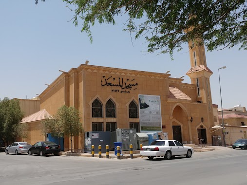
Al-Massad Mosque
Al Abdul Qadir, 12776, Riyadh, SA Saudi Arabia
contacts phone
:
+966 56 775 5823
Latitude:
24.5996905
, Longitude:
46.6839494
larger map & directions
read more
nearest Mosque
266 m
Nostalgia Mosque
Ash Shariyan, Riyadh
Mosque
read more
289 m
مسجد الحمدان
3684 تميم الحلي،, 6228, Riyadh
Mosque
read more
329 m
Balbaid Mosque
Riyadh
Mosque
read more
329 m
Balbaid Mosque
As Suwaidi
Mosque
read more
348 m
جامع وزير العدل
Shaikh At Taj, Riyadh
Mosque
read more
374 m
alsha'alan mosque
Dar As Safa, Riyadh
Mosque
read more
412 m
مسجد الشيخ عبد الرحمن محمد آل فريان
Al Malki, Riyadh
Mosque
read more
413 m
مسجد ابن ماجد
Sultanah
Mosque
read more
413 m
مسجد ابن ماجد
Riyadh
Mosque
read more
436 m
مسجد السويلم
6349 Al Malki, Riyadh
Mosque
read more
503 m
مسجد عدي بن حاتم
سلطانة،, Riyadh
Mosque
read more
508 m
مسجد الشعيبي
3169 Shaikh Abdullah Bin Mohammed Road, 6727, Riyadh
Mosque
read more
535 m
مسجد حنين
Hanin, Riyadh
Mosque
read more
536 m
Rings nostalgic for the memorization of the Holy Quran
7650 حنين، السويدي، الرياض 12785 5706 Hanin, Riyadh
Mosque
read more
585 m
جامع أسامة بن زيد
Abi Al Hasan Al Hamadhani, Riyadh
Mosque
read more
635 m
مسجد ابن عياف
سلطانة،, Riyadh
Mosque
read more
656 m
مسجد الأمير عبدالله بن عبدالعزيز بن مقرن
الرياض
Mosque
read more
726 m
مسجد الماجد
3534 At Taimi, Riyadh
Mosque
read more
736 m
مسجد عبدالرحمن عثمان الدهش
Riyadh
Mosque
read more
771 m
Princess Sarah Bint Saad Grand Mosque
Ibn Al Mutamid, Riyadh
Mosque
read more
774 m
حلقات البراء بجامع الأميرة سارة بنت سعد بالسويدي
شارع ابن المعتمد، حي السويدي, Riyadh
Mosque
read more
774 m
حلقات البراء بجامع الأميرة سارة بنت سعد بالسويدي
شارع ابن المعتمد، حي السويدي، الرياض
Mosque
read more
780 m
جامع الشرمات
Riyadh
Mosque
read more
846 m
Howaish mosque
Al Hasan Ibn Mukhlad, Riyadh
Mosque
read more
873 m
مسجد الحمود
سلطانه، سلطانه, Riyadh
Mosque
read more
📑
all categories
Accounting
Administrative area level 1
Airport
Amusement park
Aquarium
Art gallery
Atm
Bakery
Bank
Bar
Beauty salon
Bicycle store
Book store
Bowling alley
Bus station
Cafe
Campground
Car dealer
Car rental
Car repair
Car wash
Casino
Cemetery
Church
City hall
Clothing store
Colloquial area
Convenience store
Country
Courthouse
Dentist
Department store
Doctor
Electrician
Electronics store
Embassy
Finance
Fire station
Florist
Food
Funeral home
Furniture store
Gas station
General contractor
Grocery or supermarket
Gym
Hair care
Hardware store
Health
Hindu Temple
Home goods store
Hospital
Insurance agency
Intersection
Jewelry store
Laundry
Lawyer
Library
Light rail station
Liquor store
Local government office
Locality
Locksmith
Lodging
Meal delivery
Meal takeaway
Mosque
Movie rental
Movie theater
Moving company
Museum
Natural feature
Neighborhood
Night club
Painter
Park
Parking
Pet store
Pharmacy
Physiotherapist
Place of worship
Plumber
Point of interest
Police
Political
Post office
Premise
Real estate agency
Restaurant
Roofing contractor
Route
Rv park, camping
School
Shoe store
Shopping mall
Spa
Stadium
Storage
Store
Sublocality
Subpremise
Subway station
Supermarket
Taxi stand
Train station
Transit station
Travel agency
University
Veterinary care
Zoo
sublocality level 1
↑