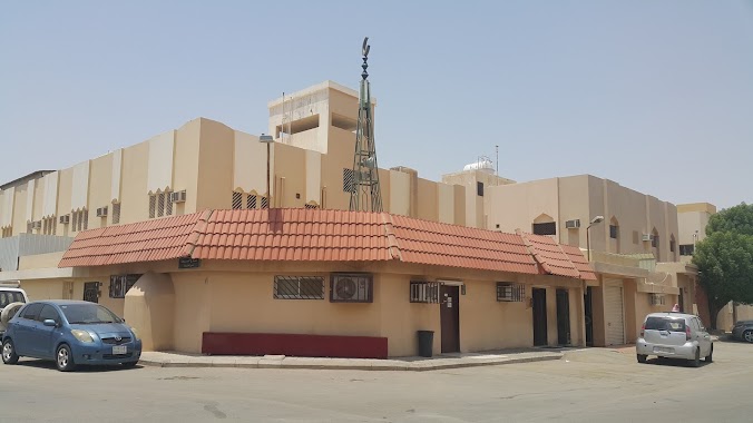
Mosque nearby Bilal bin Rabah Mosque
Saudi Arabia
Mosque nearby Bilal bin Rabah Mosque
Bilal bin Rabah Mosque
Al Dar, Riyadh Saudi Arabien
contacts phone
:
+966
Latitude:
24.5858635
, Longitude:
46.7830816
read more
nearest Mosque
303 m
مسجد العضيبي
2546 وهران, Riyadh
Mosque
read more
358 m
مسجد رياض الصالحين
2952 Sufyan Ibn Awf, Riyadh
Mosque
read more
461 m
Masjid Zathu Nithaakain جامع ذات النطاقين
Riyadh
Mosque
read more
468 m
جامع ذات النطاقين
Al Aziziyah
Mosque
read more
473 m
مسجد الغوينم
8366 Khilad Ibn Rafi, Riyadh
Mosque
read more
491 m
جامع سفيان بن عوف
Riyadh
Mosque
read more
551 m
مسجد أسيد بن حضير
7385 Ibn Hamid Al Aziziyah Riyadh 14513 3370 Ibn Hamid, Riyadh
Mosque
read more
630 m
مسجد ابي حنيفة
5095 الصائن، العزيزية الرياض 14514
Mosque
read more
735 m
مسجد زين العابدين
Riyadh
Mosque
read more
768 m
Mosque of Omar bin Abdul Aziz
Dawud Ibn Urwah, Riyadh
Mosque
read more
817 m
Al Dakhil Grand Mosque
8050 Ghalib Al Muharabi, Riyadh
Mosque
read more
821 m
جامع سعيد بن زيد
7963 Awis Al Qarni, Riyadh
Mosque
read more
835 m
مسجد
العزيزية، الرياض
Mosque
read more
836 m
جامع سعيد بن زيد
العزيزية، الرياض
Mosque
read more
846 m
جامع الأخوين
8788 Muti Ibn Amir, Al Aziziyah, Riyadh 14514 4845 Muti Ibn Amir, Riyadh
Mosque
read more
860 m
مسجد التوحيد
6953 Muhammad Ibn Al Mughirah, 3663, Riyadh
Mosque
read more
940 m
جامع عبد العزيز الضبيعي
As Saurah, Riyadh
Mosque
read more
967 m
Al Bawardi Grand Mosque
Sufyan Ibn Awf, Al Aziziyah، الرياض
Mosque
read more
967 m
Al Bawardi Grand Mosque
Sufyan Ibn Awf, Riyadh
Mosque
read more
997 m
مسجد لطفية آل الشيخ
Al Dar, Riyadh
Mosque
read more
1.092 km
Arnous mosque
Al Saqaef, Riyadh
Mosque
read more
1.16 km
مسجد ابن كثير
العزيزية،, Riyadh
Mosque
read more
1.172 km
جامع بن كثير
9192 Muti Ibn Amir, Riyadh
Mosque
read more
1.19 km
مسجد
3822 An Nasr Road, Riyadh
Mosque
read more
1.199 km
Unnamed Mosque
Al Rabiya, Riyadh
Mosque
read more
📑
all categories
Accounting
Administrative area level 1
Airport
Amusement park
Aquarium
Art gallery
Atm
Bakery
Bank
Bar
Beauty salon
Bicycle store
Book store
Bowling alley
Bus station
Cafe
Campground
Car dealer
Car rental
Car repair
Car wash
Casino
Cemetery
Church
City hall
Clothing store
Colloquial area
Convenience store
Country
Courthouse
Dentist
Department store
Doctor
Electrician
Electronics store
Embassy
Finance
Fire station
Florist
Food
Funeral home
Furniture store
Gas station
General contractor
Grocery or supermarket
Gym
Hair care
Hardware store
Health
Hindu Temple
Home goods store
Hospital
Insurance agency
Intersection
Jewelry store
Laundry
Lawyer
Library
Light rail station
Liquor store
Local government office
Locality
Locksmith
Lodging
Meal delivery
Meal takeaway
Mosque
Movie rental
Movie theater
Moving company
Museum
Natural feature
Neighborhood
Night club
Painter
Park
Parking
Pet store
Pharmacy
Physiotherapist
Place of worship
Plumber
Point of interest
Police
Political
Post office
Premise
Real estate agency
Restaurant
Roofing contractor
Route
Rv park, camping
School
Shoe store
Shopping mall
Spa
Stadium
Storage
Store
Sublocality
Subpremise
Subway station
Supermarket
Taxi stand
Train station
Transit station
Travel agency
University
Veterinary care
Zoo
sublocality level 1
↑