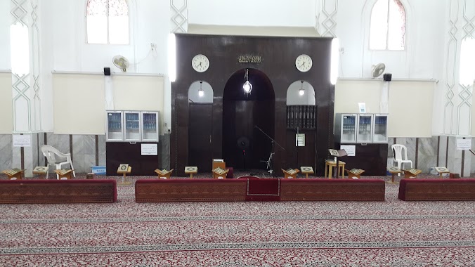
Mosque nearby جامع الزياده
Saudi Arabia
Mosque nearby جامع الزياده
جامع الزياده
Dammam Saudi Arabia
contacts phone
:
+966
Latitude:
26.4075075
, Longitude:
50.0795701
read more
nearest Mosque
395 m
مسجد العسكر
8027 مالك بن جبير, 2821, Dammam
Mosque
read more
404 m
مسجد شرحبيل بن حسنه
8027 مالك بن جبير, Dammam
Mosque
read more
505 m
جامع عبدالله الخلف
7532 9ب, Dammam
Mosque
read more
513 m
Abu Ayyub al-Ansari Mosque
3518 1 ا, Dammam
Mosque
read more
515 m
جامع عبد الله الخلف يرحمه الله
2752 الشموخ, Dammam
Mosque
read more
524 m
جامع عبدالله الخلف
2752 الشموخ, Dammam
Mosque
read more
552 m
مسجد الثبيتي
7892 حليمة السعدية, 2603, Dammam
Mosque
read more
564 m
Eid Gha
Dammam
Mosque
read more
584 m
مسجد عسكر أبو زهير الهاجري
8361 عامر بن ربيعة, Dammam
Mosque
read more
592 m
Huda Mosque
Amer Ibn Fuhairah Street, Dammam
Mosque
read more
592 m
Huda Masjid
Amer Ibn Fuhairah Street, Dammam
Mosque
read more
626 m
مسجد خبيب بن عدي
3368 الرحمانية، الإتصالات، الدمام 32257
Mosque
read more
820 m
جامع العيسى
Dammam
Mosque
read more
823 m
Abdullah ben huthafah alsahme
6996 Halima Al Sadiah Street, Dammam
Mosque
read more
826 m
Utbah Ibn Ghazwan Mosque
Dammam
Mosque
read more
1.063 km
Abdullah Al-Hamdan Mosque Allah's mercy
7900 القرنفل, Dammam
Mosque
read more
1.115 km
Al Wabel Mosque
Dhahran Jubail Expressway, Dammam
Mosque
read more
1.115 km
Al Wabel Masjid
Dhahran Jubail Expressway, Dammam
Mosque
read more
1.122 km
Masjid Alhijrah
6 Street, Dammam
Mosque
read more
1.123 km
Al Hidayah Mosque
Dammam
Mosque
read more
1.133 km
مسجد منيرة التركي
4805 صبيا, Dammam
Mosque
read more
1.16 km
مسجد سعد بن معاذ
3945 البكيرية, 8682, Dammam
Mosque
read more
1.173 km
ِAlmishil Mosque
Raihan Street, Dammam
Mosque
read more
1.193 km
مسجد زيد بن الخطاب
Hafsa Bint Omar Street, Dammam
Mosque
read more
1.274 km
مسجد أويس القرني
6845 المبرز، القادسية، الدمام 32247
Mosque
read more
📑
all categories
Accounting
Administrative area level 1
Airport
Amusement park
Aquarium
Art gallery
Atm
Bakery
Bank
Bar
Beauty salon
Bicycle store
Book store
Bowling alley
Bus station
Cafe
Campground
Car dealer
Car rental
Car repair
Car wash
Casino
Cemetery
Church
City hall
Clothing store
Colloquial area
Convenience store
Country
Courthouse
Dentist
Department store
Doctor
Electrician
Electronics store
Embassy
Finance
Fire station
Florist
Food
Funeral home
Furniture store
Gas station
General contractor
Grocery or supermarket
Gym
Hair care
Hardware store
Health
Hindu Temple
Home goods store
Hospital
Insurance agency
Intersection
Jewelry store
Laundry
Lawyer
Library
Light rail station
Liquor store
Local government office
Locality
Locksmith
Lodging
Meal delivery
Meal takeaway
Mosque
Movie rental
Movie theater
Moving company
Museum
Natural feature
Neighborhood
Night club
Painter
Park
Parking
Pet store
Pharmacy
Physiotherapist
Place of worship
Plumber
Point of interest
Police
Political
Post office
Premise
Real estate agency
Restaurant
Roofing contractor
Route
Rv park, camping
School
Shoe store
Shopping mall
Spa
Stadium
Storage
Store
Sublocality
Subpremise
Subway station
Supermarket
Taxi stand
Train station
Transit station
Travel agency
University
Veterinary care
Zoo
sublocality level 1
↑