Mosque nearby Jarir Al Bajali Mosque
Saudi Arabia
Mosque nearby Jarir Al Bajali Mosque
Jarir Al Bajali Mosque
Al Mohammadiyah, Jeddah 23623, Saudi Arabia
contacts phone
:
+966
Latitude:
21.6453355
, Longitude:
39.1370512
larger map & directions
read more
nearest Mosque
Jarir Al Bajali Mosque
Al Mohammadiyyah
Mosque
read more
20 m
جامع جرير بن عبدالله البجلي رضي الله عنه
شارع علي بن بلبان، حي شارع علي بن بلبان، جدة
Mosque
read more
357 m
Dawa Mosque
Jeddah
Mosque
read more
397 m
Abu Bakr As-Siddique Mosque
Jeddah
Mosque
read more
439 m
Ar Rahman Mosque
Amna Bint Wahb Street, Jeddah
Mosque
read more
535 m
Mosque of Omar ibn al-Khattab
9070 ابي محمد الانباري, حي المحمدية, Jeddah
Mosque
read more
583 m
Amna mosque
Jeddah
Mosque
read more
687 m
مسجد إعمار
2831, An Naim District 7939, Jeddah
Mosque
read more
688 m
مسجد إعمار
2831, حي النعيم، 7939, Jeddah
Mosque
read more
727 m
مسجد الحمّد
شارع علي الهائمي، حي المحمدية، جدة
Mosque
read more
728 m
Mosque
Al Mohammadiyyah
Mosque
read more
754 m
As'ad ibn Zurarah mosque
8044 البراء بن حازم, حي النعيم،, Jeddah
Mosque
read more
759 m
Mosque
An Naim
Mosque
read more
853 m
AlSalam Mosque
Jeddah
Mosque
read more
897 m
Aisha Mosque
Jeddah
Mosque
read more
946 m
المسجد اللي عند الحديقه
3857 سوار بن همام, An Naim District, Jeddah
Mosque
read more
972 m
مسجد اسكان العامودي
المحمدية،, Jeddah
Mosque
read more
1.268 km
Jawaher Mosque
3625, An Naim District, Jeddah
Mosque
read more
1.319 km
مسجد الشيخ محمد بن عبدالوهاب
8396 Prince Sultan Road, Al Muhammadiyah District, Jeddah
Mosque
read more
1.35 km
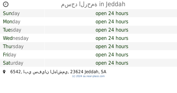
مسجد الرحمة
6542 ابي سفيان الهاشمي, Al Muhammadiyah District 3151, Jeddah
Mosque
read more
1.361 km
مسجد الوالدين
شارع سعود مختار، حي النعيم، جدة
Mosque
read more
1.373 km
Spring Villas mosque compound
زيد بن الخطاب Zayd Ibn Al Katab, حي النعيم،, Jeddah
Mosque
read more
1.386 km
مسجد الوالدين
جدة
Mosque
read more
1.42 km
Al-Iman Mosque
شارع أحمد شاكر الكرمي، حي المحمدية، جدة
Mosque
read more
1.422 km
مسجد الايمان
2570 احمد الاروادي, حي المحمدية 6237, Jeddah
Mosque
read more
📑
all categories
Accounting
Administrative area level 1
Airport
Amusement park
Aquarium
Art gallery
Atm
Bakery
Bank
Bar
Beauty salon
Bicycle store
Book store
Bowling alley
Bus station
Cafe
Campground
Car dealer
Car rental
Car repair
Car wash
Casino
Cemetery
Church
City hall
Clothing store
Colloquial area
Convenience store
Country
Courthouse
Dentist
Department store
Doctor
Electrician
Electronics store
Embassy
Finance
Fire station
Florist
Food
Funeral home
Furniture store
Gas station
General contractor
Grocery or supermarket
Gym
Hair care
Hardware store
Health
Hindu Temple
Home goods store
Hospital
Insurance agency
Intersection
Jewelry store
Laundry
Lawyer
Library
Light rail station
Liquor store
Local government office
Locality
Locksmith
Lodging
Meal delivery
Meal takeaway
Mosque
Movie rental
Movie theater
Moving company
Museum
Natural feature
Neighborhood
Night club
Painter
Park
Parking
Pet store
Pharmacy
Physiotherapist
Place of worship
Plumber
Point of interest
Police
Political
Post office
Premise
Real estate agency
Restaurant
Roofing contractor
Route
Rv park, camping
School
Shoe store
Shopping mall
Spa
Stadium
Storage
Store
Sublocality
Subpremise
Subway station
Supermarket
Taxi stand
Train station
Transit station
Travel agency
University
Veterinary care
Zoo
sublocality level 1
↑