Mosque nearby Mosque
Saudi Arabia
Mosque nearby Mosque
Mosque
Khuzaah, 12988, Riyadh, SA Saudi Arabia
contacts phone
:
+966
Latitude:
24.5711264
, Longitude:
46.6640633
larger map & directions
read more
nearest Mosque
265 m
جامع الصانع
Abi Mishab, Riyadh
Mosque
read more
337 m
Al Salem Mosque
Aishah Bint Abi Bakr, Riyadh
Mosque
read more
363 m
مسجد البر
الرياض
Mosque
read more
371 m
جامع الايمان
Daws, Riyadh
Mosque
read more
385 m
Sheikh Hamad Al-Masjid incursive
Dhabia, Riyadh
Mosque
read more
554 m
Al-Sayari Mosque
Riyadh
Mosque
read more
607 m
Zaid bin Haritha Mosque
Tamim Ad Dari, Riyadh
Mosque
read more
611 m
مصلى حديقة شبرا
الرياض
Mosque
read more
654 m
Mohammed Nasser Mosque
Al Karama, Riyadh
Mosque
read more
664 m
مسجد الأندلس
As Sulailan, Riyadh
Mosque
read more
708 m
مسجد الشيخ محمد العريفي
Al Warad, Riyadh
Mosque
read more
830 m
Ihsan Mosque
Al Karama, Riyadh
Mosque
read more
855 m
مسجد عبدالله بن حذافه
6485 Rana Shubra Riyadh 12799 3422 Rana, Riyadh
Mosque
read more
865 m
مسجد
Southern Ring Branch Road, Riyadh
Mosque
read more
867 m
جامع الامير عبد الرحمن بن عبد الله بن عبد الرحمن ٱل سعود
7772 الصحراوي، الزهرة، الرياض 12985 4825 As Saharawi, Riyadh
Mosque
read more
886 m
Masjid Aishah bint Abi Bakr
Abi Bakr Al Qattan, Riyadh
Mosque
read more
923 m
جامع ناصر بن سعد الصفيان
Ibn Abdul Hay Al Khazraji, Riyadh
Mosque
read more
932 m
جامع الشيخ ناصر بن سعد الصفيان
Riyadh
Mosque
read more
1.012 km
مسجد الشيخ عبدالعزيز بن باز رحمه الله بشبرا
باب الشام, Riyadh
Mosque
read more
1.025 km
Arifi mosque
Ismail Al Falaki, Riyadh
Mosque
read more
1.052 km
Masjid Al-Rahmah
12788 Wadi Ar Rashad, Riyadh
Mosque
read more
1.091 km
مسجد الشيخ آل فريان
Southern Ring Road, Riyadh
Mosque
read more
1.115 km
مسجد النور
3419 Qartajah, Riyadh
Mosque
read more
1.117 km
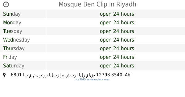
Mosque Ben Clip
6801 ابي منصور البزاز، شبرا الرياض 12798 3540 Abi Mansur Al Bazzaz, Riyadh
Mosque
read more
1.125 km
جامع النور
7976 Zahir Ibn Tahir, Riyadh
Mosque
read more
📑
all categories
Accounting
Administrative area level 1
Airport
Amusement park
Aquarium
Art gallery
Atm
Bakery
Bank
Bar
Beauty salon
Bicycle store
Book store
Bowling alley
Bus station
Cafe
Campground
Car dealer
Car rental
Car repair
Car wash
Casino
Cemetery
Church
City hall
Clothing store
Colloquial area
Convenience store
Country
Courthouse
Dentist
Department store
Doctor
Electrician
Electronics store
Embassy
Finance
Fire station
Florist
Food
Funeral home
Furniture store
Gas station
General contractor
Grocery or supermarket
Gym
Hair care
Hardware store
Health
Hindu Temple
Home goods store
Hospital
Insurance agency
Intersection
Jewelry store
Laundry
Lawyer
Library
Light rail station
Liquor store
Local government office
Locality
Locksmith
Lodging
Meal delivery
Meal takeaway
Mosque
Movie rental
Movie theater
Moving company
Museum
Natural feature
Neighborhood
Night club
Painter
Park
Parking
Pet store
Pharmacy
Physiotherapist
Place of worship
Plumber
Point of interest
Police
Political
Post office
Premise
Real estate agency
Restaurant
Roofing contractor
Route
Rv park, camping
School
Shoe store
Shopping mall
Spa
Stadium
Storage
Store
Sublocality
Subpremise
Subway station
Supermarket
Taxi stand
Train station
Transit station
Travel agency
University
Veterinary care
Zoo
sublocality level 1
↑