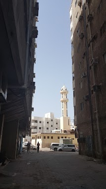
Mosque nearby مسجد الراجحي في عمائر الراجحي طريق مكة ك٣
Saudi Arabia
Mosque nearby مسجد الراجحي في عمائر الراجحي طريق مكة ك٣
مسجد الراجحي في عمائر الراجحي طريق مكة ك٣
8863, Zahrat Al Bashnin, 22332, Jeddah, SA Saudi Arabia
contacts phone
:
+966
Latitude:
21.4820543
, Longitude:
39.2106161
larger map & directions
read more
nearest Mosque
205 m
مصلى العيد
An Nazlah Al Yamaniyyah
Mosque
read more
205 m
مصلى العيد
Al-Nazlah Al-Yamaniyah
Mosque
read more
375 m
Abdul Rahman Basabreen Mosque
2351 Hilal Al Umari, حي الثغر،, Jeddah
Mosque
read more
569 m
Buqshan mosque
Hilal Al Umari, Jeddah
Mosque
read more
594 m
مسجد النور
شارع باخشب، الثغر، جدة
Mosque
read more
612 m
Al-Quba Mosque
Bakhashab, Jeddah
Mosque
read more
619 m
Isa'ee mosque
King Khalid Road, Jeddah
Mosque
read more
620 m
مسجد سوق الاتحاد
4902, حي السبيل،, Jeddah
Mosque
read more
621 m
جامع الأمير سلطان بن عبد العزيز آل سعود
Jeddah
Mosque
read more
664 m
Taqwa Mosque
Bab Al Multazim, Jeddah
Mosque
read more
690 m
مسجد بحلس
4840, As Sabil District 8466, Jeddah
Mosque
read more
707 m
Al-Hidayah Mosque
Al Imam Al Murshidi, Jeddah
Mosque
read more
819 m
Mosque Al Huda
Al Imam Al Murshidi, Jeddah
Mosque
read more
843 m
مسجد النعيم
8546، حي السبيل، جدة 22325
Mosque
read more
887 m
جامع النور
3166 دار الهمه, Ath Thaghr District, Jeddah
Mosque
read more
913 m
Al-Aziz-Mosque
Jeddah
Mosque
read more
926 m
Abdullah bin Abbas Mosque
Ibn Said Al Qazzaz, Jeddah
Mosque
read more
931 m
مسجد الملك سعود
كيلو تلاتة
Mosque
read more
954 m
Bin Mahfouz mosque - Kilo 2
Old road kilo 2, Jeddah
Mosque
read more
968 m
جامع باسيف
Bab Al Wida, Jeddah
Mosque
read more
975 m
جامع السلومي
8332, حي السبيل، 4579, Jeddah
Mosque
read more
998 m
King Saud Grand Mosque
King Khalid Road, بقصر خزام, Jeddah
Mosque
read more
1.01 km
جامع الملك سعود
كيلو تلاتة
Mosque
read more
1.018 km
مسجد العماري
4518، حي السبيل، جدة 22325
Mosque
read more
1.032 km
Alabbasi Masjid
7675, 3008 Ahmad Ash Sharani, An Nazlah Al Yamaniyah District حي النزلة اليمانية, Jeddah
Mosque
read more
📑
all categories
Accounting
Administrative area level 1
Airport
Amusement park
Aquarium
Art gallery
Atm
Bakery
Bank
Bar
Beauty salon
Bicycle store
Book store
Bowling alley
Bus station
Cafe
Campground
Car dealer
Car rental
Car repair
Car wash
Casino
Cemetery
Church
City hall
Clothing store
Colloquial area
Convenience store
Country
Courthouse
Dentist
Department store
Doctor
Electrician
Electronics store
Embassy
Finance
Fire station
Florist
Food
Funeral home
Furniture store
Gas station
General contractor
Grocery or supermarket
Gym
Hair care
Hardware store
Health
Hindu Temple
Home goods store
Hospital
Insurance agency
Intersection
Jewelry store
Laundry
Lawyer
Library
Light rail station
Liquor store
Local government office
Locality
Locksmith
Lodging
Meal delivery
Meal takeaway
Mosque
Movie rental
Movie theater
Moving company
Museum
Natural feature
Neighborhood
Night club
Painter
Park
Parking
Pet store
Pharmacy
Physiotherapist
Place of worship
Plumber
Point of interest
Police
Political
Post office
Premise
Real estate agency
Restaurant
Roofing contractor
Route
Rv park, camping
School
Shoe store
Shopping mall
Spa
Stadium
Storage
Store
Sublocality
Subpremise
Subway station
Supermarket
Taxi stand
Train station
Transit station
Travel agency
University
Veterinary care
Zoo
sublocality level 1
↑