Mosque nearby مسجد
Saudi Arabia
Mosque nearby مسجد
مسجد
As Sinaiyah, Riyadh 12873, Saudi Arabia
contacts phone
:
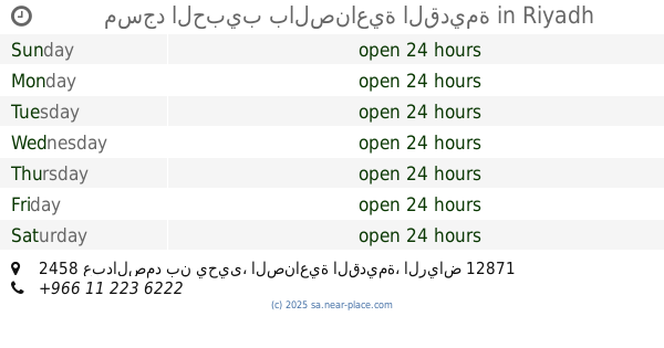
+966
Latitude:
24.6343834
, Longitude:
46.7410114
larger map & directions
read more
nearest Mosque
مسجد الحبيب بالصناعية القديمة
2458 عبدالصمد بن يحيى، الصناعية القديمة، الرياض 12871 8403 Abdul Samad Ibn Yahya, Riyadh
Mosque
read more
11 m
مسجد الحبيب
الصناعية القديمة، الرياض
Mosque
read more
143 m
مسجد
2530-2482 عطية بن الحارث، الصناعية القديمة،, Riyadh
Mosque
read more
210 m
جامع الخيرين
الصخرة As Sakhrah, Riyadh
Mosque
read more
215 m
جامع الخيرين
2431 Al Jamiyyah, Riyadh
Mosque
read more
237 m
مسجد البلاد
Riyadh
Mosque
read more
260 m
مسجد أنس بن مالك
شارع السنبل، حي الصناعية، الرياض
Mosque
read more
263 m
مسجد 24
As Sinaiyah
Mosque
read more
301 m
مسجد
8307 Al Kharj Road, Riyadh
Mosque
read more
495 m
Awais Al Qarni Grand Mosque
2407 Al Anuz, Riyadh
Mosque
read more
549 m
مسجد
شارع اسماعيل البصري - حي الصناعية، الرياض
Mosque
read more
583 m
مسجد السبعان
Al Hilla, Riyadh
Mosque
read more
626 m
as sinsiyah islamic center mosqe
Riyadh
Mosque
read more
643 m
مسجد عبد الله البصير
Umar Al Muaddab, Riyadh
Mosque
read more
688 m
Sinead Mosque
Abdullah Ibn Arjah, Riyadh
Mosque
read more
706 m
Jumma Mosque
Riyadh
Mosque
read more
718 m
Namly Mosque
7949 Namly, Al Khalidiyah, Riyadh 12873 3018 Namly, Riyadh
Mosque
read more
756 m
مسجد الصناعية
As Sinaiyah
Mosque
read more
756 m
مسجد الصناعية
شارع القتادية ، حي الصناعية، الرياض
Mosque
read more
770 m
Thariq bin Ziad
Al Madinah Al Munawwarah Road, Riyadh
Mosque
read more
816 m
مسجد العمار
7852 شكيب ارسلان، الخالدية الرياض 12873
Mosque
read more
819 m
جامع عبد الرحمن بن إبراهيم أبو حيمد
2758 Ibn Sahl, Riyadh
Mosque
read more
829 m
Rings Khaled Ibn Al-Walid Mosque
الشماسية, Riyadh
Mosque
read more
850 m
جامع الصالحية الشمالي
As Salhiyah
Mosque
read more
860 m
مسجد المصيريعي
شارع الاشتر النخعي، حي الصالحين، الرياض
Mosque
read more
📑
all categories
Accounting
Administrative area level 1
Airport
Amusement park
Aquarium
Art gallery
Atm
Bakery
Bank
Bar
Beauty salon
Bicycle store
Book store
Bowling alley
Bus station
Cafe
Campground
Car dealer
Car rental
Car repair
Car wash
Casino
Cemetery
Church
City hall
Clothing store
Colloquial area
Convenience store
Country
Courthouse
Dentist
Department store
Doctor
Electrician
Electronics store
Embassy
Finance
Fire station
Florist
Food
Funeral home
Furniture store
Gas station
General contractor
Grocery or supermarket
Gym
Hair care
Hardware store
Health
Hindu Temple
Home goods store
Hospital
Insurance agency
Intersection
Jewelry store
Laundry
Lawyer
Library
Light rail station
Liquor store
Local government office
Locality
Locksmith
Lodging
Meal delivery
Meal takeaway
Mosque
Movie rental
Movie theater
Moving company
Museum
Natural feature
Neighborhood
Night club
Painter
Park
Parking
Pet store
Pharmacy
Physiotherapist
Place of worship
Plumber
Point of interest
Police
Political
Post office
Premise
Real estate agency
Restaurant
Roofing contractor
Route
Rv park, camping
School
Shoe store
Shopping mall
Spa
Stadium
Storage
Store
Sublocality
Subpremise
Subway station
Supermarket
Taxi stand
Train station
Transit station
Travel agency
University
Veterinary care
Zoo
sublocality level 1
↑