Mosque nearby مسجد علي إبن ابي طالب
Saudi Arabia
Mosque nearby مسجد علي إبن ابي طالب
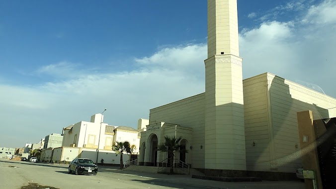
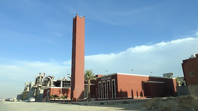
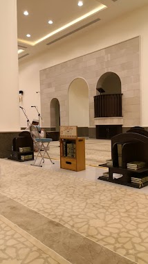
مسجد علي إبن ابي طالب
Salbukh Road, SABIC Coumpand, Riyadh Saudi Arabia
contacts phone
:
+966
Latitude:
24.8192518
, Longitude:
46.5432609
read more
nearest Mosque
853 m
جامع إبي بكر الصديق
مجمع تلال الوصيل السكني، الوصيل، الرياض
Mosque
read more
863 m
جامع أبى بكر الصديق رضي الله عنه
Mosque
read more
2.207 km
جامع حصة بنت ناصر الراجحي
Riyadh
Mosque
read more
2.717 km
Sheikh / Saad bin Abdulaziz bin Saeed Mosque of Allah's mercy
Waseel Road
Mosque
read more
2.719 km
Sheikh Saad bin Saeed Mosque
Riyadh
Mosque
read more
3.103 km
Ibrahim Mosque
Riyadh
Mosque
read more
3.423 km
Haya Al-Ajlan Grand Mosque
Riyadh
Mosque
read more
3.666 km
مسجد فلل جواهر
الرياض
Mosque
read more
4.167 km
مسجد لطيفة إبراهيم الشويعر
Riyadh
Mosque
read more
4.212 km
مسجد الجوهرة الشبانات
الرياض
Mosque
read more
4.226 km
مسجد الجوهرة بنت ناصر الشبانات
حي القيروان، الرياض
Mosque
read more
4.284 km
مسجد مصلى
Riyadh
Mosque
read more
4.434 km
جامع السيف
Ad Diriyah
Mosque
read more
4.474 km
مسجد
Ad Diriyah
Mosque
read more
4.474 km
D Mosque. Helped Bin Saad Al-Orabi Al-Harthy
Ad Diriyah
Mosque
read more
4.486 km
مصلي نساء
طريق الملك خالد الفرعي، حي حطين، الدرعية
Mosque
read more
4.495 km
مسجد
9064 الرياض 13721 4823
Mosque
read more
4.607 km
مسجد
شارع الشيخ عبد الله بن جبرين، حي القيروان، الرياض
Mosque
read more
4.642 km
جامع الجهيمي
خليفه العتيبي, Riyadh
Mosque
read more
4.649 km
مصلي نساء
شارع خليفه العتيبي ، حي القيروان، الرياض
Mosque
read more
4.682 km
جامع حصة أم ماجد
الرياض
Mosque
read more
4.773 km
Prince Muqrin Mother's Mosque
Riyadh
Mosque
read more
4.921 km
مسجد القيروان
Riyadh
Mosque
read more
4.934 km
مسجد حي القيروان
Riyadh
Mosque
read more
5.004 km
جامع الأميرة موضي السبهان
Riyadh
Mosque
read more
📑
all categories
Accounting
Administrative area level 1
Airport
Amusement park
Aquarium
Art gallery
Atm
Bakery
Bank
Bar
Beauty salon
Bicycle store
Book store
Bowling alley
Bus station
Cafe
Campground
Car dealer
Car rental
Car repair
Car wash
Casino
Cemetery
Church
City hall
Clothing store
Colloquial area
Convenience store
Country
Courthouse
Dentist
Department store
Doctor
Electrician
Electronics store
Embassy
Finance
Fire station
Florist
Food
Funeral home
Furniture store
Gas station
General contractor
Grocery or supermarket
Gym
Hair care
Hardware store
Health
Hindu Temple
Home goods store
Hospital
Insurance agency
Intersection
Jewelry store
Laundry
Lawyer
Library
Light rail station
Liquor store
Local government office
Locality
Locksmith
Lodging
Meal delivery
Meal takeaway
Mosque
Movie rental
Movie theater
Moving company
Museum
Natural feature
Neighborhood
Night club
Painter
Park
Parking
Pet store
Pharmacy
Physiotherapist
Place of worship
Plumber
Point of interest
Police
Political
Post office
Premise
Real estate agency
Restaurant
Roofing contractor
Route
Rv park, camping
School
Shoe store
Shopping mall
Spa
Stadium
Storage
Store
Sublocality
Subpremise
Subway station
Supermarket
Taxi stand
Train station
Transit station
Travel agency
University
Veterinary care
Zoo
sublocality level 1
↑