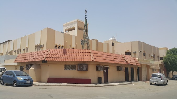
Mosque nearby مسجد علي بن ابي طالب
Saudi Arabia
Mosque nearby مسجد علي بن ابي طالب
مسجد علي بن ابي طالب
7484, ابي العلي السراج, 14514, Riyadh, SA Saudi Arabia
contacts phone
:
+966
Latitude:
24.5747
, Longitude:
46.7799465
larger map & directions
read more
nearest Mosque
299 m
مسجد
عرفات، العزيزية، الرياض
Mosque
read more
441 m
Khalid ibn al-Walid Mosque
Ash Shamiyah, Riyadh
Mosque
read more
464 m
Arian Mosque
Riyadh
Mosque
read more
476 m
مسجد ابن باز
7244 العاقول, 5008, Riyadh
Mosque
read more
477 m
جامع سعيد بن زيد
العزيزية، الرياض
Mosque
read more
490 m
جامع سعيد بن زيد
7963 Awis Al Qarni, Riyadh
Mosque
read more
683 m
مسجد الوالدين
8151 Al Ashqar, Riyadh
Mosque
read more
707 m
Arnous mosque
Al Saqaef, Riyadh
Mosque
read more
736 m
Al Tawheed Mosque
Al Umara, Riyadh
Mosque
read more
744 m
مسجد التوحيد
Nahawnd, Riyadh
Mosque
read more
761 m
Al Noor Mosque
Al Said, Riyadh
Mosque
read more
805 m
مسجد الطويل
Riyadh
Mosque
read more
857 m
جامع الطويل
7096, 4637, Riyadh
Mosque
read more
864 m
مسجد الغوينم
8366 Khilad Ibn Rafi, Riyadh
Mosque
read more
896 m
Zubair bin Awam Mosque Sharae Ajman
Ibn Shirin, Riyadh
Mosque
read more
921 m
Khalid ibn al-Walid Mosque
7989 جبل طرفة, Riyadh
Mosque
read more
926 m
مصلى العيد العزيزيه
7510 العمارة، العزيزية الرياض 14514 4473 Al Umara, Riyadh
Mosque
read more
937 m
Malik bin Anas mosque
Yahya Ibn Ali, Riyadh
Mosque
read more
950 m
Unnamed Mosque
Al Rabiya, Riyadh
Mosque
read more
951 m
مسجد عبدالله الخماش الرياض
4688 Hafidh Wahba, Riyadh
Mosque
read more
977 m
جامع
جبل نعام, Riyadh
Mosque
read more
997 m
جامع عبد العزيز الضبيعي
As Saurah, Riyadh
Mosque
read more
1.074 km
مسجد عبد الله عبد الرحمن النصار يرحمه الله
7548 Ibn Abi At Tahir, Riyadh
Mosque
read more
1.103 km
Al Bawardi Grand Mosque
Sufyan Ibn Awf, Riyadh
Mosque
read more
1.103 km
Al Bawardi Grand Mosque
Sufyan Ibn Awf, Al Aziziyah، الرياض
Mosque
read more
📑
all categories
Accounting
Administrative area level 1
Airport
Amusement park
Aquarium
Art gallery
Atm
Bakery
Bank
Bar
Beauty salon
Bicycle store
Book store
Bowling alley
Bus station
Cafe
Campground
Car dealer
Car rental
Car repair
Car wash
Casino
Cemetery
Church
City hall
Clothing store
Colloquial area
Convenience store
Country
Courthouse
Dentist
Department store
Doctor
Electrician
Electronics store
Embassy
Finance
Fire station
Florist
Food
Funeral home
Furniture store
Gas station
General contractor
Grocery or supermarket
Gym
Hair care
Hardware store
Health
Hindu Temple
Home goods store
Hospital
Insurance agency
Intersection
Jewelry store
Laundry
Lawyer
Library
Light rail station
Liquor store
Local government office
Locality
Locksmith
Lodging
Meal delivery
Meal takeaway
Mosque
Movie rental
Movie theater
Moving company
Museum
Natural feature
Neighborhood
Night club
Painter
Park
Parking
Pet store
Pharmacy
Physiotherapist
Place of worship
Plumber
Point of interest
Police
Political
Post office
Premise
Real estate agency
Restaurant
Roofing contractor
Route
Rv park, camping
School
Shoe store
Shopping mall
Spa
Stadium
Storage
Store
Sublocality
Subpremise
Subway station
Supermarket
Taxi stand
Train station
Transit station
Travel agency
University
Veterinary care
Zoo
sublocality level 1
↑