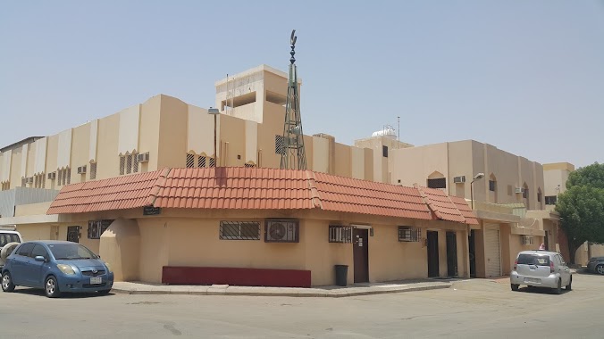
Mosque nearby مسجد ثمامة بن اثال
Saudi Arabia
Mosque nearby مسجد ثمامة بن اثال
مسجد ثمامة بن اثال
7486 وادي حبان, 4283, Riyadh Saudi Arabien
contacts phone
:
+966
Latitude:
24.5780443
, Longitude:
46.7675141
read more
nearest Mosque
191 m
مسجد
شارع محمد رشيد رضا، حي العزيزية، الرياض
Mosque
read more
324 m
جامع حماد الثقفي
شارع الرقة، حي العزيزية، الرياض
Mosque
read more
352 m
مسجد الصحابة
العزيزية، الرياض
Mosque
read more
357 m
Al Sahaba Mosque
Abdulrahman Al Qadi, Riyadh
Mosque
read more
426 m
Al Omari Grand Mosque
No 84, Riyadh
Mosque
read more
456 m
مسجد باحميد
Al Aziziyah
Mosque
read more
464 m
مسجد علي باحميد
Riyadh
Mosque
read more
471 m
مسجد الشيخ/ علي باحميد
Riyadh
Mosque
read more
474 m
مصلى العيد العزيزيه
7510 العمارة، العزيزية الرياض 14514 4473 Al Umara, Riyadh
Mosque
read more
490 m
مسجد بن حويس
7537, 3758, Riyadh
Mosque
read more
528 m
مسجد المحطه
شارع محمد رشيد رضا - حي العزيزية، الرياض
Mosque
read more
558 m
Al Noor Mosque
Al Said, Riyadh
Mosque
read more
599 m
مسجد عبدالله الخماش الرياض
4688 Hafidh Wahba, Riyadh
Mosque
read more
601 m
Unnamed Mosque
Al Rabiya, Riyadh
Mosque
read more
654 m
Mosque of Mohammed bin Rashid Al Harbi
4294 مسلمة، العزيزية الرياض 14514 8522 Muslimah, Riyadh
Mosque
read more
665 m
مسجد التوحيد
Nahawnd, Riyadh
Mosque
read more
671 m
Al Tawheed Mosque
Al Umara, Riyadh
Mosque
read more
709 m
مسجد الامام البخاري
4433 Ath Thaniy, Al Aziziyah, Riyadh 14514 8463 Ath Thaniy, Riyadh
Mosque
read more
713 m
Khadija Baghlaf Grand Mosque
No 84, Riyadh
Mosque
read more
725 m
مسجد الغفران
Riyadh
Mosque
read more
761 m
مسجد الطوق
8335, 3548, Riyadh
Mosque
read more
777 m
Arnous mosque
Al Saqaef, Riyadh
Mosque
read more
794 m
Ibn Al Kayyem Mosque
Al Raya, Riyadh
Mosque
read more
854 m
مسجد نوره بنت مرزوق الخنفزي رحمها الله
3306, 7569, Riyadh
Mosque
read more
862 m
Al Bawardi Grand Mosque
Sufyan Ibn Awf, Riyadh
Mosque
read more
📑
all categories
Accounting
Administrative area level 1
Airport
Amusement park
Aquarium
Art gallery
Atm
Bakery
Bank
Bar
Beauty salon
Bicycle store
Book store
Bowling alley
Bus station
Cafe
Campground
Car dealer
Car rental
Car repair
Car wash
Casino
Cemetery
Church
City hall
Clothing store
Colloquial area
Convenience store
Country
Courthouse
Dentist
Department store
Doctor
Electrician
Electronics store
Embassy
Finance
Fire station
Florist
Food
Funeral home
Furniture store
Gas station
General contractor
Grocery or supermarket
Gym
Hair care
Hardware store
Health
Hindu Temple
Home goods store
Hospital
Insurance agency
Intersection
Jewelry store
Laundry
Lawyer
Library
Light rail station
Liquor store
Local government office
Locality
Locksmith
Lodging
Meal delivery
Meal takeaway
Mosque
Movie rental
Movie theater
Moving company
Museum
Natural feature
Neighborhood
Night club
Painter
Park
Parking
Pet store
Pharmacy
Physiotherapist
Place of worship
Plumber
Point of interest
Police
Political
Post office
Premise
Real estate agency
Restaurant
Roofing contractor
Route
Rv park, camping
School
Shoe store
Shopping mall
Spa
Stadium
Storage
Store
Sublocality
Subpremise
Subway station
Supermarket
Taxi stand
Train station
Transit station
Travel agency
University
Veterinary care
Zoo
sublocality level 1
↑