Mosque nearby Sand Cafe Mosque
Saudi Arabia
Mosque nearby Sand Cafe Mosque
Sand Cafe Mosque
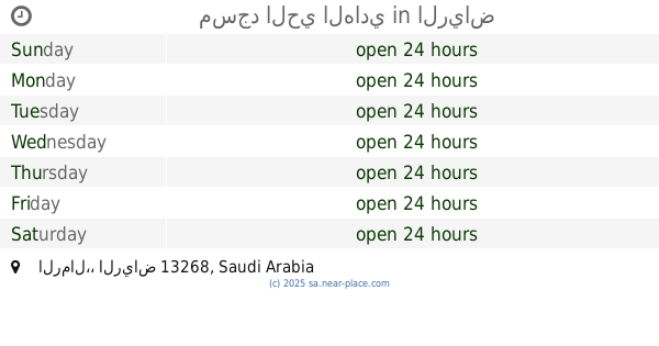
Ar Rimal, Riyadh 13266, Saudi Arabia
contacts phone
:
+966 11 473 0401
website:
moia.gov.sa
Latitude:
24.8697592
, Longitude:
46.8056095
larger map & directions
read more
nearest Mosque
808 m
مسجد الدروازه
Ath Thumamah Road, Riyadh
Mosque
read more
1.045 km
Mosque
3159, Riyadh
Mosque
read more
1.605 km
مسجد لولوة محمد العُمري الرياض
3135, Riyadh
Mosque
read more
1.72 km
Abdul Qadir Mhaideb Mosque
Riyadh
Mosque
read more
1.72 km
Sheikh Abdulkader Al-Muhaidib Mosque
Riyadh
Mosque
read more
1.724 km
مسجد
6169 خزام, King Khalid Airport, Riyadh
Mosque
read more
1.964 km
مسجد ناصر الرشيدي
Riyadh
Mosque
read more
2.516 km
Masjid Al-Otaibi starred
Riyadh
Mosque
read more
2.768 km
جامع ماجد المغيري
Riyadh
Mosque
read more
2.775 km
Ali bin Ali Mosque
Riyadh
Mosque
read more
2.809 km
Fahid Hamad Al-Mishari Mosque
Riyadh
Mosque
read more
2.926 km
جامع نايف بن زهيان
6940, 3236, Riyadh
Mosque
read more
3.027 km
جامع مقعد علي العتيبي
Riyadh
Mosque
read more
3.128 km
مسجد صالح محمد الرشيد وز
4290 Prince Saud Bin Mohammed Bin Muqrin Road, Riyadh
Mosque
read more
3.128 km
جامع صالح محمد الرشيد وزوجته ام عبدالرحمن رحمهما الله
4290 Prince Saud Bin Mohammed Bin Muqrin Road, Riyadh
Mosque
read more
3.145 km
Mosque Motib Rahimi
Riyadh
Mosque
read more
3.146 km
مسجد الرحمة
2727, Riyadh
Mosque
read more
3.174 km
مسجد صابر المطيري
Riyadh
Mosque
read more
3.193 km
مسجد الرمال
Riyadh
Mosque
read more
3.208 km
مسجد حي الرمال
Riyadh
Mosque
read more
3.289 km
مسجد داخل منيع الله الرحيمي
الرياض
Mosque
read more
3.312 km
مسجد الخنيني
Riyadh
Mosque
read more
3.363 km
مسجد الحي الهادي
الرياض
Mosque
read more
3.37 km
جامع الرمال
الرياض
Mosque
read more
3.37 km
مسجد / جامع الرمال
Riyadh
Mosque
read more
📑
all categories
Accounting
Administrative area level 1
Airport
Amusement park
Aquarium
Art gallery
Atm
Bakery
Bank
Bar
Beauty salon
Bicycle store
Book store
Bowling alley
Bus station
Cafe
Campground
Car dealer
Car rental
Car repair
Car wash
Casino
Cemetery
Church
City hall
Clothing store
Colloquial area
Convenience store
Country
Courthouse
Dentist
Department store
Doctor
Electrician
Electronics store
Embassy
Finance
Fire station
Florist
Food
Funeral home
Furniture store
Gas station
General contractor
Grocery or supermarket
Gym
Hair care
Hardware store
Health
Hindu Temple
Home goods store
Hospital
Insurance agency
Intersection
Jewelry store
Laundry
Lawyer
Library
Light rail station
Liquor store
Local government office
Locality
Locksmith
Lodging
Meal delivery
Meal takeaway
Mosque
Movie rental
Movie theater
Moving company
Museum
Natural feature
Neighborhood
Night club
Painter
Park
Parking
Pet store
Pharmacy
Physiotherapist
Place of worship
Plumber
Point of interest
Police
Political
Post office
Premise
Real estate agency
Restaurant
Roofing contractor
Route
Rv park, camping
School
Shoe store
Shopping mall
Spa
Stadium
Storage
Store
Sublocality
Subpremise
Subway station
Supermarket
Taxi stand
Train station
Transit station
Travel agency
University
Veterinary care
Zoo
sublocality level 1
↑