Night club nearby منتجع روز لاند
Coronavirus disease (COVID-19) Situation
confirmed cases
841469
deaths
9646
Saudi Arabia
Night club nearby منتجع روز لاند
منتجع روز لاند
Unnamed Road, Jeddah Saudi Arabia
contacts phone
:
+966
Latitude:
21.5870927
, Longitude:
39.2972106
read more
nearest Night club
1.367 km
فيلاميلانو
Unnamed Road, Jeddah
Night club
read more
1.72 km
الرزوا
Jeddah
Night club
read more
1.764 km
Raghadan Resort
Unnamed Road, Jeddah
Night club
read more
2.795 km
منتجات وسترحه ربيه
Unnamed Road, Jeddah
Night club
read more
3.045 km
أستراحة الأجواد
Jeddah
Night club
read more
4.712 km
العزبه
Al Samer, Jeddah
Night club
read more
5.173 km
استراحة الاوفياء
Jeddah
Night club
read more
5.616 km
جبل ابرق الرغامة
Jeddah
Night club
read more
6.619 km
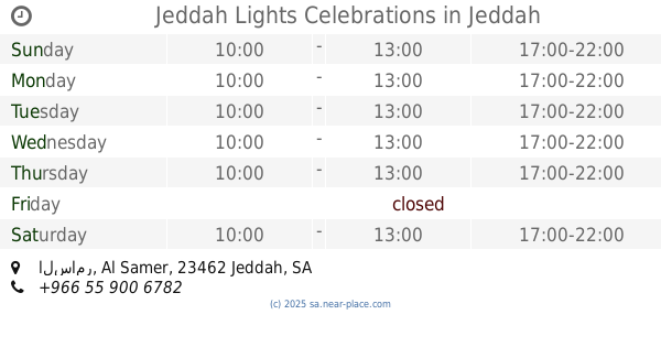
Jeddah Lights Celebrations
السامر Al Samer, 3182-, Jeddah
Night club
read more
6.946 km
قاعه السامر
6525-6643 نسيبة بنت كعب، السامر،, Jeddah
Night club
read more
7.176 km
مخيم ابو ساري
Jeddah
Night club
read more
7.815 km
Internet Cafe meeting
4517 الشاكرين، حي الصفا جدة 23453 7482 Al-Shakireen, Jeddah
Night club
read more
8.314 km
ابو ملوح الرويس
Jeddah
Night club
read more
8.463 km
صالون البتره
4105-4137 Al Muallifeen Street, Jeddah
Night club
read more
8.479 km
سكن الجوازات
Unnamed Road, Jeddah
Night club
read more
8.818 km
مركاز ابو معيوف
Saudi Arabia
Night club
read more
9.284 km
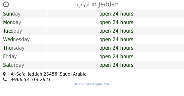
ابانا
Jeddah
Night club
read more
9.793 km
استراحة وملعب العز
Jeddah
Night club
read more
9.994 km
عمارة فايز فلمبان
2460 ابن بنانه السعدي، حي الصفا، جدة 23451 6645،
Night club
read more
10.104 km
استراحه القحاطين
Jeddah
Night club
read more
10.139 km
ابو هاشم معدت غوص
2728 Al Manfaluti, Mishrifah District, Jeddah
Night club
read more
10.186 km
المبدع المصور نايف
الوليد بن قيس،، جدة
Night club
read more
10.186 km
نايف المصور
6894 حي ابرق الرغامة، جدة 22264
Night club
read more
10.199 km
عطاء
Jeddah
Night club
read more
10.23 km
snooker club
Unnamed Road, Jeddah
Night club
read more
📑
all categories
Accounting
Administrative area level 1
Airport
Amusement park
Aquarium
Art gallery
Atm
Bakery
Bank
Bar
Beauty salon
Bicycle store
Book store
Bowling alley
Bus station
Cafe
Campground
Car dealer
Car rental
Car repair
Car wash
Casino
Cemetery
Church
City hall
Clothing store
Colloquial area
Convenience store
Country
Courthouse
Dentist
Department store
Doctor
Electrician
Electronics store
Embassy
Finance
Fire station
Florist
Food
Funeral home
Furniture store
Gas station
General contractor
Grocery or supermarket
Gym
Hair care
Hardware store
Health
Hindu Temple
Home goods store
Hospital
Insurance agency
Intersection
Jewelry store
Laundry
Lawyer
Library
Light rail station
Liquor store
Local government office
Locality
Locksmith
Lodging
Meal delivery
Meal takeaway
Mosque
Movie rental
Movie theater
Moving company
Museum
Natural feature
Neighborhood
Night club
Painter
Park
Parking
Pet store
Pharmacy
Physiotherapist
Place of worship
Plumber
Point of interest
Police
Political
Post office
Premise
Real estate agency
Restaurant
Roofing contractor
Route
Rv park, camping
School
Shoe store
Shopping mall
Spa
Stadium
Storage
Store
Sublocality
Subpremise
Subway station
Supermarket
Taxi stand
Train station
Transit station
Travel agency
University
Veterinary care
Zoo
sublocality level 1
↑