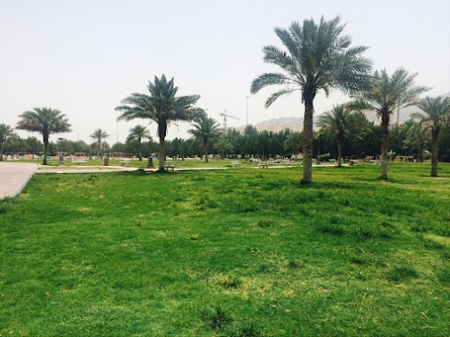
Park nearby حديقة تابعه لممشى بطحاء قريش
Coronavirus disease (COVID-19) Situation
confirmed cases
841469
deaths
9646
Saudi Arabia
Park nearby حديقة تابعه لممشى بطحاء قريش
حديقة تابعه لممشى بطحاء قريش
Batha Quraysh, Mecca 24352, Saudi Arabia
contacts phone
:
+966
Latitude:
21.3752264
, Longitude:
39.8302674
larger map & directions
read more
nearest Park
628 m
Batha Quraish Park
حديقة بطحاء قريش،، مكة
Park
read more
712 m
حديقة الهجرة
Mecca
Park
read more
724 m
حديقة الهجرة 2
Al Hijrah
Park
read more
1.995 km
Local Park
3715 3rd Ring Road, Mecca
Park
read more
2.038 km
حديقة كدي
3359, Mecca
Park
read more
2.306 km
حديقة حي الهجرة
Mecca
Park
read more
2.454 km
Park
Mecca
Park
read more
3.035 km
ALMAJDOUIE Park
Unnamed Road, Mecca
Park
read more
3.051 km
حديقة
Mecca
Park
read more
3.208 km
حديقة
النسيم،
Park
read more
3.403 km
Mecca park
8019 Ibrahim Al Khalil, Mecca
Park
read more
3.403 km
Mecca parking
8019 Ibrahim Al Khalil, Mecca
Park
read more
3.803 km
Misfalah National Park
8518 ابراهيم الخليل، جرهم، مكة 24233 3116 Ibrahim Al Khalil, Mecca
Park
read more
3.865 km
حديقة المسفلة
Ibrahim Al Khalil, Mecca
Park
read more
4.043 km
حديقة الحي
7185, 2857, Mecca
Park
read more
4.369 km
حديقة مسجد الحصان
6183, 3352, Mecca
Park
read more
4.417 km
حديقة مسجد الباتي
3363, 6363, Mecca
Park
read more
4.432 km
منتزه عثمان أبوالخير
الخالدية،, Mecca
Park
read more
4.44 km
Park Tilal Al Naseem
8152, 3304, Mecca
Park
read more
4.594 km
Small Parkحديقة
Al Jamiah, Mecca
Park
read more
4.716 km
Park Mohammedia
مكة
Park
read more
4.741 km
قمة الشوقية Top of Al-Shouqiah
8202, Mecca
Park
read more
4.863 km
Hussainiya Park
Mecca
Park
read more
4.872 km
ممشى الحسينية
Mecca
Park
read more
4.872 km
King Abdullah Garden
Mecca
Park
read more
📑
all categories
Accounting
Administrative area level 1
Airport
Amusement park
Aquarium
Art gallery
Atm
Bakery
Bank
Bar
Beauty salon
Bicycle store
Book store
Bowling alley
Bus station
Cafe
Campground
Car dealer
Car rental
Car repair
Car wash
Casino
Cemetery
Church
City hall
Clothing store
Colloquial area
Convenience store
Country
Courthouse
Dentist
Department store
Doctor
Electrician
Electronics store
Embassy
Finance
Fire station
Florist
Food
Funeral home
Furniture store
Gas station
General contractor
Grocery or supermarket
Gym
Hair care
Hardware store
Health
Hindu Temple
Home goods store
Hospital
Insurance agency
Intersection
Jewelry store
Laundry
Lawyer
Library
Light rail station
Liquor store
Local government office
Locality
Locksmith
Lodging
Meal delivery
Meal takeaway
Mosque
Movie rental
Movie theater
Moving company
Museum
Natural feature
Neighborhood
Night club
Painter
Park
Parking
Pet store
Pharmacy
Physiotherapist
Place of worship
Plumber
Point of interest
Police
Political
Post office
Premise
Real estate agency
Restaurant
Roofing contractor
Route
Rv park, camping
School
Shoe store
Shopping mall
Spa
Stadium
Storage
Store
Sublocality
Subpremise
Subway station
Supermarket
Taxi stand
Train station
Transit station
Travel agency
University
Veterinary care
Zoo
sublocality level 1
↑