Pharmacy nearby صيدلية عباد الرحمن
Coronavirus disease (COVID-19) Situation
confirmed cases
841469
deaths
9646
Saudi Arabia
Pharmacy nearby صيدلية عباد الرحمن
صيدلية عباد الرحمن
البلد،، Al-Balad, Jeddah 22233, Saudi Arabia
contacts phone
:
+966 11 264 7998
Latitude:
21.4808073
, Longitude:
39.1857567
larger map & directions
read more
nearest Pharmacy
341 m
صيدلية الصلاح
3371 عروف, حي البلد, Jeddah
Pharmacy
read more
379 m
صيدلية المتحدة
حي البلد، جدة
Pharmacy
read more
382 m
Sina Pharmacy
Qabel Trail, Jeddah
Pharmacy
read more
388 m
United Pharmacy
King Fahd Branch Road, Jeddah
Pharmacy
read more
431 m
صيدلية التوحيد
Unnamed Road, Jeddah
Pharmacy
read more
533 m
صيدلية نور الهدى
3069 Shajarat Al Arak, Jeddah
Pharmacy
read more
592 m
صيدلية الجواهر
شارع قابل - البلد، جدة
Pharmacy
read more
633 m
صيدلية الحقل
6661-6687 باناجة، البلد،, Jeddah
Pharmacy
read more
696 m
صيدليه المجتمع الحديثه ٨
6688 زقاق النفيس, Al Balad District,, Jeddah
Pharmacy
read more
726 m
Al Mujtama Pharmacy 08
6687 Al Bandar Ln, Al Balad District Jeddah 22238
Pharmacy
read more
765 m
صيدليه الاجواد الهنداويه
3637 King Fahd Road, حي الهنداوية 8065, Jeddah
Pharmacy
read more
782 m
صيدلية الأجواد
3637 King Fahd Road, Jeddah
Pharmacy
read more
786 m
حي البلد
Jeddah
Pharmacy
read more
788 m
صيدلية الجمل
طريق الملك فهد، حي البلد، جدة
Pharmacy
read more
794 m
صيدلية الجمل
Jeddah
Pharmacy
read more
822 m
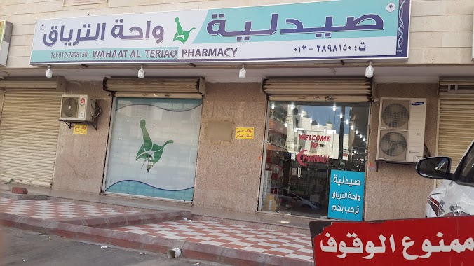
صيدلية واحة الترياق-3
7633-7707 الترقفي،, Jeddah
Pharmacy
read more
870 m
صيدلية المتحدة ٣٣
7205 Old Makkah Road, Jeddah
Pharmacy
read more
887 m
صيدلية الوصفة
Ahl Al Manzilah, Jeddah
Pharmacy
read more
893 m
جده الروابي
Jeddah
Pharmacy
read more
923 m
صيدلية مستقبل الصحة
حي العمارية، جدة
Pharmacy
read more
941 m
Nahdi Pharmacy
6274 الغر, حي البلد، 3947, Jeddah
Pharmacy
read more
964 m
Seven Medcne
Ahl Al Hamd, 3745-3757, Jeddah
Pharmacy
read more
965 m
Nahdi Pharmacy
3120 ابو جعفر الناصري, Al Hindawiyah District, Jeddah
Pharmacy
read more
1.106 km
صيدلية خالد
3932 Ahl Al-Suhaifah، Jeddah
Pharmacy
read more
1.143 km
صيدلية جوهره الكريستال
Jeddah
Pharmacy
read more
📑
all categories
Accounting
Administrative area level 1
Airport
Amusement park
Aquarium
Art gallery
Atm
Bakery
Bank
Bar
Beauty salon
Bicycle store
Book store
Bowling alley
Bus station
Cafe
Campground
Car dealer
Car rental
Car repair
Car wash
Casino
Cemetery
Church
City hall
Clothing store
Colloquial area
Convenience store
Country
Courthouse
Dentist
Department store
Doctor
Electrician
Electronics store
Embassy
Finance
Fire station
Florist
Food
Funeral home
Furniture store
Gas station
General contractor
Grocery or supermarket
Gym
Hair care
Hardware store
Health
Hindu Temple
Home goods store
Hospital
Insurance agency
Intersection
Jewelry store
Laundry
Lawyer
Library
Light rail station
Liquor store
Local government office
Locality
Locksmith
Lodging
Meal delivery
Meal takeaway
Mosque
Movie rental
Movie theater
Moving company
Museum
Natural feature
Neighborhood
Night club
Painter
Park
Parking
Pet store
Pharmacy
Physiotherapist
Place of worship
Plumber
Point of interest
Police
Political
Post office
Premise
Real estate agency
Restaurant
Roofing contractor
Route
Rv park, camping
School
Shoe store
Shopping mall
Spa
Stadium
Storage
Store
Sublocality
Subpremise
Subway station
Supermarket
Taxi stand
Train station
Transit station
Travel agency
University
Veterinary care
Zoo
sublocality level 1
↑