Premise nearby Football Ground
Coronavirus disease (COVID-19) Situation
confirmed cases
841469
deaths
9646
Saudi Arabia
Premise nearby Football Ground
Football Ground
Khamis Mushait Saudi Arabia
contacts phone
:
+966
Latitude:
18.253514
, Longitude:
42.7469283
read more
nearest Premise
621 m
تاج القصور للوحدات السكنية
Khamis Mushait
Premise
read more
2.716 km
مدرسة العباس بن عبدالمطلب الابتدائية
Khamis Mushait
Premise
read more
2.716 km
مدرسة العباس بن عبدالمطلب الابتدائية
Chamis Muszajt
Premise
read more
2.716 km
مدرسة العباس بن عبدالمطلب الابتدائية
Chamis Muschait
Premise
read more
3.117 km
مدرسة ثانوية البهيقي
Chamis Muszajt
Premise
read more
3.117 km
مدرسة ثانوية البهيقي
Khamis Mushait
Premise
read more
3.117 km
مدرسة ثانوية البهيقي
Chamis Muschait
Premise
read more
4.33 km
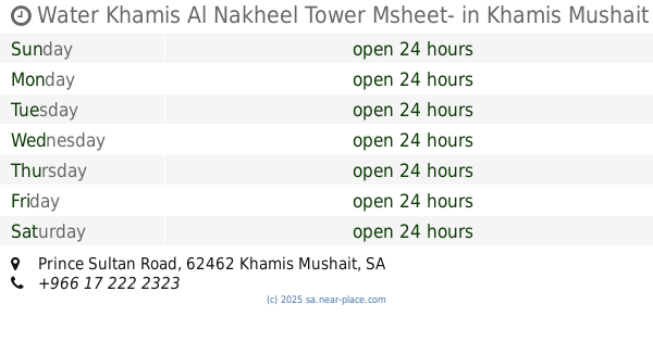
Water Khamis Al Nakheel Tower Msheet-
Prince Sultan Road, Khamis Mushait
Premise
read more
4.43 km
حديقة النخيل
An Nakhil
Premise
read more
4.446 km
ملعب كرة سلة
An Nakhil
Premise
read more
5.574 km
حديقة الشرفية
Ash Sharafiyah
Premise
read more
5.645 km
هيئة التحقيق والإدعاء العام
Ash Sharafiyah
Premise
read more
5.711 km
مدرسة الإمام الشافعي الابتدائية
Al Khaldiyah
Premise
read more
5.737 km
مقبرة آل قصال
Al Khaldiyah
Premise
read more
5.942 km
شقق فخامتكم
Khamis Mushait
Premise
read more
6.262 km
مركز التدريب
Ad Dawhah
Premise
read more
6.389 km
مدرسة الجزيرة الابتدائية
Al Irq Ash Shamali
Premise
read more
6.527 km
ابتدائية مالك بن دينار
Al Aziziyah
Premise
read more
6.598 km
Governorate of Khamis Mushait
Atod
Premise
read more
6.695 km
مدرسة المدينة المنورة المتوسطة
Qambar
Premise
read more
6.769 km
City of technical and communication
Khamis Mushait
Premise
read more
6.807 km
مدرسة عبدالله بن رواحة الابتدائية
Qambar
Premise
read more
7.109 km
وردة النايفات للشقق المفروشة
Al Fath
Premise
read more
7.149 km
محطة التوزيع الكهربائية
An Nahdah
Premise
read more
7.296 km
محطة بن قرعة
Shubaah
Premise
read more
📑
all categories
Accounting
Administrative area level 1
Airport
Amusement park
Aquarium
Art gallery
Atm
Bakery
Bank
Bar
Beauty salon
Bicycle store
Book store
Bowling alley
Bus station
Cafe
Campground
Car dealer
Car rental
Car repair
Car wash
Casino
Cemetery
Church
City hall
Clothing store
Colloquial area
Convenience store
Country
Courthouse
Dentist
Department store
Doctor
Electrician
Electronics store
Embassy
Finance
Fire station
Florist
Food
Funeral home
Furniture store
Gas station
General contractor
Grocery or supermarket
Gym
Hair care
Hardware store
Health
Hindu Temple
Home goods store
Hospital
Insurance agency
Intersection
Jewelry store
Laundry
Lawyer
Library
Light rail station
Liquor store
Local government office
Locality
Locksmith
Lodging
Meal delivery
Meal takeaway
Mosque
Movie rental
Movie theater
Moving company
Museum
Natural feature
Neighborhood
Night club
Painter
Park
Parking
Pet store
Pharmacy
Physiotherapist
Place of worship
Plumber
Point of interest
Police
Political
Post office
Premise
Real estate agency
Restaurant
Roofing contractor
Route
Rv park, camping
School
Shoe store
Shopping mall
Spa
Stadium
Storage
Store
Sublocality
Subpremise
Subway station
Supermarket
Taxi stand
Train station
Transit station
Travel agency
University
Veterinary care
Zoo
sublocality level 1
↑