Premise nearby Ibn Katheer Mosque
Coronavirus disease (COVID-19) Situation
confirmed cases
841469
deaths
9646
Saudi Arabia
Premise nearby Ibn Katheer Mosque
Ibn Katheer Mosque
Al Jamiah Saudi Arabia
contacts phone
:
+966
Latitude:
26.342901
, Longitude:
50.1280853
read more
nearest Premise
431 m
Alhasan Bin Ali Mosque
Al Jamiah
Premise
read more
461 m
Saad Ibn Obada Mosque
Al Jamiah
Premise
read more
470 m
Karama School
Al Jamiah
Premise
read more
535 m
Aljamiah Soccer Fields
Al Jamiah
Premise
read more
785 m
Bilal Ibn Rabah Mosque
Al Jamiah
Premise
read more
2.18 km
Al-Uhaideb Apartments complex
Al Qusur
Premise
read more
2.476 km
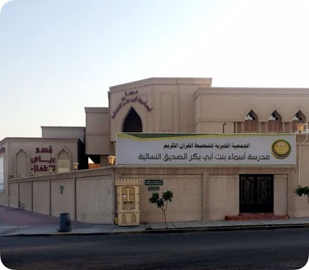
Asma'a Bint Abi Bakr School
Dana Al Shamaliah
Premise
read more
2.514 km
Marbella
Al Qusur
Premise
read more
2.514 km
Safeway
Al Qusur
Premise
read more
2.579 km
Munirah Soccer Field
Saudi Aramco
Premise
read more
2.78 km
Ahmed Bin Hanbal Mosque
Dana Al Janubiyah
Premise
read more
2.939 km
Internal Security Forces Housing
Dana South
Premise
read more
3.121 km
Car Service
Ash Shulah
Premise
read more
3.281 km
Building 902
King Fahd University of Petroleum and Minerals
Premise
read more
3.343 km
Bldg 91
King Fahd University of Petroleum and Minerals
Premise
read more
3.359 km
Gate #90
Saudi Aramco
Premise
read more
3.383 km
Dhahran Grand Mosque
King Fahd University of Petroleum and Minerals
Premise
read more
3.465 km
AlZubair Ibn AlAwam Mosque
King Fahd University of Petroleum and Minerals
Premise
read more
3.481 km
Tower Administration Building
730 Core Area Access Road, Dhahran
Premise
read more
3.488 km
Tower Building
Saudi Aramco
Premise
read more
3.525 km
Students Housing Playground
King Fahd University of Petroleum and Minerals
Premise
read more
3.53 km
Student Lines
King Fahd University of Petroleum and Minerals
Premise
read more
3.553 km
Building 844
King Fahd University of Petroleum and Minerals
Premise
read more
3.561 km
844
King Fahd University of Petroleum and Minerals
Premise
read more
3.573 km
843
King Fahd University of Petroleum and Minerals
Premise
read more
📑
all categories
Accounting
Administrative area level 1
Airport
Amusement park
Aquarium
Art gallery
Atm
Bakery
Bank
Bar
Beauty salon
Bicycle store
Book store
Bowling alley
Bus station
Cafe
Campground
Car dealer
Car rental
Car repair
Car wash
Casino
Cemetery
Church
City hall
Clothing store
Colloquial area
Convenience store
Country
Courthouse
Dentist
Department store
Doctor
Electrician
Electronics store
Embassy
Finance
Fire station
Florist
Food
Funeral home
Furniture store
Gas station
General contractor
Grocery or supermarket
Gym
Hair care
Hardware store
Health
Hindu Temple
Home goods store
Hospital
Insurance agency
Intersection
Jewelry store
Laundry
Lawyer
Library
Light rail station
Liquor store
Local government office
Locality
Locksmith
Lodging
Meal delivery
Meal takeaway
Mosque
Movie rental
Movie theater
Moving company
Museum
Natural feature
Neighborhood
Night club
Painter
Park
Parking
Pet store
Pharmacy
Physiotherapist
Place of worship
Plumber
Point of interest
Police
Political
Post office
Premise
Real estate agency
Restaurant
Roofing contractor
Route
Rv park, camping
School
Shoe store
Shopping mall
Spa
Stadium
Storage
Store
Sublocality
Subpremise
Subway station
Supermarket
Taxi stand
Train station
Transit station
Travel agency
University
Veterinary care
Zoo
sublocality level 1
↑