School nearby Charity center to teach the Quran and its Sciences
Saudi Arabia
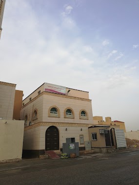
School nearby Charity center to teach the Quran and its Sciences
Charity center to teach the Quran and its Sciences
Al Malqa, Riyadh 13525, Saudi Arabia
contacts phone
:
+966 55 526 3791
Latitude:
24.8184052
, Longitude:
46.5956461
larger map & directions
read more
nearest School
446 m
Flag school
رقم 384, Riyadh
School
read more
585 m
معهد جسر المعرفه للغات
Unnamed Road, Riyadh
School
read more
766 m
Creative stats kindergarten
Riyadh
School
read more
771 m
دار هيا العيسى لتعليم القرآن الكريم وعلومه
2661 العمارية, Riyadh
School
read more
845 m
School of Global Learning Stages
Riyadh
School
read more
846 m
مركز واحة الصحراء لضيافة الاطفال
Unnamed Road, Riyadh
School
read more
1.145 km
مركز فريق التاهيل الدولي
5350, 8396, Riyadh
School
read more
1.435 km
مدارس دانة العلوم
Al Malqa, North of Anas bin Malik road, West of Prince Mohammed bin Saad bin Abdul Aziz Road, Riyadh
School
read more
1.435 km
مدارس دانة العلوم
24°48'20.2"N 46°35'58.8"E
School
read more
1.468 km
روضة دانة العلوم
شارع ارجوان - حي الملقا، الرياض
School
read more
1.525 km
Al Rajwan
24, 8057501,46.5973431, Dammam
School
read more
1.583 km
روضة واحة الغد
ارجوان, الملقا، الرياض
School
read more
1.595 km
مدرسة حي الملقا الابتدائية
3601, Riyadh
School
read more
1.623 km
ابتدائية الملقا
3516, Riyadh
School
read more
1.667 km
Medium Star Ayyubid Religion
3580, Riyadh
School
read more
1.672 km
ابتدائية عبدالله ابن ذكوان
3601, Riyadh
School
read more
1.674 km
مدرسة نجم الدين ايوب المتوسطة
3601, Riyadh
School
read more
1.677 km
ابتدائية عبدالله بن ذكوان لتحفيظ القرأن
3601, Riyadh
School
read more
1.686 km
دار رياض الذاكرات
الرياض
School
read more
1.693 km
عبدالله بن ذكوان لتحفيظ القرآن الكريم
Unnamed Road, Riyadh
School
read more
1.722 km
School Necmettin
3601, Riyadh
School
read more
2.069 km
International Indian Public School
Main Gate 3, H.E Ali Naimi Street, Dhahran
School
read more
2.151 km
حضانة Almalqa Village Nursery
6701 وادي وج، الملقا، الرياض 13524 3827 Wag Valley, Riyadh
School
read more
2.175 km
رواد التربية .القروان
Unnamed Road, القيروان، الرياض 13531،
School
read more
2.238 km
مدارس رؤية البلاد العالمية the country vision international school
Unnamed Road, Riyadh
School
read more
📑
all categories
Accounting
Administrative area level 1
Airport
Amusement park
Aquarium
Art gallery
Atm
Bakery
Bank
Bar
Beauty salon
Bicycle store
Book store
Bowling alley
Bus station
Cafe
Campground
Car dealer
Car rental
Car repair
Car wash
Casino
Cemetery
Church
City hall
Clothing store
Colloquial area
Convenience store
Country
Courthouse
Dentist
Department store
Doctor
Electrician
Electronics store
Embassy
Finance
Fire station
Florist
Food
Funeral home
Furniture store
Gas station
General contractor
Grocery or supermarket
Gym
Hair care
Hardware store
Health
Hindu Temple
Home goods store
Hospital
Insurance agency
Intersection
Jewelry store
Laundry
Lawyer
Library
Light rail station
Liquor store
Local government office
Locality
Locksmith
Lodging
Meal delivery
Meal takeaway
Mosque
Movie rental
Movie theater
Moving company
Museum
Natural feature
Neighborhood
Night club
Painter
Park
Parking
Pet store
Pharmacy
Physiotherapist
Place of worship
Plumber
Point of interest
Police
Political
Post office
Premise
Real estate agency
Restaurant
Roofing contractor
Route
Rv park, camping
School
Shoe store
Shopping mall
Spa
Stadium
Storage
Store
Sublocality
Subpremise
Subway station
Supermarket
Taxi stand
Train station
Transit station
Travel agency
University
Veterinary care
Zoo
sublocality level 1
↑