School nearby منتجع السرحان
Coronavirus disease (COVID-19) Situation
confirmed cases
841469
deaths
9646
Saudi Arabia
School nearby منتجع السرحان
منتجع السرحان
Dammam Saudi Arabia
contacts phone
:
+966
Latitude:
26.2212359
, Longitude:
49.9365795
read more
nearest School
1.648 km
تشليح السعاده
Dammam
School
read more
3.365 km
Enerco Training Center
Dammam
School
read more
4.187 km
Gujranwala Gagewali
Dammam
School
read more
4.433 km
Gulf Fire Direct Training Center
7013, 3289, Dammam
School
read more
5.319 km
المعهد التقني للاختبارات الغير اتلافية
Dammam
School
read more
6.209 km
مركز تدريب الطويرقي
Dammam
School
read more
7.147 km
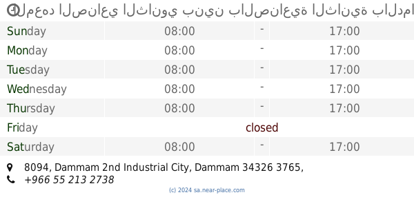
المعهد الصناعي الثانوي بنين بالصناعية الثانية بالدمام
8094, Dammam
School
read more
8.85 km
مدرسة القوات الجوية للبقاء
7505, Dhahran
School
read more
10.378 km
Al Karama Primary School in Dhahran
Dhahran 34257
School
read more
10.435 km
Nesma Training Institute
615, Dhahran
School
read more
13.551 km
دار مريم ابنة عمران لتحفيظ القرآن الكريم بالمجمع الطبي
2332 الدمام 34313
School
read more
13.847 km
Prince Sultan College
2638, Dammam
School
read more
13.886 km
Education and Training Center
2669, Dammam
School
read more
15.019 km
Bala Vikas Dammam
Dammam
School
read more
15.622 km
Medium Marwa
Unnamed Road الفرسان, Dammam
School
read more
15.793 km
مدرسة أم العلاء الأنصارية النسائية
الدمام
School
read more
15.986 km
ابتدائية عائشة بنت أبي بكر
Unnamed Road, Dammam
School
read more
16.243 km
Al asker driving school
4208, Dammam
School
read more
16.285 km
مدرسة الدمام النموذجية لتعليم قيادة السيارات
Dammam
School
read more
16.514 km
bilal ch
Unnamed Road, Dhahran
School
read more
17.104 km
MMG Steel Factory (DMS) & Training Center
4838, 6739, Dammam
School
read more
17.336 km
مدرسة
Dhahran
School
read more
17.609 km
Pmu
Dhahran
School
read more
17.684 km
IT Department
Dhahran
School
read more
18.397 km
Medam Ji
Unnamed Road, Saudi Aramco, Dhahran
School
read more
📑
all categories
Accounting
Administrative area level 1
Airport
Amusement park
Aquarium
Art gallery
Atm
Bakery
Bank
Bar
Beauty salon
Bicycle store
Book store
Bowling alley
Bus station
Cafe
Campground
Car dealer
Car rental
Car repair
Car wash
Casino
Cemetery
Church
City hall
Clothing store
Colloquial area
Convenience store
Country
Courthouse
Dentist
Department store
Doctor
Electrician
Electronics store
Embassy
Finance
Fire station
Florist
Food
Funeral home
Furniture store
Gas station
General contractor
Grocery or supermarket
Gym
Hair care
Hardware store
Health
Hindu Temple
Home goods store
Hospital
Insurance agency
Intersection
Jewelry store
Laundry
Lawyer
Library
Light rail station
Liquor store
Local government office
Locality
Locksmith
Lodging
Meal delivery
Meal takeaway
Mosque
Movie rental
Movie theater
Moving company
Museum
Natural feature
Neighborhood
Night club
Painter
Park
Parking
Pet store
Pharmacy
Physiotherapist
Place of worship
Plumber
Point of interest
Police
Political
Post office
Premise
Real estate agency
Restaurant
Roofing contractor
Route
Rv park, camping
School
Shoe store
Shopping mall
Spa
Stadium
Storage
Store
Sublocality
Subpremise
Subway station
Supermarket
Taxi stand
Train station
Transit station
Travel agency
University
Veterinary care
Zoo
sublocality level 1
↑