School nearby Nineteen high school for girls
Coronavirus disease (COVID-19) Situation
confirmed cases
841469
deaths
9646
Saudi Arabia
School nearby Nineteen high school for girls
Nineteen high school for girls
7348, Hail Saudi Arabia
contacts phone
:
+966
Latitude:
27.5260879
, Longitude:
41.6531396
read more
nearest School
40 m
المتوسطة الثلاثون
3861, 7432, Hail
School
read more
43 m
Secondary Nineteenth Hail
3861, Hail
School
read more
96 m
الروضه السادسه
Unnamed Road, Hail
School
read more
426 m
مدرسة الشهداء بحائل
Hail
School
read more
426 m
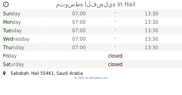
مدرسة صبابه بحائل
Hail
School
read more
595 m
مدرسة ثانوية الطفيل بن عمرو
Hail
School
read more
655 m
برزان الشمري
King Faisal Road, Hail
School
read more
659 m
متوسطة الثلاثون للبنات
King Faisal Road, Hail
School
read more
787 m
ادارة التربيه الخاصه
2309, Hail
School
read more
807 m
مدارس الرواد المتفوقون
king Faisal Road, Hail
School
read more
808 m
Alroid civil Aptdaa School and Average
2377 ابن القيم، الوسيطاء حائل 55424 7735 Ibn Al Qaym, Hail
School
read more
986 m
Sababah Middle School
King Faisal Road, Hail
School
read more
1.087 km
Directorate General of Civil Schools Virtue
3556, Hail
School
read more
1.093 km
ثانوية الفضيلة الاهلية
3556, Hail
School
read more
1.11 km
Virtue Secondary Schools Eligibility
Uqdah Road, Hail
School
read more
1.136 km
متوسطة الفضلية
Hail
School
read more
1.177 km
مدرسة النووي الابتدائية
Hail
School
read more
1.223 km
10th Intermediate School
Uqdah Road, Hail
School
read more
1.261 km
36th Elementary School
Uqdah Road, Hail
School
read more
1.386 km
Enriching values Institute
6837, Hail
School
read more
1.57 km
دار رقية لتحفيظ القرآن الكريم
2573, Hail
School
read more
1.575 km
إشراقة الغد لضيافة الأطفال
Hail
School
read more
1.588 km
معهد ايلاف حائل النسائي
Hail
School
read more
1.643 km
ثانوية الفرزدق
Makkah Al Mukarramah, Hail
School
read more
1.717 km
Twenty-seventh middle school
Hail
School
read more
📑
all categories
Accounting
Administrative area level 1
Airport
Amusement park
Aquarium
Art gallery
Atm
Bakery
Bank
Bar
Beauty salon
Bicycle store
Book store
Bowling alley
Bus station
Cafe
Campground
Car dealer
Car rental
Car repair
Car wash
Casino
Cemetery
Church
City hall
Clothing store
Colloquial area
Convenience store
Country
Courthouse
Dentist
Department store
Doctor
Electrician
Electronics store
Embassy
Finance
Fire station
Florist
Food
Funeral home
Furniture store
Gas station
General contractor
Grocery or supermarket
Gym
Hair care
Hardware store
Health
Hindu Temple
Home goods store
Hospital
Insurance agency
Intersection
Jewelry store
Laundry
Lawyer
Library
Light rail station
Liquor store
Local government office
Locality
Locksmith
Lodging
Meal delivery
Meal takeaway
Mosque
Movie rental
Movie theater
Moving company
Museum
Natural feature
Neighborhood
Night club
Painter
Park
Parking
Pet store
Pharmacy
Physiotherapist
Place of worship
Plumber
Point of interest
Police
Political
Post office
Premise
Real estate agency
Restaurant
Roofing contractor
Route
Rv park, camping
School
Shoe store
Shopping mall
Spa
Stadium
Storage
Store
Sublocality
Subpremise
Subway station
Supermarket
Taxi stand
Train station
Transit station
Travel agency
University
Veterinary care
Zoo
sublocality level 1
↑