School nearby روضة الحمدانية
Coronavirus disease (COVID-19) Situation
confirmed cases
841469
deaths
9646
Saudi Arabia
School nearby روضة الحمدانية
روضة الحمدانية
Unnamed Road, Jeddah Saudi Arabia
contacts phone
:
+966
Latitude:
21.7907297
, Longitude:
39.1949673
read more
nearest School
573 m
ابو عبد المحسن الفروسية
Jeddah
School
read more
1.527 km
مدارس البشائر
4638, حي البشائر،, Jeddah
School
read more
1.76 km
دار براعم الدانه
Unnamed Road, الفلاح،, Jeddah
School
read more
1.782 km
مركز سلمى بنت صخر للعلوم الشرعية
7131, حي الفلاح 4943, Jeddah
School
read more
1.788 km
دار وروضه براعم الرحمن
Unnamed Road, Jeddah
School
read more
1.9 km
House holsters 35
Jeddah
School
read more
2.028 km
masjed alwaldain
Unnamed Road, Jeddah
School
read more
2.033 km
مدرسة دار الأجيال
6763, حي الفلاح،, Jeddah
School
read more
2.058 km
هلا
Jeddah
School
read more
2.302 km
الابتدائية ١٣٦بجدة
حي, Jeddah
School
read more
2.337 km
روضة جيل العزم
Jeddah
School
read more
2.337 km
مدارس فرسان المعرفة
Unnamed Road, Jeddah
School
read more
2.368 km
Civil Faisaliah Schools Branch
7310, Al Falah District, Jeddah
School
read more
2.368 km
School Faysaliyah Benin
7310, حي الفلاح،, Jeddah
School
read more
2.373 km
مجمع مدارس الفيصلية الأهلية بجدة - فرع الفلاح
7310, Jeddah
School
read more
2.374 km
Al Falah
2951, Al Falah District, Jeddah
School
read more
2.378 km
فرع مدارس الفيصلية الأهلية
7310, حي الفلاح، 3064, Jeddah
School
read more
2.39 km
مجمع مدارس الفيصلية
7310, حي الفلاح 3064, Jeddah
School
read more
2.396 km
مدارس الفيصلية الأهلية للبنين
حي الفلاح، 3064 7310 حي الفلاح Jeddah Saudi Arabia
School
read more
2.485 km
sfshwshhs
Unnamed Road, Jeddah
School
read more
2.57 km
Peace Future Private School
Jeddah
School
read more
2.636 km
حضانة و روضة بيتي الصغير
2843 As Salhiyah District Jeddah 23763
School
read more
2.833 km
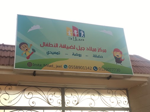
مركز ميلاد لضيافة الأطفال
Jeddah
School
read more
2.835 km
Dar Al Hanan hospitality Kids
6609, حي الحمدانية،, Jeddah
School
read more
2.87 km
حضانة ماما عزة
Unnamed Road, Jeddah
School
read more
📑
all categories
Accounting
Administrative area level 1
Airport
Amusement park
Aquarium
Art gallery
Atm
Bakery
Bank
Bar
Beauty salon
Bicycle store
Book store
Bowling alley
Bus station
Cafe
Campground
Car dealer
Car rental
Car repair
Car wash
Casino
Cemetery
Church
City hall
Clothing store
Colloquial area
Convenience store
Country
Courthouse
Dentist
Department store
Doctor
Electrician
Electronics store
Embassy
Finance
Fire station
Florist
Food
Funeral home
Furniture store
Gas station
General contractor
Grocery or supermarket
Gym
Hair care
Hardware store
Health
Hindu Temple
Home goods store
Hospital
Insurance agency
Intersection
Jewelry store
Laundry
Lawyer
Library
Light rail station
Liquor store
Local government office
Locality
Locksmith
Lodging
Meal delivery
Meal takeaway
Mosque
Movie rental
Movie theater
Moving company
Museum
Natural feature
Neighborhood
Night club
Painter
Park
Parking
Pet store
Pharmacy
Physiotherapist
Place of worship
Plumber
Point of interest
Police
Political
Post office
Premise
Real estate agency
Restaurant
Roofing contractor
Route
Rv park, camping
School
Shoe store
Shopping mall
Spa
Stadium
Storage
Store
Sublocality
Subpremise
Subway station
Supermarket
Taxi stand
Train station
Transit station
Travel agency
University
Veterinary care
Zoo
sublocality level 1
↑