School nearby روضة اطفال
Saudi Arabia
School nearby روضة اطفال
روضة اطفال
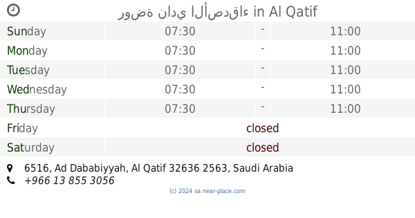
الكويكب،، القطيف 32636, Saudi Arabia
contacts phone
:
+966
Latitude:
26.5507846
, Longitude:
50.0087676
larger map & directions
read more
nearest School
193 m
مدرسة النخيل الابتدائية
القطيف
School
read more
248 m
روضة و قافلة البتول
شارع عمرو بن خارجة, Al Qatif
School
read more
479 m
Rainbow town daycare and learning center
Al Qatif
School
read more
481 m
مركز الورود
3628 Abu Abdullah Al Katib Street, Al Qatif
School
read more
532 m
Office of Education Qatif - Girls
Al Qatif
School
read more
537 m
الوحدة الصحية المدرسية للبنات
7095 Abdul Rahman Ibn Dinar Street, Al Qatif
School
read more
538 m
Education Office Qatif
Al Qatif
School
read more
564 m
مكتب التعليم للبنات بالقطيف
Al Qatif
School
read more
610 m
The second high school for girls Bakaddih
Badr Street, Al Qatif
School
read more
614 m
مدرسة معن بن زائدة المتوسطة
Ad Dababiyyah
School
read more
614 m
The first primary school for girls in Qatif
Badr Street, Al Qatif
School
read more
624 m
مدرسة معن بن زائدة المتوسطة (القطيف الثانوية سابقا)
6851, Al Qatif
School
read more
626 m
مدرسة معن بن زائدة المتوسطة
Al Qatif
School
read more
639 m
زهراء المهر
شارع ٨، المسعودية،، القطيف
School
read more
654 m
المتوسطة الثانية بالقطيف
Al Qatif
School
read more
657 m
روضة نادي الأصدقاء
6516, Al Qatif
School
read more
664 m
Zain Al Abdeen Elementary School
القطيف
School
read more
665 m
الابتدائية الحادية عشر بالقطيف
6333 الملك فيصل بن عبد العزيز، المسعودية القطيف 32636
School
read more
758 m
مركز النور الأمثل للتدريب والتطور
King Faisal Ibn Abdulaziz Street, Al Qatif
School
read more
760 m
بناية الغروب
King Faisal Ibn Abdulaziz Street, Al Qatif
School
read more
769 m
معهد انجليزي Englush Place
Al Qatif
School
read more
922 m
مدرسة الثانوية الاولى بالتوبي للبنات
6709 الملك فيصل بن عبد العزيز, Al Qatif
School
read more
922 m
مدرسه الثانوية الاولى بالتوبي
Al Qatif
School
read more
926 m
المدرسة الرابعة
Al Qatif
School
read more
933 m
Secondary fourth Qatif
Al Qatif
School
read more
📑
all categories
Accounting
Administrative area level 1
Airport
Amusement park
Aquarium
Art gallery
Atm
Bakery
Bank
Bar
Beauty salon
Bicycle store
Book store
Bowling alley
Bus station
Cafe
Campground
Car dealer
Car rental
Car repair
Car wash
Casino
Cemetery
Church
City hall
Clothing store
Colloquial area
Convenience store
Country
Courthouse
Dentist
Department store
Doctor
Electrician
Electronics store
Embassy
Finance
Fire station
Florist
Food
Funeral home
Furniture store
Gas station
General contractor
Grocery or supermarket
Gym
Hair care
Hardware store
Health
Hindu Temple
Home goods store
Hospital
Insurance agency
Intersection
Jewelry store
Laundry
Lawyer
Library
Light rail station
Liquor store
Local government office
Locality
Locksmith
Lodging
Meal delivery
Meal takeaway
Mosque
Movie rental
Movie theater
Moving company
Museum
Natural feature
Neighborhood
Night club
Painter
Park
Parking
Pet store
Pharmacy
Physiotherapist
Place of worship
Plumber
Point of interest
Police
Political
Post office
Premise
Real estate agency
Restaurant
Roofing contractor
Route
Rv park, camping
School
Shoe store
Shopping mall
Spa
Stadium
Storage
Store
Sublocality
Subpremise
Subway station
Supermarket
Taxi stand
Train station
Transit station
Travel agency
University
Veterinary care
Zoo
sublocality level 1
↑