School nearby School culture medium
Coronavirus disease (COVID-19) Situation
confirmed cases
841469
deaths
9646
Saudi Arabia
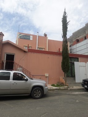
School nearby School culture medium
School culture medium
Abha Saudi Arabia
contacts phone
:
+966
Latitude:
18.2363953
, Longitude:
42.6010966
read more
nearest School
8 m
Khabab bin Aratt Primary School
King Fahd Rd, Abha
School
read more
14 m
مدرسة خباب بن الأرت الابتدائية
Khamis Mushait
School
read more
68 m
متوسطة الثقافة
3591, Abha
School
read more
83 m
روضة بداية الرائدة
أبها
School
read more
175 m
روضة الفرقان
3420, Abha
School
read more
181 m
دار الفرقان النسائية لتحفيظ القرآن الكريم
الموظفين، أبها
School
read more
367 m
الروضه الثالثة عشر بحي الموظفين
7943, Abha
School
read more
419 m
مدرسة المنح الابتدائية
7810, Abha
School
read more
424 m
ابتدائية ومتوسطة المنح
7794, Abha
School
read more
674 m
Prince Mohammad Bin Naif Secondary School.
2992, Abha
School
read more
698 m
ثانوية الملك عبدالله
عمرو بن الجموح, Abha
School
read more
705 m
الابتدائية الثالث لتحفيظ القران الكريم
Abha
School
read more
721 m
الإبتدائية الثالثة لتحفيظ القرآن الكريم
الموظفين، أبها
School
read more
725 m
ادارة التربية الخاصة بعسير
2230, Abha
School
read more
727 m
الإبتدائية الحادية والثلاثون للبنات
3196, 7064, Abha
School
read more
749 m
المتوسطة السابعة للبنات
3196, Abha
School
read more
843 m
Turkish International School
Abha
School
read more
868 m
ابتدائية عبد الله بن مسعود
AL MOZVIN، أبها
School
read more
872 m
متوسطة محمد بن سيرين
المؤظفين، أبها
School
read more
889 m
Medium Muhammad Ibn Sirin
2999, Abha
School
read more
933 m
مركز الامير فيصل بن خالد لخدمات التربية الخاصة
School
read more
934 m
مركز عالم الطفل
6789, Abha
School
read more
934 m
School and baby nursery world
3442, Abha
School
read more
943 m
دار الصافنات
حي المؤظفين، أبها
School
read more
997 m
معهد التربية الفكرية للبنات بأبها
6996 طريق المحلة, Abha
School
read more
📑
all categories
Accounting
Administrative area level 1
Airport
Amusement park
Aquarium
Art gallery
Atm
Bakery
Bank
Bar
Beauty salon
Bicycle store
Book store
Bowling alley
Bus station
Cafe
Campground
Car dealer
Car rental
Car repair
Car wash
Casino
Cemetery
Church
City hall
Clothing store
Colloquial area
Convenience store
Country
Courthouse
Dentist
Department store
Doctor
Electrician
Electronics store
Embassy
Finance
Fire station
Florist
Food
Funeral home
Furniture store
Gas station
General contractor
Grocery or supermarket
Gym
Hair care
Hardware store
Health
Hindu Temple
Home goods store
Hospital
Insurance agency
Intersection
Jewelry store
Laundry
Lawyer
Library
Light rail station
Liquor store
Local government office
Locality
Locksmith
Lodging
Meal delivery
Meal takeaway
Mosque
Movie rental
Movie theater
Moving company
Museum
Natural feature
Neighborhood
Night club
Painter
Park
Parking
Pet store
Pharmacy
Physiotherapist
Place of worship
Plumber
Point of interest
Police
Political
Post office
Premise
Real estate agency
Restaurant
Roofing contractor
Route
Rv park, camping
School
Shoe store
Shopping mall
Spa
Stadium
Storage
Store
Sublocality
Subpremise
Subway station
Supermarket
Taxi stand
Train station
Transit station
Travel agency
University
Veterinary care
Zoo
sublocality level 1
↑