School nearby School flags of the civil nobility
Coronavirus disease (COVID-19) Situation
confirmed cases
841469
deaths
9646
Saudi Arabia
School nearby School flags of the civil nobility
School flags of the civil nobility
An Nur, Dammam 32444, Saudi Arabia
contacts phone
:
+966 55 521 6264
Latitude:
26.4371112
, Longitude:
50.0254619
larger map & directions
read more
nearest School
413 m
Kindergarten Cubs glory in Dammam
3512 14 ب, Dammam
School
read more
418 m
Isgd
7915 ابن اسحاق, Dammam
School
read more
440 m
International Schools Group - Dammam
King Saud Street, Dammam
School
read more
491 m
حضانة بيبي
Dammam
School
read more
500 m
School
7867, Dammam
School
read more
574 m
Shumua Al Amal for Special Education & Rehabilitation
Omar Ibn Al Khattab St, Dammam
School
read more
638 m
Shamah Autism Center
Dammam
School
read more
854 m
isg
4110 7, Dammam
School
read more
953 m
ابتدائية النور بالدمام
النور، حي،, Dammam
School
read more
960 m
Nur Primary School Boys
4243 ابو عبد الله بن الكناني, 7759, Dammam
School
read more
966 m
ISG
Dammam
School
read more
1.017 km
روضة مدارس اجيال واعدة الأهلية
4295 7, Dammam
School
read more
1.47 km
مكتب إشراف غرب الدمام
Dammam
School
read more
1.491 km
مكتب تعليم غرب الدمام المؤقت
Dammam
School
read more
1.496 km
مكتب التعليم غرب الدمام
Dammam
School
read more
1.504 km
School
Dammam
School
read more
1.504 km
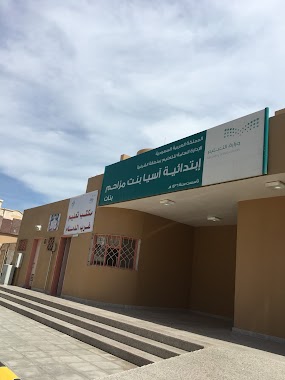
ابتدائية آسية بنت مزاحم الدمام حي الفيحاء
Dammam
School
read more
1.529 km
ادارة تعليم غرب الدمام
Dammam
School
read more
1.533 km
ابتدائية آسيا بنت مزاحم
Dammam
School
read more
1.589 km
Rikaaz Private Schools
Dammam
School
read more
1.752 km
البيت
Unnamed Road, Dammam
School
read more
1.792 km
Laith Bin Saad Ib School
9 Street, Dammam
School
read more
1.793 km
مدرسة الوليد بن القاسم
لايوجد عنوان
School
read more
1.83 km
Elementary Seventy-first Girls
شارع آل عبيد, Dammam
School
read more
1.86 km
ابتدائية الوليد بن القاسم
Dammam
School
read more
📑
all categories
Accounting
Administrative area level 1
Airport
Amusement park
Aquarium
Art gallery
Atm
Bakery
Bank
Bar
Beauty salon
Bicycle store
Book store
Bowling alley
Bus station
Cafe
Campground
Car dealer
Car rental
Car repair
Car wash
Casino
Cemetery
Church
City hall
Clothing store
Colloquial area
Convenience store
Country
Courthouse
Dentist
Department store
Doctor
Electrician
Electronics store
Embassy
Finance
Fire station
Florist
Food
Funeral home
Furniture store
Gas station
General contractor
Grocery or supermarket
Gym
Hair care
Hardware store
Health
Hindu Temple
Home goods store
Hospital
Insurance agency
Intersection
Jewelry store
Laundry
Lawyer
Library
Light rail station
Liquor store
Local government office
Locality
Locksmith
Lodging
Meal delivery
Meal takeaway
Mosque
Movie rental
Movie theater
Moving company
Museum
Natural feature
Neighborhood
Night club
Painter
Park
Parking
Pet store
Pharmacy
Physiotherapist
Place of worship
Plumber
Point of interest
Police
Political
Post office
Premise
Real estate agency
Restaurant
Roofing contractor
Route
Rv park, camping
School
Shoe store
Shopping mall
Spa
Stadium
Storage
Store
Sublocality
Subpremise
Subway station
Supermarket
Taxi stand
Train station
Transit station
Travel agency
University
Veterinary care
Zoo
sublocality level 1
↑