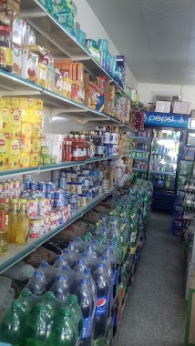
Supermarket nearby مستودع الاحجار السعودية
Saudi Arabia
Supermarket nearby مستودع الاحجار السعودية
مستودع الاحجار السعودية
حي الشروق، 6874, حي الشروق، Jeddah 23361, Saudi Arabia
contacts phone
:
+966
Latitude:
21.5566883
, Longitude:
39.2850753
larger map & directions
read more
nearest Supermarket
632 m
Diamond Supermarket
4065, حي مريخ،, Jeddah
Supermarket
read more
699 m
زل الفرش
Jeddah
Supermarket
read more
845 m
Basamh markets
Jeddah
Supermarket
read more
1.071 km
مشروع الرفق للتمليك
مخطط التيسير مشروع الرفق 1 جدة
Supermarket
read more
1.093 km
حي المريخ
Unnamed Road, Jeddah
Supermarket
read more
1.234 km
Al Dukan
Jeddah
Supermarket
read more
1.413 km
شقق تمليك القمه الفاخرة
Jeddah
Supermarket
read more
1.96 km
بقالة التعاون للمواد الغذائية
Jeddah
Supermarket
read more
2.444 km
دثار الحديثة للدعاية والإعلان والهدايا الدعائية
2884, حي مريخ،, Jeddah
Supermarket
read more
2.45 km
تسويق الخير
شارع فلسطين، حي وادي المريخ، جدة
Supermarket
read more
2.656 km
Wadi Maria
Jeddah
Supermarket
read more
2.678 km
Tamvenat al Khayer
7500, Mraykh District,, Jeddah
Supermarket
read more
3.3 km
قطع غيار الزامل والمستودع
9154, حي النخيل, Jeddah
Supermarket
read more
3.639 km
بقالة الطيبات
الحجاج بن مسعود, Jeddah
Supermarket
read more
3.678 km
بندتي
Osama bin Zaid Al Laithi, Jeddah
Supermarket
read more
3.691 km
مستودع شركة يلاف للسياحة والفنادق
قيس بن عباد الضبعي, Jeddah
Supermarket
read more
3.783 km
الشركة المتحدة لأعمال الخرسانة الجاهزة
Jeddah
Supermarket
read more
3.906 km
سوبر ماركت السحاب
السامر، جدة
Supermarket
read more
3.936 km
هايبر ماركت زاد مارت النهدي
3767, Jeddah
Supermarket
read more
3.967 km
زاد مارت
الواحة،, Jeddah
Supermarket
read more
4.02 km
مخبز وتموينات الشاملة
8549, 3640, Jeddah
Supermarket
read more
4.083 km
Oasis Supermarket
Mohammed bin Haroun, Jeddah
Supermarket
read more
4.124 km
تموينات النور
الاجواد، جدة
Supermarket
read more
4.234 km
بيت فؤاد
Jeddah
Supermarket
read more
4.28 km
EST mainstay of sanitary ware
Muhammad Ibn Dawud, Jeddah
Supermarket
read more
📑
all categories
Accounting
Administrative area level 1
Airport
Amusement park
Aquarium
Art gallery
Atm
Bakery
Bank
Bar
Beauty salon
Bicycle store
Book store
Bowling alley
Bus station
Cafe
Campground
Car dealer
Car rental
Car repair
Car wash
Casino
Cemetery
Church
City hall
Clothing store
Colloquial area
Convenience store
Country
Courthouse
Dentist
Department store
Doctor
Electrician
Electronics store
Embassy
Finance
Fire station
Florist
Food
Funeral home
Furniture store
Gas station
General contractor
Grocery or supermarket
Gym
Hair care
Hardware store
Health
Hindu Temple
Home goods store
Hospital
Insurance agency
Intersection
Jewelry store
Laundry
Lawyer
Library
Light rail station
Liquor store
Local government office
Locality
Locksmith
Lodging
Meal delivery
Meal takeaway
Mosque
Movie rental
Movie theater
Moving company
Museum
Natural feature
Neighborhood
Night club
Painter
Park
Parking
Pet store
Pharmacy
Physiotherapist
Place of worship
Plumber
Point of interest
Police
Political
Post office
Premise
Real estate agency
Restaurant
Roofing contractor
Route
Rv park, camping
School
Shoe store
Shopping mall
Spa
Stadium
Storage
Store
Sublocality
Subpremise
Subway station
Supermarket
Taxi stand
Train station
Transit station
Travel agency
University
Veterinary care
Zoo
sublocality level 1
↑