Airport nearby TALJV
Saudi Arabia
Airport nearby TALJV
TALJV
Jeddah Saudi Arabia
contacts phone
:
+966
Latitude:
21.7287769
, Longitude:
39.1756217
read more
nearest Airport
3.731 km
الاسطول الملكي
Jeddah
Airport
read more
4.166 km
New Deportees Terminal Building
Jeddah
Airport
read more
4.192 km
Deportees lounge
Jeddah
Airport
read more
4.412 km
Halls of Hajj and Umrah
Unnamed Road, King Abdulaziz International Airport،, Jeddah
Airport
read more
4.526 km
الهنقر الملكي
Jeddah
Airport
read more
4.698 km
Bandara Haji Jedah
Jeddah
Airport
read more
4.75 km
مطارملك عبدالعزيزالدولي
Jeddah
Airport
read more
4.843 km
مطار الملك عبدالعزيز الدولي بجدة الصالة الجنوبية
Jeddah
Airport
read more
4.843 km
مطار الملك عبدالعزيز الدولي بجدة الصالة الشمالية
Jeddah
Airport
read more
4.893 km
Pilgrims Terminal
Jeddah
Airport
read more
4.899 km
Hac terminalı cidde
haj terminal, jeddah airport, Jeddah
Airport
read more
4.985 km
Hajj Terminal Jeddah Airport
Jeddah
Airport
read more
5.384 km
المطار الدولي الرحلات الخارجية
Jeddah
Airport
read more
5.482 km
Saudi Aramco Airport
Unnamed Road, Jeddah
Airport
read more
5.495 km
Arabasco
King Abdulaziz International Airport Northern Terminal for Foreign Airlines, Jeddah
Airport
read more
5.509 km
First Class Lounge, North Terminal, KAIA
Jeddah
Airport
read more
5.554 km
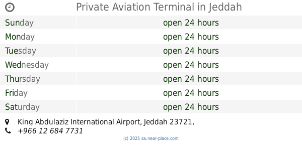
Private Aviation Terminal
Jeddah
Airport
read more
5.57 km
الصالة الشمالية وصول الحجاج الخارجي
Jeddah
Airport
read more
5.6 km
Saudia Private Aviation (SPA)
Jeddah
Airport
read more
5.613 km
North Terminal, King Abdulaziz International Airport, Jeddah
Entrance, King Abdulaziz International Airport, Jeddah
Airport
read more
5.902 km
RWY 16C/34C
Jeddah
Airport
read more
6.228 km
Air Traffic Control Tower
Jeddah
Airport
read more
6.253 km
وحدة إطفاء المطار
Jeddah
Airport
read more
6.378 km
برج المراقبة الجوية
Jeddah
Airport
read more
6.805 km
Jeddah kfa
Unnamed Road, Jeddah
Airport
read more
📑
all categories
Accounting
Administrative area level 1
Airport
Amusement park
Aquarium
Art gallery
Atm
Bakery
Bank
Bar
Beauty salon
Bicycle store
Book store
Bowling alley
Bus station
Cafe
Campground
Car dealer
Car rental
Car repair
Car wash
Casino
Cemetery
Church
City hall
Clothing store
Colloquial area
Convenience store
Country
Courthouse
Dentist
Department store
Doctor
Electrician
Electronics store
Embassy
Finance
Fire station
Florist
Food
Funeral home
Furniture store
Gas station
General contractor
Grocery or supermarket
Gym
Hair care
Hardware store
Health
Hindu Temple
Home goods store
Hospital
Insurance agency
Intersection
Jewelry store
Laundry
Lawyer
Library
Light rail station
Liquor store
Local government office
Locality
Locksmith
Lodging
Meal delivery
Meal takeaway
Mosque
Movie rental
Movie theater
Moving company
Museum
Natural feature
Neighborhood
Night club
Painter
Park
Parking
Pet store
Pharmacy
Physiotherapist
Place of worship
Plumber
Point of interest
Police
Political
Post office
Premise
Real estate agency
Restaurant
Roofing contractor
Route
Rv park, camping
School
Shoe store
Shopping mall
Spa
Stadium
Storage
Store
Sublocality
Subpremise
Subway station
Supermarket
Taxi stand
Train station
Transit station
Travel agency
University
Veterinary care
Zoo
sublocality level 1
↑