Atm nearby بنك الرياض
Saudi Arabia
Atm nearby بنك الرياض
بنك الرياض
8567, Hassan Ibn Thabit, 14243, Riyadh, SA Saudi Arabia
contacts phone
:
+966 800 244 0404
website:
www.aljazirh.com
Latitude:
24.7420745
, Longitude:
46.8271184
larger map & directions
read more
nearest Atm
294 m
مصرف الراجحي
شارع حسان بن ثابت - حي النسيم الشرقي، الرياض
Atm
read more
295 m
مصرف الراجحي
شارع حسان بن ثابت، حي النسيم، الرياض
Atm
read more
563 m
بنك البلاد
Wahb Ibn Ammar, Riyadh
Atm
read more
597 m
ساب
7176 Abi Hurairah, 2977, Riyadh
Atm
read more
607 m
مسعود بن رسد
4219 ظهران الجنوب، النسيم الغربي، الرياض 14232
Atm
read more
621 m
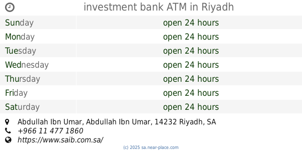
investment bank ATM
Abdullah Ibn Umar Abdullah Ibn Umar, Riyadh
Atm
read more
621 m
SABB
Al Batha, Etisalat, Riyadh
Atm
read more
640 m
Al Rajhi Bank ATM
Abdul Muhsin Aba Bitin, Riyadh
Atm
read more
647 m
صراف بنك العربي
شارع حسان بن ثابت، حي النسيم، الرياض
Atm
read more
716 m
Alinma ATM
7305 Abi Hurairah, 2971, Riyadh
Atm
read more
783 m
NCB AlAhli Bank ATM
7385 Abi Hurairah, Riyadh
Atm
read more
801 m
صراف بنك الأهلي
Abi Hurairah, Riyadh
Atm
read more
843 m
Riyadh Bank ATM
4356 Abdullah Al Maruzi, Riyadh
Atm
read more
1.001 km
ATM Al Rajhi Bank
Riyadh
Atm
read more
1.037 km
بنك الرياض
2317 Abdul Rahman Ibn Salim, Riyadh
Atm
read more
1.039 km
مصرف الإنماء
2317 Abdul Rahman Ibn Salim, Riyadh
Atm
read more
1.039 km
مصرف الراجحي
2317 Abdul Rahman Ibn Salim, Riyadh
Atm
read more
1.039 km
بنك الرياض
طريق خريص الفرعي - حي النهضة, Riyadh
Atm
read more
1.04 km
بنك البلاد
2317 Abdul Rahman Ibn Salim, Riyadh
Atm
read more
1.04 km
بنك البلاد
طريق خريص الفرعي - حي النهضة، الرياض
Atm
read more
1.04 km
مصرف الأنماء
طريق خريص الفرعي، حي النهضة، الرياض
Atm
read more
1.04 km
بنك الرياض
طريق خريص الفرعي ، حي النهضة، الرياض
Atm
read more
1.04 km
مصرف الراجحي
طريق خريص الفرعي، حي النهضة، الرياض
Atm
read more
1.043 km
الأهلي
Usamah Ibn Zaid, Riyadh
Atm
read more
1.049 km
Riyadh Bank ATM
Otheim Mall Khuris 2، الرياض
Atm
read more
📑
all categories
Accounting
Administrative area level 1
Airport
Amusement park
Aquarium
Art gallery
Atm
Bakery
Bank
Bar
Beauty salon
Bicycle store
Book store
Bowling alley
Bus station
Cafe
Campground
Car dealer
Car rental
Car repair
Car wash
Casino
Cemetery
Church
City hall
Clothing store
Colloquial area
Convenience store
Country
Courthouse
Dentist
Department store
Doctor
Electrician
Electronics store
Embassy
Finance
Fire station
Florist
Food
Funeral home
Furniture store
Gas station
General contractor
Grocery or supermarket
Gym
Hair care
Hardware store
Health
Hindu Temple
Home goods store
Hospital
Insurance agency
Intersection
Jewelry store
Laundry
Lawyer
Library
Light rail station
Liquor store
Local government office
Locality
Locksmith
Lodging
Meal delivery
Meal takeaway
Mosque
Movie rental
Movie theater
Moving company
Museum
Natural feature
Neighborhood
Night club
Painter
Park
Parking
Pet store
Pharmacy
Physiotherapist
Place of worship
Plumber
Point of interest
Police
Political
Post office
Premise
Real estate agency
Restaurant
Roofing contractor
Route
Rv park, camping
School
Shoe store
Shopping mall
Spa
Stadium
Storage
Store
Sublocality
Subpremise
Subway station
Supermarket
Taxi stand
Train station
Transit station
Travel agency
University
Veterinary care
Zoo
sublocality level 1
↑