Atm nearby مصرف الإنماء
Saudi Arabia
Atm nearby مصرف الإنماء
مصرف الإنماء
شارع المدينة المنورة, 14926, الرياض, SA Saudi Arabia
contacts phone
:
+966 800 120 8000
website:
www.alinma.com
Latitude:
24.5722837
, Longitude:
46.5939409
larger map & directions
read more
nearest Atm
282 m
Rajhi ATMصراف الراجحي
3729 المدينة المنورة, Riyadh
Atm
read more
392 m
Riyad Bank
شارع أسماء بنت أبي بكر، حي طويق، الرياض
Atm
read more
818 m
Alinma ATM
أسواق القرية الشعبية، شارع أسماء بنت أبي بكر، حي العريجاء، الرياض
Atm
read more
919 m
Albilad ATM صراف البلاد
2904 المدينة المنورة, Riyadh
Atm
read more
943 m
البلاد
Riyadh
Atm
read more
961 m
NCB ATM
3355 Bilal Ibn Rabah, Riyadh
Atm
read more
974 m
Tahweel Al Rajhi
Belal BinBabah, Twaq, Riyadh
Atm
read more
978 m
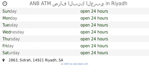
ANB ATM صراف البنك العربي
2863 Sidrah, Riyadh
Atm
read more
993 m
صراف البنك الأهلي التجاري
مدخل صراف, Riyadh
Atm
read more
1.026 km
Alawwal ATM صراف البنك الأول
3037 Bilal Ibn Rabah, Riyadh
Atm
read more
1.105 km
SABB
Ghuom alsama Market (36-168910, Riyadh
Atm
read more
1.107 km
SABB ATM
3652 Bilal Ibn Rabah, Riyadh
Atm
read more
1.119 km
مصرف الراجحي
7006 Sulaiman Al Adawi, Riyadh
Atm
read more
1.119 km
صراف الراجحي
7006 Sulaiman Al Adawi, Riyadh
Atm
read more
1.126 km
ARB-1T1
Asma Bint Abi Bakr Asma Bint Abi Bakr, Riyadh
Atm
read more
1.13 km
NCB ATM
عثمان شطا, Riyadh
Atm
read more
1.134 km
مصرف الراجحي
3807 Bilal Ibn Rabah, Riyadh
Atm
read more
1.221 km
Alinma ATM
عبدالمنعم قاضي, Riyadh
Atm
read more
1.225 km
NCB ATM صراف البنك الأهلي
2734 Bilal Ibn Rabah, 6588, Riyadh
Atm
read more
1.283 km
مصرف الإنماء
طريق الدائري الغربي الفرعي، حي العريجاء، الرياض
Atm
read more
1.304 km
NCB ATM صراف البنك الأهلي
2684 Bilal Ibn Rabah, Riyadh
Atm
read more
1.309 km
صراف الراجحي ATM
الرياض
Atm
read more
1.335 km
صراف بنك الرياض
4th, Riyadh
Atm
read more
1.336 km
صراف بنك الرياض
7721 Western Ring Branch Road, Riyadh
Atm
read more
1.372 km
صراف الإنماء
علي بن شيبان, Riyadh
Atm
read more
📑
all categories
Accounting
Administrative area level 1
Airport
Amusement park
Aquarium
Art gallery
Atm
Bakery
Bank
Bar
Beauty salon
Bicycle store
Book store
Bowling alley
Bus station
Cafe
Campground
Car dealer
Car rental
Car repair
Car wash
Casino
Cemetery
Church
City hall
Clothing store
Colloquial area
Convenience store
Country
Courthouse
Dentist
Department store
Doctor
Electrician
Electronics store
Embassy
Finance
Fire station
Florist
Food
Funeral home
Furniture store
Gas station
General contractor
Grocery or supermarket
Gym
Hair care
Hardware store
Health
Hindu Temple
Home goods store
Hospital
Insurance agency
Intersection
Jewelry store
Laundry
Lawyer
Library
Light rail station
Liquor store
Local government office
Locality
Locksmith
Lodging
Meal delivery
Meal takeaway
Mosque
Movie rental
Movie theater
Moving company
Museum
Natural feature
Neighborhood
Night club
Painter
Park
Parking
Pet store
Pharmacy
Physiotherapist
Place of worship
Plumber
Point of interest
Police
Political
Post office
Premise
Real estate agency
Restaurant
Roofing contractor
Route
Rv park, camping
School
Shoe store
Shopping mall
Spa
Stadium
Storage
Store
Sublocality
Subpremise
Subway station
Supermarket
Taxi stand
Train station
Transit station
Travel agency
University
Veterinary care
Zoo
sublocality level 1
↑