Atm nearby SABB
Saudi Arabia
Atm nearby SABB
SABB
Almarwah, 23542, Jeddah, SA Saudi Arabia
contacts phone
:
+966 9200 07222
website:
www.sabb.com
Latitude:
21.618961
, Longitude:
39.192833
larger map & directions
read more
nearest Atm
300 m
Riyadh Bank
Jeddah
Atm
read more
337 m
The Saudi Investment Bank
Al-Rayyan Petrol Station، جدة
Atm
read more
337 m
Alarbi ATM
Jeddah
Atm
read more
479 m
Samba ATM🏧
Prince Mutaib bin Abdulaziz Road, Jeddah
Atm
read more
631 m
ANB ATM
Prince Mutaib bin Abdulaziz Road, Jeddah
Atm
read more
702 m
ATM Bank AlJazira
2800 Sultan Ibn Salman Al Marwah District Jeddah 23542 8748 Sultan Ibn Salman, Jeddah
Atm
read more
794 m
بنك الرياض
شارع الأمير ماجد- حي المروة، جدة
Atm
read more
877 m
صراف البنك السعودي الفرنسي
Jeddah
Atm
read more
914 m
Jazira Bank ATM
Prince Majid Road, Jeddah
Atm
read more
994 m
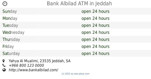
Bank Albilad ATM
Yahya Al Mualimi, Jeddah
Atm
read more
994 m
بنك البلاد
حي الربوة، جدة
Atm
read more
1.034 km
صرافة بنك الرياض
Jeddah
Atm
read more
1.145 km
صراف بنك سامبا
المروة،, Jeddah
Atm
read more
1.145 km
سامبا
المروة،, Jeddah
Atm
read more
1.178 km
NCB ATM
Ali Al Qusi, Jeddah
Atm
read more
1.2 km
NCB ATM
Ahmad Ibn Harasan, Jeddah
Atm
read more
1.208 km
SABB ATM
8674 Hamzah Al Birkani, حي المروة،, Jeddah
Atm
read more
1.322 km
SABB
Al Rabwah Lobby, Jeddah
Atm
read more
1.331 km
SAAB ATM 🏧
Jeddah
Atm
read more
1.401 km
Alawwal Bank ATM 🏧
Yahya Al Mualimi, Jeddah
Atm
read more
1.514 km
SABB
Almakaronah Lobby TTW (36-22615, Jeddah
Atm
read more
1.523 km
anb ATM 🏧
Al Makarunah Road, Jeddah
Atm
read more
1.585 km
Tahweel Al Rajhi
Makarona, Al Bawadi, Jeddah
Atm
read more
1.585 km
ATM Rajhi
6597 المكرونة, حي النزهة, Jeddah
Atm
read more
1.599 km
صراف البنك السعودي للاستثمار
Jeddah
Atm
read more
📑
all categories
Accounting
Administrative area level 1
Airport
Amusement park
Aquarium
Art gallery
Atm
Bakery
Bank
Bar
Beauty salon
Bicycle store
Book store
Bowling alley
Bus station
Cafe
Campground
Car dealer
Car rental
Car repair
Car wash
Casino
Cemetery
Church
City hall
Clothing store
Colloquial area
Convenience store
Country
Courthouse
Dentist
Department store
Doctor
Electrician
Electronics store
Embassy
Finance
Fire station
Florist
Food
Funeral home
Furniture store
Gas station
General contractor
Grocery or supermarket
Gym
Hair care
Hardware store
Health
Hindu Temple
Home goods store
Hospital
Insurance agency
Intersection
Jewelry store
Laundry
Lawyer
Library
Light rail station
Liquor store
Local government office
Locality
Locksmith
Lodging
Meal delivery
Meal takeaway
Mosque
Movie rental
Movie theater
Moving company
Museum
Natural feature
Neighborhood
Night club
Painter
Park
Parking
Pet store
Pharmacy
Physiotherapist
Place of worship
Plumber
Point of interest
Police
Political
Post office
Premise
Real estate agency
Restaurant
Roofing contractor
Route
Rv park, camping
School
Shoe store
Shopping mall
Spa
Stadium
Storage
Store
Sublocality
Subpremise
Subway station
Supermarket
Taxi stand
Train station
Transit station
Travel agency
University
Veterinary care
Zoo
sublocality level 1
↑